
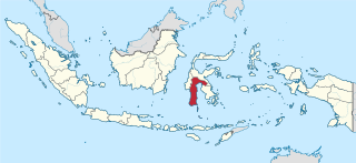
Balanipa is a subdistrict (Indonesian : kecamatan ) of the Polewali Mandar regency, in West Sulawesi, Indonesia.
The sub-district had an estimated population of 26,140 as of 2019. [1]
Balanipa is a subdistrict (Indonesian : kecamatan ) of the Polewali Mandar regency, in West Sulawesi, Indonesia.
The sub-district had an estimated population of 26,140 as of 2019. [1]
South Sulawesi is a province in the southern peninsula of Sulawesi, Indonesia. The Selayar Islands archipelago to the south of Sulawesi is also part of the province. The capital and largest city is Makassar. The province is bordered by Central Sulawesi and West Sulawesi to the north, the Gulf of Bone and Southeast Sulawesi to the east, Makassar Strait to the west, and Flores Sea to the south.

Makassar Strait is a strait between the islands of Borneo and Sulawesi in Indonesia. To the north it joins the Celebes Sea, while to the south it meets the Java Sea. To the northeast, it forms the Sangkulirang Bay south of the Mangkalihat Peninsula. The strait is an important regional shipping route in Southeast Asia.

Donggala Regency is a regency in the Central Sulawesi Province of Indonesia. It lies between 0° 30" north and 2°20" south latitude, and between 119° 45°" and 121° 45" east longitude, and covers a land area of 5,126.59 km2. It had a population of 277,236 at the 2010 Census and 300,436 at the 2020 Census; the official estimate as at mid 2023 was 308,301. The administrative capital of Donggala Regency is the town of Banawa, located a 30-minute drive (34 km) northwest from the city of Palu, the capital of the province.

Lake Tempe is a lake in South Sulawesi, Indonesia. It is located at 4°6′20″S119°56′49″E. The town of Sengkang is situated to the east of the lake. The lake is the biggest lake in South Sulawesi.

Soppeng Regency is a landlocked regency in South Sulawesi province of Indonesia. Soppeng Regency has its seat of government (capital) in the town of Watansoppeng, located 180 km from Makassar. The regency covers an area of 1,385.55 km2, and had a population of 223,826 at the 2010 Census and 235,167 at the 2020 Census. The official estimate of population as of mid-2023 was 240,955.

Polewali Mandar is one of the five regencies in West Sulawesi province of Indonesia. It borders on the regencies of Mamasa in the North, Majene in the West and Pinrang regency of South Sulawesi in the East. It covers an area of 2,074.76 km2 and had a population of 396,120 at the 2010 Census and 478,534 at the 2020 Census; the official estimate as at mid 2023 was 495,371. The regency is inhabited by various ethnic groups such as the Mandar, Buginese, Javanese and Toraja.

Pinrang Regency is one of the twenty-one regencies in South Sulawesi Province of Indonesia. Pinrang town in Watang Sawitto District is the administrative capital of Pinrang Regency. The regency is situated in the northwest of the South Sulawesi peninsula, and covers a land area of 1,896.57 km2. It had a population of 351,161 at the 2010 Census and 403,994 at the 2020 Census; the official estimate as at mid 2023 was 417,932.
The Jeneberang is a river of approximately 75 km in length in the south-western half of the island of Sulawesi, Indonesia. The catchment has an area of 760 square kilometers.
The Sadang is a river of Sulawesi in South Sulawesi province, Indonesia. It is one of the major rivers which flow into the Strait of Macassar.

The Palu River is a river in Central Sulawesi, Sulawesi island, Indonesia, about 1600 km northeast of the capital Jakarta.
The Lariang River is a river in Sulawesi, Indonesia.
Mamasa River is a river in Sulawesi, Indonesia. It is a tributary of the Sadang River.

Pasangkayu Regency is one of the six regencies which comprise West Sulawesi Province, Indonesia, on the island of Sulawesi. It covers an area of 3,043.75 km2 and had a population of 134,303 at the 2010 Census and 188,861 at the 2020 Census. The official estimate as at mid 2023 was 204,216. The town of Pasangkayu is the capital and chief town of the regency.

Mamasa Regency is one of the six regencies that make up the West Sulawesi Province, Indonesia, on the island of Sulawesi. It covers a land area of 3,005.88 km2. The population was 140,082 at the 2010 Census and 163,383 at the 2020 Census; the official estimate as at mid 2023 was 170,354. Its capital is the town of Mamasa. The Mamasa people - which is a sub-group of the Toraja people - form the most common ethnic group.

Bantaeng Regency is a regency of South Sulawesi Province in Indonesia. It covers an area of 395.83 km2 and had a population of 176,984 at the 2010 Census, rising to 196,716 at the 2020 Census. The official estimate as at mid 2023 was 211,623. The administrative centre is the town of Bantaeng, which lies on the south coast of the southern peninsula of Sulawesi island.

Barru Regency is a regency of South Sulawesi province of Indonesia. It covers an area of 1,174.72 km2 and had a population of 165,983 at the 2010 Census and 184,452 at the 2020 Census. The official estimate of population as of mid-2023 was 194,543. The principal town lies at Barru.

Enrekang Regency is an inland regency of South Sulawesi Province of Indonesia. It covers an area of 1,821.53 km2 and had a population of 190,175 at the 2010 census and 225,172 at the 2020 census; the official estimate as at mid 2023 was 231,301. The principal town lies at Enrekang.

Maros Regency is a regency of South Sulawesi province of Indonesia. It covers an area of 1,619.12 sq.km, and had a population of 319,002 at the 2010 Census and 391,774 at the Census of 2020. The official population estimate for mid-2023 was 407,920 according the Province's official estimates but only 389,277 according to the Regency's official estimates. Almost all of the regency lies within the official metropolitan area of the city of Makassar. The administrative centre of the regency is the town of Maros.

Sigi Regency is a regency of Central Sulawesi, Indonesia. It was created on 21 July 2008 by splitting off the southern districts from Donggala Regency. It lies upstream on the Palu River, and immediately south of Palu city, the provincial capital. The regency is almost landlocked; it has a small coastline between Palu city and the western part of Donggala regency. It covers an area of 5,196.02 km2 and had a population of 215,030 at the 2010 Census and 239,421 at the 2020 Census; the official estimate as at mid 2023 was 266,656. The principal town lies at Sigi Biromaru.

North Toraja is a landlocked regency (kabupaten) of South Sulawesi Province of Indonesia, and the home of the Toraja ethnic group. The local government seat is in Rantepao which is also the center of Toraja culture. Formerly this regency was the northern part of Tana Toraja Regency, but on 24 June 2008 the northeastern 36% of the latter's area was split off to form this separate North Toraja Regency. It covers an area of 1,289.13 km2 and had a population of 216,762 at the 2010 census and 261,086 at the 2020 census; the official estimate as at mid 2023 was 261,652, comprising 133,529 males and 128,123 females.
3°28′42″S119°03′27″E / 3.4782973°S 119.0576298°E
| | This West Sulawesi location article is a stub. You can help Wikipedia by expanding it. |