The Hooghly River or the Bhāgirathi-Hooghly, called the 'Ganga' or the 'Kati-Ganga' in mythological texts, is the eastern distributary of the Ganges River in West Bengal, India, rising close to Giria in Murshidabad. It is referred to as an arm of the Ganges in the Encyclopedia Britannica and was previously the major flow of the waters of the Ganga It is because of this reason, people believe the holy waters of the Ganga still flow through the Bhagirathi-Hoogly and hence it is still worshipped today. The other distributary of Ganga then flows into Bangladesh as the Padma. Today there is a man-made canal called the Farakka Feeder Canal connecting the Ganges to the Bhagirathi.

Burrard Inlet is a relatively shallow-sided fjord in northwestern Lower Mainland, British Columbia, Canada. Formed during the last Ice Age, it separates the City of Vancouver and the rest of the lowland Burrard Peninsula to the south from the coastal slopes of the North Shore Mountains, which span West Vancouver and the City and District of North Vancouver to the north.

False Point is a low headland in the Bay of Bengal. It is located in the Kendrapara district of Odisha, India. The point derives its name from the circumstance that vessels proceeding up the Bay of Bengal frequently mistook it for Point Palmyras, less than a degree farther north. A lighthouse is situated 2 km inland from the point, at a place which screens it from the southern monsoon.
Kolkata is the capital of the Indian state of West Bengal and is located in eastern India on the east bank of the River Bhagirathi-Hooghly (Ganga). The city was a colonial city developed by the East India Company and then by the British Empire. Kolkata was the capital of the British Indian empire until 1911, when the capital was relocated to Delhi. Kolkata grew rapidly in the 19th century to become the second city of the British Indian Empire. This was accompanied by the development of a culture that fused Indian philosophies with Arabian tradition.

Port of Kolkata or Kolkata Port, officially known as Syama Prasad Mookerjee Port Trust, is the only riverine major port of India, located in the city of Kolkata, West Bengal, around 203 kilometres (126 mi) from the sea. It is the oldest operating port in India and was constructed by the British East India Company. Kolkata is a freshwater port with no variation in salinity. The port has two distinct dock systems — Kolkata Docks at Kolkata and a deep water dock at Haldia Dock Complex, Haldia.

A roadstead is a body of water sheltered from rip currents, spring tides, or ocean swell where ships can lie reasonably safely at anchor without dragging or snatching. It can be open or natural, usually estuary-based, or may be created artificially. In maritime law, it is described as a "known general station for ships, notoriously used as such, and distinguished by the name".

Robert Moresby was a captain of the East India Company's Bombay Marine/Indian Navy who distinguished himself as a hydrographer, maritime surveyor and draughtsman.
The Battle of Chinsurah took place near Chinsurah, India on 25 November 1759 during the Seven Years' War between a force of British troops mainly of the British East India Company and a force of the Dutch East India Company which had been invited by the Nawab of Bengal Mir Jafar to help him expel the British and establish themselves as the leading commercial company in Bengal. Despite Britain and the Dutch Republic not formally being at war, the Dutch advanced up the Hooghly River. They met a mixed force of British and Indian troops at Chinsurah, fifty kilometres outside Calcutta. The British, under Colonel Francis Forde, defeated the Dutch, forcing them to withdraw. The British engaged and defeated the ships the Dutch used to deliver the troops in a separate naval battle on 24 November.

The Java campaign of 1806–1807 was a minor campaign during the Napoleonic Wars by British Royal Navy forces against a naval squadron of the Kingdom of Holland, a client state of the French Empire, based on the island of Java in the Dutch East Indies. Seeking to eliminate any threat to valuable British merchant convoys passing through the Malacca Straits, Rear-Admiral Sir Edward Pellew determined in early 1806 that the Dutch naval forces based at Java, which included several ships of the line and three frigates, had to be defeated to ensure British dominance in the region. Lacking the forces to effect an invasion of the Dutch colony, Pellew instead sought to isolate and blockade the Dutch squadron based at Batavia in preparation for raids specifically targeting the Dutch ships with his main force.
Grappler was a 14-gun brig, that belonged to the East India Company's navy - the Bombay Marine. Grappler was launched in 1804. The French captured her in 1806, but the British recaptured her in 1809. She then disappears from readily available records.

The Anglo-Mughal War, also known as Child's War, was the first Anglo-Indian War on the Indian Subcontinent.

The Kharagpur–Puri line is a railway line connecting Kharagpur in the Indian state of West Bengal and Puri in Odisha. The Kharagpur–Khurda Road portion of this line is part of the Howrah–Chennai main line.

The action of 28 February 1799 was a minor naval engagement of the French Revolutionary Wars, fought off the mouth of the Hooghly River in the Bay of Bengal between the French frigate Forte and the Royal Navy frigate HMS Sybille. Forte was an exceptionally large and powerful ship engaged on a commerce raiding operation against British merchant shipping off the port of Calcutta in British India. To eliminate this threat, Sybille was sent from Madras in pursuit. Acting on information from released prisoners, Edward Cooke, captain of Sybille, was sailing off Balasore when distant gunfire alerted him to the presence of Forte on the evening of 28 February. The French frigate was discovered at anchor in the sandbanks at the mouth of the Hooghly with two recently captured British merchant ships.
Cornwallis was a snow that the Honourable East India Company (EIC) had built in 1787 at Bombay Dockyard for the Bengal Pilot Service. A French privateer captured her in 1796.
Harrington was launched at Calcutta in 1796 for the Bengal Pilot Service. A French privateer captured her on 9 November 1797 at Balasore Roads. She returned to British ownership and Calcutta registry c. 1800. She undertook sealing expeditions, captured two Spanish vessels off South America, and was seized by convicts in Port Jackson, before being wrecked in March 1809.

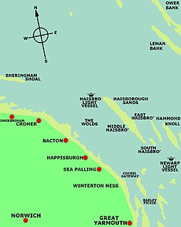
Yarmouth Roads is a coastal feature in Norfolk, England that was used by merchant and naval ships as an anchorage or roadstead off Great Yarmouth.
Hinchinbrooke was the Spanish ship San Carlos that Admiral Rodney's squadron captured on 8 January 1780. She was sold as a prize and in 1781 commenced a voyage as an "extra" ship of the British East India Company. During the voyage a French squadron captured her at the Battle of Porto Praya, but the British Royal Navy recaptured her within a day or so. She was lost in the Hooghly River in 1783 on her return voyage to Britain.
India has the 18th-largest exclusive economic zone (EEZ) with a total size of 2,305,143 km2 (890,021 sq mi). It includes the Lakshadweep island group in the Laccadive Sea off the southwestern coast of India and the Andaman and Nicobar Islands at the Bay of Bengal and the Andaman Sea. India's EEZ is bordered to the west by Pakistan, to the south by the Maldives and Sri Lanka and to the east by Bangladesh, Myanmar, Thailand, Malaysia and Indonesia.


