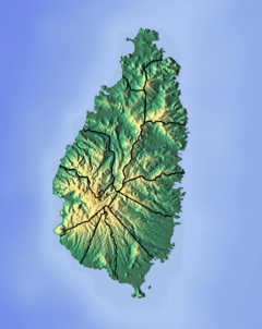
The Cul De Sac River is a river in Castries Quarter of the island country of Saint Lucia. It flows north and then west from the central highlands in the south of the island, reaching the Caribbean Sea in Grand Cul de Sac Bay, south of the capital, Castries. It is one of the longest rivers in Saint Lucia.

The Canelles River is a river in Saint Lucia. It flows southeast from the central highlands in the south of the island, reaching the Atlantic Ocean to the south of the town of Micoud.
The Roseau River is a river in the Anse-la-Raye Quarter of the island country of Saint Lucia. It flows north and then west from the central highlands in the south of the island, reaching the Caribbean Sea to the north of the town of Anse la Raye. The Roseau river is also the longest in the country and is dammed by the John Compton Dam near Millet.
The Castries River is a river in Castries Quarter on the island county of Saint Lucia.
The Dennery River is the river on the southern end of the fishing village of Dennery on the island of Saint Lucia. The community of Dennery is built on its flood plain and in recent times has been the cause of serious flooding in the coastal community. It drains into the Atlantic Ocean.
The Dorée River is a river on the island of Saint Lucia.
The Migny River is a river on the island of Saint Lucia.
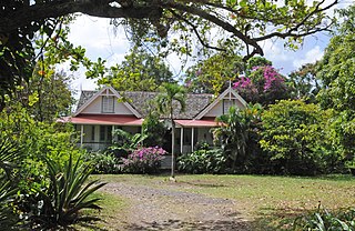
Balembouche is the original name of a historic 18th-century sugar plantation, Balenbouche Estate, which is now a guesthouse, designated heritage site and organic farm on the island of Saint Lucia. It is located on the south west coast of the island, near Bongalo and Piaye.

Piaye is a community on the island of Saint Lucia; it is located on the southern coast, near Balembouche and Bongaloin the constituency of Choiseul, and shares its name with a nearby river. This community started as a small settlement of workers who laboured on the Balembouche estate. In the post-Balembouche period Piaye transformed into a community of fishermen, subsistence farmers and producers of hand-crushed aggregate for the construction industry.
The Choc River is a river in the Soufrière Quarter of the island country of Saint Lucia. It flows to the Caribbean Sea.
The Dauphin River is a river in Gros Islet Quarter, Saint Lucia.
The Esperance River is a river in Gros Islet Quarter in the island country of Saint Lucia.
The Jeremy River is a river of Saint Lucia. It drains from the forest area to the east coast.
The La Verdure River is a river of Saint Lucia.
The Louvet River is a river of Saint Lucia. It drains from the forest area to the east coast.
The Mamin River is a river of Saint Lucia.
The Millet River is a river of Saint Lucia.
The Trou Sallé River is a river of Saint Lucia.
The Mahaut River is a river in the Laborie Quarter of Saint Lucia. The mouth is at the Caribbean Sea.