Brookfield is a town in Fairfield County, Connecticut, United States, situated within the southern foothills of the Berkshire Mountains. The population was 17,528 at the 2020 census. The town is located 55 miles (89 km) northeast of New York City, making it part of the New York metropolitan area. The town is part of the Western Connecticut Planning Region. In July 2013, Money magazine ranked Brookfield the 26th-best place to live in the United States, and the best place to live in Connecticut.
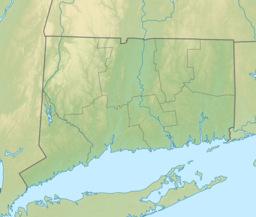
New Fairfield is a town in Fairfield County, Connecticut, United States. The population was 13,579 at the 2020 census. New Fairfield is one of five towns that surround Candlewood Lake, the largest lake in Connecticut. The town is located 55 miles (89 km) northeast of New York City, making it part of the New York metropolitan area. The town is part of the Western Connecticut Planning Region.

The Connecticut River is the longest river in the New England region of the United States, flowing roughly southward for 406 miles (653 km) through four states. It rises 300 yards south of the U.S. border with Quebec, Canada, and discharges at Long Island Sound. Its watershed encompasses 11,260 square miles (29,200 km2), covering parts of five U.S. states and one Canadian province, via 148 tributaries, 38 of which are major rivers. It produces 70% of Long Island Sound's fresh water, discharging at 18,400 cubic feet (520 m3) per second.

The Housatonic River is a river, approximately 149 miles (240 km) long, in western Massachusetts and western Connecticut in the United States. It flows south to southeast, and drains about 1,950 square miles (5,100 km2) of southwestern Connecticut into Long Island Sound. Its watershed is just to the west of the watershed of the lower Connecticut River.
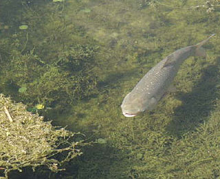
Several species of heavy-bodied cyprinid fishes are collectively known in the United States as Asian carp. Cyprinids from the Indian subcontinent—for example, catla and mrigal —are not included in this classification and are known collectively as "Indian carp". Asian carp are considered invasive species in the United States. In June, 2022, the EPA funded initiative to rebrand Asian Carp as Copi was announced. The new name — Copi — is a part of the Federal and multi-state campaign to reintroduce the carps to the public as a healthy and responsible seafood option in order to decrease its numbers in U.S. waterways.
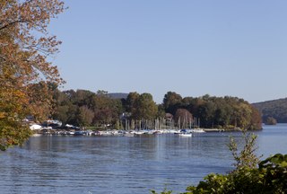
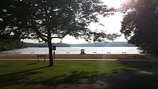
Candlewood Lake is a manmade lake located in Fairfield and Litchfield counties of Western Connecticut, in the northeastern United States. At 8.4 square miles (22 km2), it is the largest lake in Connecticut and the largest lake within a 60 mi (97 km) radius of New York City. The lake is bordered by the city of Danbury, and the towns of Brookfield, New Fairfield, New Milford, and Sherman. Some of the most expensive real estate in the Greater Danbury area is located along the shores of the lake.

Island Pond is a 532-acre (215 ha) water body located in Rockingham County in southern New Hampshire, in the towns of Derry, Hampstead and Atkinson. The pond is at the head of the Spicket River watershed, which feeds into the Merrimack River in Lawrence, Massachusetts. The pond was formed from the merger of Perch Pond in Hampstead and Lake Wentworth in Derry in 1878, when a new dam raised the water level by 8.5 feet (2.6 m).
Swartswood State Park is a 3,460-acre (14.0 km2) protected area located in the Swartswood section of Stillwater and Hampton townships in Sussex County, New Jersey, in the United States. Established in 1915 by the state's Forest Park Reservation Commission, it was the first state park established by the state of New Jersey for the purposes of recreation at the state's third-largest freshwater lake. Today, Swartswood State Park is operated and maintained by the New Jersey Division of Parks and Forestry.

The Saugatuck Reservoir is a reservoir in Fairfield County, Connecticut, United States, that straddles the border between the towns of Redding, Weston, and Easton. Its completion is marked by the creation of the Samuel P. Senior dam of the Saugatuck River in January 1942, and provides water to several of the nearby towns. The reservoir is surrounded by the Centennial Watershed State Forest and a small section of the Trout Brook Valley State Park Reserve on the southeast end of the reservoir. The Saugatuck Reservoir utilizes an uncontrolled spillway adjacent to the Samuel P. Senior dam that effectively limits the maximum water level. There is also a concrete levee positioned on the southeastern side of the reservoir that prevents water from flooding Trout Brook Valley.

Malheur Lake is one of the lakes in the Malheur National Wildlife Refuge in Harney County in the U.S. state of Oregon. Located about 18 miles (29 km) southeast of Burns, the lake is marsh fed by the Donner und Blitzen River from the south and the Silvies River from the north. Malheur Lake periodically overflows into Mud Lake to the west and thence to Harney Lake, the sink of Harney Basin.
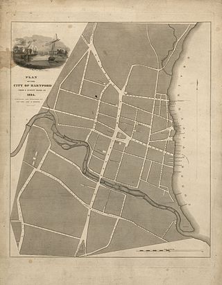
The Park River is a tributary of the Connecticut River in Hartford, Connecticut. It was officially named the Park River in 1892 after Bushnell Park, through which it flowed in downtown Hartford. A local newspaper had advocated for that name rather than the “’Hog River’” name which was then in use.Between 1940 and the 1980s, the 2.3-mile (3.7 km) river was buried by the Army Corps of Engineers to prevent the spring floods regularly caused by increased surface runoff from urban development.

Lake Waramaug is a 656-acre (265 ha) lake occupying parts of the towns of Kent, Warren and Washington in Litchfield County, Connecticut, United States, approximately 24 miles (39 km) north of Danbury. The lake is named after Chief Waramaug, who wintered in the area surrounding Lake Waramaug.

Indian Well State Park is a public recreation area occupying 153 acres (62 ha) on the west bank of Lake Housatonic, an impoundment of the Housatonic River, within the city limits of Shelton, Connecticut. The state park's scenic features include a 15-foot (4.6 m) horsetail waterfalls with splash pool at bottom. The park is managed by the Connecticut Department of Energy and Environmental Protection.

Karkarook Park is a metropolitan park in Melbourne, Victoria, Australia, located at the northwest corner of the southeastern suburb of Heatherton, southeast of the intersection between Warrigal Road and Dingley Bypass, accessible to cars only via Fairchild Street on the south side. The park is a wetland reserve built around the Karkarook Lake, a 15 hectares, 420 m (1,380 ft) wide artificial lake built from a pit created by sand mining between 1997 and 2001, filled in 2004 by groundwater pumped from a bore 500 metres (550 yd) to the southeast.

Lake Sunapee is located within Sullivan County and Merrimack County in western New Hampshire, the United States. It is the fifth-largest lake located entirely in New Hampshire.

Carp is a common name for various species of freshwater fish from the family Cyprinidae that are native to Eurasia and sought after by some recreational fishermen. Certain carp species have been introduced, with mixed results, to various other locations around the world, and even declared invasive in certain regions.

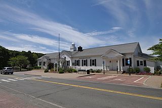
The Connecticut Audubon Society, founded in 1898 and headquartered in Fairfield, Connecticut, is a nonprofit organization dedicated to "conserving Connecticut’s environment through science-based education and advocacy focused on the state’s bird populations and habitats." Connecticut Audubon Society is independent of the National Audubon Society (NAS), just as in the neighboring state of Massachusetts, where Massachusetts Audubon Society is independent of the NAS.

Lake Zoar is a reservoir on the Housatonic River in the U.S. state of Connecticut. It was formed by the completion of the Stevenson Dam, which flooded an area of Oxford and Stevenson named "Pleasantvale" or "Pleasant Vale". "Connecticut's Lakes Reflect Our History, Present". Retrieved 2018-04-02. The towns of Monroe, Newtown, Oxford, and Southbury border Lake Zoar. The name Zoar originates from corner of Newtown and Monroe that once called itself Zoar after the Biblical city Zoara near the Dead Sea.

Squantz Pond is a 288-acre lake in Fairfield County, Connecticut. It is located on the town line of Sherman and New Fairfield, and is bordered by manmade Candlewood Lake. The south shore is protected as Squantz Pond State Park, and is managed by the Connecticut Department of Energy and Environmental Protection. The pond is named for Chief Squantz, a leader of the Schaghticoke tribe.

Margerie Lake Reservoir is a 244 acre lake in New Fairfield, Connecticut. It is a source of drinking water for the Danbury area and is managed by the Danbury Water Department. It has a watershed of 2,942 acres.