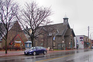
The Glebe is a neighbourhood in Ottawa, Ontario, Canada. It is located just south of Ottawa's downtown area in the Capital Ward. According to the Glebe Community Association, the neighbourhood is bounded on the north by the Queensway, on the east and south by the Rideau Canal and on the west by LeBreton Street South, Carling Avenue and Dow's Lake. As of 2016, this area had a population of 13,055. This area includes the Glebe Annex, an area west of Bronson Avenue that maintains its own neighbourhood association.

Westboro is an area in the west end of Ottawa, Ontario, Canada. Located along the Ottawa River, Island Park Drive defines Westboro's eastern border, while the Ottawa River defines its northern border. Under this definition, the population of the area is 22,725.

Old Ottawa South is an older urban neighbourhood in Capital Ward in Ottawa, Ontario, Canada. Old Ottawa South is a relatively small and compact neighbourhood, located between the Rideau Canal and the Rideau River. The eastern boundary is Avenue Road. Bronson Avenue forms the western border of the residential neighbourhood. Carleton University is on the other (western) side of Bronson but the campus can be considered to be geographically within Old Ottawa South as the campus is also nestled between the river and the canal.

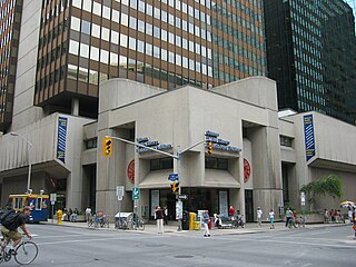
The Ottawa Public Library is the library system of Ottawa, Ontario, Canada. The library was founded in 1906 with a donation from the Carnegie Foundation.

Carling Avenue is a major east–west arterial road in the west end of Ottawa, Ontario, Canada. It runs from March Road in Kanata to Bronson Avenue in the Glebe. The road is named for John Carling, founder of Carling Brewery and Conservative MP and Senator, Postmaster General and Minister of Agriculture.

Carleton is a federal electoral district in Ontario, Canada, represented in the House of Commons of Canada from 1867 to 1968 and since 2015. It was represented in the Legislative Assembly of Upper Canada from 1821 to 1840 and in the Legislative Assembly of the Province of Canada from 1841 until 1866.
Whitehaven is a neighbourhood located in Bay Ward in the west end of Ottawa, Ontario, Canada, about 10 kilometres west of downtown. It is bounded by Carling Avenue to the north, Woodroffe Avenue to the east, the OC Transpo Transitway to the west and highway 417 to the south. The population of the neighbourhood is about 2350

Ottawa Centre is an urban provincial electoral district in Ontario, Canada that has been represented in the Legislative Assembly of Ontario since 1968. While the riding's boundaries have changed over the years to account for population changes, the riding has always comprised the central areas of Ottawa, the nation's capital.

Ottawa—Vanier is a provincial electoral district in Ottawa, Ontario, Canada, that has been represented in the Legislative Assembly of Ontario since 1908. It is located in the east end of Ottawa.

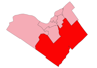
Ottawa South is a provincial electoral district (riding) in the Canadian province of Ontario, in the city of Ottawa.
Sheffield Glen is a neighbourhood in Alta Vista Ward in southeast Ottawa, Ontario, Canada. It is bounded on the west by Russell Road, on the south by Walkley Road and on the north and east by Lancaster Road. The neighbourhood is more commonly referred to as Southvale by Ottawans, but appears as Sheffield Glen on maps. Southvale Crescent is the name of the main street which runs through the neighbourhood and is home to a majority of residents. The neighbourhood is home to many apartment buildings and townhouses. Its population according to the Canada 2011 Census was 2877. This decreased to 2,744 according to the Canada 2016 Census.
Qualicum-Graham Park or Qualicum is a suburban neighbourhood in College Ward in the City of Ottawa, Ontario, Canada. It is located in the former City of Nepean in the west end of the city. Many of the residences in the area are executive homes situated on large lots (100x100) being built in the 1960s. Qualicum Street boasts large custom houses built by Bill Teron. The neighbourhood is bounded to the north by the Queensway, to the west by Richmond Road, to the south by Baseline Road, and to the east by Morrison Drive at the former Ottawa-Nepean border towards Redwood. Named after Qualicum Beach in British Columbia.

Terry Fox Stadium, also known as the Terry Fox Athletic Facility is an athletic field in Ottawa, Ontario, Canada, named after cancer research activist Terry Fox. It has a regulation-size natural grass soccer field, surrounded by a 400-metre track. Surrounding the track are bleachers with a capacity of approximately 2,000. It is located in Mooney's Bay Park, on the west side of Riverside Drive, south of Heron Road, which is south of downtown Ottawa.
Woodpark is a small neighbourhood in Bay Ward, in the west end of Ottawa, Ontario, Canada. It is bounded in the north by Richmond Road, to the East by Woodroffe Avenue north, in the South by Carling Avenue and in the west by the Sir John A. Macdonald Parkway. The total population of the neighbourhood according to the Canada 2016 Census was 2,191.
City View is a neighbourhood in College Ward in the west end of the city of Ottawa, Canada. It is located within the former city of Nepean.
McKellar Heights is a small neighbourhood located in Kitchissippi Ward, in the west end of Ottawa, Ontario, Canada. It is bounded on the north by Carling Avenue, on the west by Maitland Avenue, on the south by The Queensway and on the east by Clyde Avenue. The population as of the 2011 Census was 557.
Queensway Terrace North (QTN) is a neighbourhood in Bay Ward in the west end of Ottawa, Ontario, Canada. Its neighbourhood association is bounded to the north by Carling Avenue, to the west by Pinecrest Road, to the south by the Queensway, and to the east by the Transitway. These boundaries include the adjacent neighbourhood of Britannia Heights.
Uplands, also known as Elizabeth Park or Airport-Uplands is a neighbourhood in Gloucester-Southgate Ward in the south end of Ottawa, Ontario, Canada. It is located in the federal and provincial districts of Ottawa South, in the former city of Gloucester. It is bordered by the Hunt Club Road to the north, Uplands Drive to the east, and the Macdonald-Cartier International Airport to the south and west. The neighbourhood is adjacent to the military community living at CFB Uplands, which was a large air force base in the 1960s and which still contains residential housing for military members.

Byron Linear Tramway Park is a municipal park in Kitchissippi Ward and Bay Ward in Ottawa, Ontario, Canada. The park forms a narrow strip of park land that runs westward from Holland Avenue to Richardson Avenue in Woodpark, with the exception of Westboro Village. Running through the entirety of the park is a path through grass and trees. The park forms a narrow 2.5 km strip, but has a width varies between 5 and 15 metres.

Ambleside is a small sub-neighbourhood of Woodroffe North in Bay Ward in the west end of Ottawa, Ontario, Canada. It is bounded in the West and North by the Sir John A. Macdonald Parkway, in the East by New Orchard Avenue (North), and in the South by Richmond Road. The total population of this area was 2,546 according to the Canada 2016 Census.


