Related Research Articles

Ballyda is a small townland in the civil parish of Danesfort in County Kilkenny, Ireland. The townland has an area of approximately 0.5 square miles (1.3 km2), and had a population of 70 people as of the 2011 census.
Brawny is a barony in south–west County Westmeath, Ireland. It was formed by 1672. It is bordered by County Roscommon to the west. It also borders two other Westmeath baronies: Kilkenny West and Clonlonan. The largest centre of population in the barony is the town of Athlone.

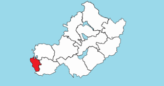
Clonlonan is a barony in south–west County Westmeath, Ireland. It was formed by 1672. It is bordered by County Offaly to the south and a small part of County Roscommon at Long Island on the River Shannon to the west. It also borders four other Westmeath baronies: Kilkenny West and Rathconrath, Moycashel and Brawny. The largest centre of population in the barony is the town of Moate.
Rathaniska, also known as Baile Marlainn or Marlinstown, is a townland in County Westmeath, Ireland. It is located about 11 kilometres (7 mi) north–west of Mullingar.
Ballynafid is a townland in County Westmeath, Ireland. It is located about 10 kilometres (6 mi) north–west of Mullingar. This place name is not to be confused with Ballinafid and Ballinafid Lake which are in the neighbouring townland of Knightswood.
Ballinalack is a village and a townland in County Westmeath, Ireland. It is located about 14 kilometres (9 mi) north–west of Mullingar.
Piercefield is a townland in County Westmeath, Ireland. It is located about 10 kilometres (6 mi) north–west of Mullingar. The name Piercefield also applies to the neighbouring townland of Piercefield.
Newtown is a civil parish in County Westmeath, Ireland. It is located about 16.02 kilometres (10 mi) south of Mullingar.
Ardnurcher is a civil parish in County Westmeath, Ireland. It is located about 19.89 kilometres (12 mi) south–west of Mullingar.
Ballyloughloe is a civil parish in County Westmeath, Ireland. It is located about 31.67 kilometres (20 mi) west–south–west of Mullingar.
Ballymore is a civil parish in County Westmeath, Ireland. It is located about 23.57 kilometres (15 mi) west of Mullingar.
Ballymorin is a civil parish in County Westmeath, Ireland. It is located about 16.21 kilometres (10 mi) west of Mullingar.
Churchtown is a civil parish in County Westmeath, Ireland. It is located about 11.13 kilometres (7 mi) west–south–west of Mullingar.
Piercetown is a civil parish in County Westmeath, Ireland. It is located about 18.69 kilometres (12 mi) west–north–west of Mullingar. It was formerly often spelled Pierstown.
Ballyharney is a townland in County Westmeath, Ireland. It is located about 14.52 kilometres (9 mi) north-north–west of Mullingar.
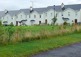
Dalystown is a village in Carrick, County Westmeath, Ireland. It is located in the south of the county on the N52 road, to the north of Tyrrellspass and Rochfortbridge.
Martinstown is a townland in County Westmeath, Ireland. The townland is located in the civil parish of Delvin. The townland lies directly south of the town of Delvin, close to the N52 road.
Athlone is the name given to two bordering townlands in County Westmeath, Ireland. The townlands are in the civil parish of St. Mary's.
Kippinstown is a townland in Athlone, County Westmeath, Ireland. The townland is in the civil parish of St. Mary's.
Windmill also known as Blackislands is a townland in the civil parish of Enniscoffey in County Westmeath, Ireland.
References
- ↑ "Baile an Leasa/Ballinlassy". logainm.ie.
- 1 2 "Ballinlassy Townland, Co. Westmeath". townlands.ie.
- ↑ "River Boor / River Boor, Westmeath, Ireland, Europe". travelingluck.com.
- ↑ "CD172 - Westmeath Population by Private Households, Occupied and Vacancy Rate". data.gov.ie.
| | This article related to the geography of County Westmeath, Ireland is a stub. You can help Wikipedia by expanding it. |