Balmoral (District Electoral Area)

Last updated

Balmoral
Belfast City Council DEA constituency
Balmoral Post 2014.png
Balmoral DEA marked on a map of Belfast City Council and its wards
Current constituency
Created1985
Seats5 (1985-1993)
6 (1993–2014)
5 (2014–)
Councillors
  •   Natasha Brennan (SF)
  •   Tara Brooks (APNI)
  •   Sarah Louise Bunting (DUP)
  •   Donal Lyons (SDLP)
  •   Micky Murray (APNI)
Balmoral DEA (1993-2014) within Belfast Belfast 1993 Balmoral highlight.svg
Balmoral DEA (1993-2014) within Belfast

Balmoral (from the Irish : Baile Mhoireil) is the most southern of ten district electoral areas (DEA) in Belfast, Northern Ireland. The district elects five members to Belfast City Council and contains the wards of Belvoir; Finaghy; Malone; Musgrave; Windsor; and Upper Malone. Balmoral, along with neighbouring Botanic, forms the greater part of the Belfast South constituencies for the Northern Ireland Assembly and UK Parliament.

Contents

The district is bounded to the west and south west by the M1 Motorway, to east and south east by the River Lagan, to the east and north east by the Malone Road and to the north by Belfast City Hospital, Queen's University Belfast and Royal Victoria Hospital.

The Lisburn Road is the main arterial route through the centre of the district, which also contains a number of public facilities including: the King's Hall conference and exhibition centre, the Musgrave Park Hospital, Sir Thomas and Lady Dixon Park and Windsor Park, the home ground of the Northern Ireland national football team. It is served by the Adelaide, Balmoral and Finaghy railway stations.

History

The DEA was created for the 1985 local elections, where it contained five wards. Four of the wards came from the abolished Belfast Area C, which it effectively replaced, with the final ward, Blackstaff, coming from Belfast Area F. From the 1993 local elections to the 2011 elections, the area contained six wards, following the creation of the Musgrave ward. For the 2014 local elections, it lost the wards of Blackstaff and Windsor and gained the Belvoir ward, which had previously been part of the abolished Castlereagh Borough Council. This was as a result of the 2014 Local Government Reform.

Wards (1985–2011)

MapWardPopulation
(2011 Census)
CatholicProtestantOtherNo ReligionAreaDensity NI Assembly UK Parliament Ref
1Blackstaff3,99815%71.5%1.8%11.7%1.92 km22,082/km2 Belfast South Belfast South [1]
2 Finaghy 4,55549.2%42.6%2.6%5.6%2.59 km21,759/km2 Belfast South Belfast South [2]
3Malone5,55561.2%30.3%2.3%6.3%2.18 km22,548/km2 Belfast South Belfast South [3]
4Musgrave4,92760.6%32.9%1.7%4.8%1.78 km22,768/km2 Belfast South Belfast South [4]
5Upper Malone4,84129.4%60.1%2.5%8.1%4.32 km21,121/km2 Belfast South Belfast South [5]
6Windsor8,14141.6%40.7%5.8%11.8%0.92 km28,849/km2 Belfast South Belfast South [6]
Balmoral32,01743.8%44.8%3.1%8.3%13.71 km22,335/km2

Councillors

The King's Hall is a multi-purpose venue located in Balmoral. Kings Hall Belfast.jpg
The King's Hall is a multi-purpose venue located in Balmoral.
ElectionCouncillor
(Party)
Councillor
(Party)
Councillor
(Party)
Councillor
(Party)
Councillor
(Party)
Councillor
(Party)
August 2024 Co-OptionSarah Bunting
(DUP)
Tara Brooks
(Alliance)
Micky Murray
(Alliance)
Natasha Brennan
(Sinn Féin)
Dónal Lyons
(SDLP)
5 seats
2014-present
2023 Geraldine McAteer
(Sinn Féin)
May 2022 Co-OptionGareth Spratt
(DUP)
May 2020 Co-Option Kate Nicholl
(Alliance)
2019 David Graham
(DUP)
May/June 2016 Co-OptionsLee Reynolds
(DUP)
Jeff Dudgeon
(UUP)
July 2015 Co-Option Christopher Stalford
(DUP)
Paula Bradshaw
(Alliance)
October 2014 Co-Option Claire Hanna
(SDLP)
2014 Máirtín Ó Muilleoir
(Sinn Féin)
2011 Ruth Patterson
(DUP)
Bob Stoker
(UUP)
Tom Ekin
(Alliance)
Bernie Kelly
(SDLP)
2005 Jim Kirkpatrick
(DUP)
Carmel Hanna
(SDLP)
2001 Mary Crooks
(UUP)
Catherine Molloy
(SDLP)
1997 Harry Smith
(DUP)
1993 Jim Kirkpatrick
(UUP)
Philip McGarry
(Alliance)
Dorita Field
(SDLP)
John Parkes
(DUP)
1989 5 seats
2014-present
Mark Long
(Alliance)
1985 John Montgomery
(Alliance)
William Dickson
(DUP)

In May 2011, Councillors Tom Ekin, Ruth Patterson and Bob Stoker were appointed as Aldermen by Belfast City Council. Alderman Ruth Patterson also served as Deputy Lord Mayor, 2011–12, while Mairtin O'Muilleoir is serving as Lord Mayor for 2013–14.

2023 Election

2019: 2 x DUP, 1 x SDLP, 1 x Alliance, 1 x Sinn Fein

2023: 2 x Alliance, 1 x DUP, 1 x SDLP, 1 x Sinn Féin

2019–2023 Change: Alliance gain from DUP

Balmoral - 5 seats [7] [8]
PartyCandidateFPv%Count
1234567
Sinn Féin Geraldine McAteer* †19.91%2,037      
SDLP Donal Lyons*15.80%1,6161,641.28 1,894.28    
Alliance Tara Brooks14.88%1,5221,530.64 1,555.28 1,729.28   
DUP Sarah Bunting*14.79%1,5131,513.32 1,514.32 1,523.32 1,524.98 1,722.98 
Alliance Micky Murray*10.66%1,0901,096.72 1,121.16 1,197.16 1,324.15 1,501.12 1,788.12
DUP Gareth Spratt*7.99%817817 818 825 825 940 941
Sinn Féin Seán Napier4.17%427699.80 716.72 755 806.46 809.46  
UUP Joshua Lowry5.39%551551.16 554.16 567.16 574.63   
Green (NI) Lauren Kendall3.26%333334.60 340.08     
SDLP Sarah Mulgrew3.16%323332.12      
Electorate: 18,691  Valid: 10,229 (54.73%)  Spoilt: 147  Quota: 1,705  Turnout: 10,376 (55.51%)  

    2019 Election

    2014: 1 x DUP, 1 x SDLP, 1 x Alliance, 1 x Sinn Fein, 1 x UUP

    2019: 2 x DUP, 1 x SDLP, 1 x Alliance, 1 x Sinn Fein

    2014-2019 Change: DUP gain from UUP

    Balmoral - 5 seats [9]
    PartyCandidateFPv%Count
    123456
    Alliance Kate Nicholl * †20.00%1,842     
    DUP David Graham15.62%1,4421,447.44 1,494.44 1,705.44  
    SDLP Dónal Lyons*14.18%1,3061,374.51 1,396.55 1,461.75 1,469.94 1,608.94
    DUP Sarah Bunting11.12%1,0251,029.08 1,056.25 1,285.35 1,432.77 1,478.69
    Sinn Féin Geraldine McAteer*13.93%1,2831,291.16 1,311.16 1,313.33 1,313.33 1,421.98
    SDLP Michael Mulhern8.82%813863.15 896.55 930.31 934.86 1,233.18
    Green (NI) Caoimhe O'Connell5.47%504616.37 752.02 862.6 870.79  
    UUP Jeffrey Dudgeon*7.16%660696.71 745.74    
    People Before Profit Pádraigín Mervyn2.19%202215.94     
    UKIP William Traynor1.44%133134.53     
    Electorate: 17,864  Valid: 9,210 (51.56%)  Spoilt: 116  Quota: 1,536  Turnout: 9,326 (52.21%)  

      2014 Election

      This election was carried out under new ward boundaries, as a result of local government reform.

      2011: 2 x SDLP, 1 x DUP, 1 x Alliance, 1 x UUP, 1 x Sinn Féin

      2014: 1 x DUP, 1 x SDLP, 1 x Alliance, 1 x Sinn Féin, 1 x UUP

      2011-2014 Change: SDLP loss due to the reduction of one seat

      Balmoral - 5 seats [10]
      PartyCandidateFPv%Count
      12345678910
      Sinn Féin Máirtín Ó Muilleoir * †17.13%1,525         
      SDLP Claire Hanna * †17.12%1,524         
      Alliance Paula Bradshaw 9.06%806809.66 812.42 830.6 896.05 986.43 989.46 1,435.23 1,748.23 
      DUP Christopher Stalford * †10.88%968968.36 968.52 981.54 986.54 1,000.54 1,233.58 1,234.58 1,247.47 1,256.5
      UUP Jeffrey Dudgeon 9.86%878878 878.2 908.2 917.2 955.22 1,129.22 1,141.26 1,170.51 1,191.5
      DUP Sarah Clarke10.67%950950.09 950.23 956.23 957.23 966.23 1,063.23 1,069.25 1,083.16 1,090.2
      SDLP Justin Cartwright6.62%589613.93 635.39 648.8 690.62 740.48 746.5 810.83   
      Alliance Jamie Doyle4.83%430434.71 437.47 454.65 515.39 594.08 601.13    
      PUP Simon Rice5.99%533533.03 533.11 544.11 546.11 553.14     
      NI21 Tina McKenzie 2.88%256257.38 258.32 325.81 349.12      
      Green (NI) Elli Kontorravdis2.52%224226.73 227.47 251.63       
      NI21 Barbara Neeson0.83%7474.6 74.8        
      NI Conservatives David Timson0.83%7474.18 74.22        
      Independent Gerard Collins0.79%7070.57 70.81        
      Electorate: 17,107  Valid: 8,901 (52.03%)  Spoilt: 131  Quota: 1,484  Turnout: 9,032 (52.80%)  

        2011 Election

        2005: 2 x SDLP, 2 x DUP, 1 x Alliance, 1 x UUP

        2011: 2 x SDLP, 1 x DUP, 1 x Alliance, 1 x UUP, 1 x Sinn Féin

        2005-2011 Change: Sinn Féin gain from DUP

        Balmoral - 6 seats [11]
        PartyCandidateFPv%Count
        123456789
        Alliance Tom Ekin *17.70%1,762        
        DUP Ruth Patterson*15.60%1,553        
        Sinn Féin Máirtín Ó Muilleoir 14.71%1,465        
        SDLP Claire Hanna 14.49%1,443        
        UUP Bob Stoker *9.26%922961.27 961.69 972.57 997.17 1,296.56 1,296.74 1,789.74 
        SDLP Bernie Kelly*7.09%706793.78 816.51 817.63 916.95 927.52 945.04 1,005.25 1,099.65
        SDLP Niall Kelly7.46%743767.15 782.57 783.13 831.22 836.25 852.18 874.21 903.21
        UUP Jim Kirkpatrick*5.80%578655.91 660.75 665.71 693.72 817.05 817.14   
        DUP Sharon Simpson3.98%396412.38 415.8 516.92 541.93     
        Green (NI) Mark Simpson2.83%282349.41 400.34 403.3      
        People Before Profit Andrew King1.07%107120.86        
        Electorate: 18,752  Valid: 9,957 (53.10%)  Spoilt: 139  Quota: 1,423  Turnout: 10,096 (53.84%)  

          2005 Election

          2001: 2 x UUP, 2 x SDLP, 1 x Alliance, 1 x DUP

          2005: 2 x SDLP, 1 x DUP, 1 x UUP, 1 x Alliance

          2001-2005 Change: DUP gain from UUP

          Balmoral - 6 seats [12]
          PartyCandidateFPv%Count
          123456789
          SDLP Carmel Hanna *17.34%2,030        
          SDLP Bernie Kelly7.09%906908 1,137.84 1,949.84     
          Alliance Tom Ekin *12.88%1,5081,524 1,559.19 1,613.31 1,755.9    
          UUP Bob Stoker *10.08%1,1801,288 1,291.93 1,296.74 1,300.17 1,312.42 2,163.42  
          DUP Jim Kirkpatrick 12.58%1,4731,484 1,485.19 1,485.19 1,487.15 1,488.13 1,642.79 1,934.39 
          DUP Ruth Patterson*9.65%1,1301,180 1,180.17 1,183.51 1,183.51 1,184 1,261.66 1,452.46 1,706.11
          Sinn Féin Stiofán Long10.26%1,2021,204 1,220.15 1,305.88 1,423.48 1,458.27 1,470.98 1,474.58 1,479.92
          UUP Esmond Birnie 9.61%1,1251,137 1,142.95 1,153.16 1,160.51 1,183.05    
          SDLP Mary Kennedy8.05%943943 991.96       
          Independent Thomas Wilson1.82%213        
          Electorate: 18,382  Valid: 11,710 (63.70%)  Spoilt: 192  Quota: 1,673  Turnout: 11,902 (64.75%)  

            2001 Election

            1997: 2 x UUP, 2 x SDLP, 1 x Alliance, 1 x DUP

            2001: 2 x UUP, 2 x SDLP, 1 x Alliance, 1 x DUP

            1997-2001 Change: No change

            Balmoral - 6 seats [13]
            PartyCandidateFPv%Count
            1234
            SDLP Carmel Hanna *22.60%3,077   
            UUP Mary Crooks*16.72%2,276   
            UUP Bob Stoker *14.93%2,032   
            SDLP Catherine Molloy*7.25%9871,919.77 1,945.77 
            Alliance Tom Ekin *12.37%1,6841,780.57 1,935.49 2,047.4
            DUP Ruth Patterson10.11%1,3771,377.74 1,779.11 1,982.6
            Sinn Féin Stephen Long9.91%1,3491,435.21 1,445.58 1,446.53
            DUP Thomas Morrow3.09%421425.07   
            UUP John Hiddleston3.02%411415.44   
            Electorate: 20,958  Valid: 13,614 (64.96%)  Spoilt: 259  Quota: 1,945  Turnout: 13,873 (66.19%)  

              1997 Election

              1993: 2 x UUP, 2 x DUP, 1 x SDLP, 1 x Alliance

              1997: 2 x UUP, 2 x SDLP, 1 x Alliance, 1 x DUP

              1993-1997 Change: SDLP gain from DUP

              Balmoral - 6 seats [14]
              PartyCandidateFPv%Count
              12345678910
              UUP Mary Crooks*20.49%2,329         
              SDLP Carmel Hanna 16.85%1,916         
              DUP Harry Smith*8.13%924969.9 969.9 979.3 983.3 1,034.5 1,129.5 1,690.5  
              UUP Bob Stoker 8.35%9491,070.5 1,070.5 1,083.9 1,088.2 1,169.2 1,448.9 1,550.8 1,936.8 
              SDLP Catherine Molloy9.21%1,0471,048.2 1,310.55 1,328.55 1,415.2 1,422.5 1,423.65 1,424.25 1,426.65 1,430.65
              Alliance Tom Ekin 8.54%971986.3 994.4 1,017 1,086.05 1,099.35 1,119.95 1,127.15 1,227.55 1,305.55
              Alliance Philip McGarry*8.43%958974.2 984.55 1,004.15 1,052.35 1,074.25 1,080.85 1,087.35 1,166.25 1,203.25
              UUP Gordon Lucy2.67%304688.6 688.6 719.3 723.2 763.2 848.5 908.9   
              DUP Joan Parkes5.75%654712.5 712.5 719 721 779.9 804.5    
              Ulster Democratic Heather Calvert4.57%520534.1 534.25 535.55 549.15 662.05     
              PUP Gordon McCrea3.49%397415 415 422 433      
              NI Women's Coalition Nuala Bradley2.08%236238.4 241.7 267.75       
              Green (NI) Mary Ringland0.81%9295.3 95.75        
              NI Conservatives Hubert Mullan0.62%7180 80.15        
              Electorate: 22,826  Valid: 11,368 (49.80%)  Spoilt: 245  Quota: 1,625  Turnout: 11,613 (50.88%)  

                1993 Election

                1989: 2 x UUP, 1 x DUP, 1 x SDLP, 1 x Alliance

                1993: 2 x UUP, 2 x DUP, 1 x SDLP, 1 x Alliance

                1989-1993 Change: DUP gain due to the addition of one seat

                Balmoral - 6 seats [15]
                PartyCandidateFPv%Count
                123456789101112
                SDLP Dorita Field *19.12%2,262           
                DUP John Parkes*17.55%2,076           
                Alliance Philip McGarry10.76%1,2731,545.43 1,547.41 1,550.68 1,572.94 1,596.07 1,633.33 1,695.77    
                UUP Mary Crooks*13.66%1,6161,617.89 1,638.59 1,639.22 1,640.22 1,644.4 1,644.58 1,649.85 1,790.85   
                UUP Jim Kirkpatrick *11.80%1,3961,397.35 1,411.57 1,411.75 1,412.75 1,413.75 1,417.75 1,425.2 1,553.36 1,906.36  
                DUP Harry Smith5.89%697697.81 993.37 995.55 995.73 996.73 1,002.18 1,011.54 1,070.86 1,242.48 1,363.48 1,396.48
                Alliance Mark Long*7.80%9231,065.02 1,066.46 1,068.46 1,078.69 1,101.01 1,149.61 1,222.54 1,298.24 1,310.14 1,325.14 1,357.14
                UUP Bob Stoker 5.17%611611 627.74 628.74 630.1 631.1 635.1 637.37 707.88    
                NI Conservatives Esmond Birnie 2.36%279279.54 280.26 304.26 304.26 307.98 311.25 318.79     
                NI Conservatives William Dickson 2.23%264264.81 276.33 276.51 276.51 279.51 292.78 296.05     
                Green (NI) Roderick McAlister1.05%124168.28 168.82 172.82 189.38 213.13 273.59      
                Independent Labour Niall Cusack0.96%113153.5 154.04 166.04 178.25 207.45       
                Democratic Left Jean Craig0.82%97117.52 118.06 118.06 133.81        
                Workers' Party Shaun McKeown0.40%4885.53 86.25 86.25         
                NI Conservatives Hubert Mullan0.42%5050.54 51.98          
                Electorate: 23,497  Valid: 11,829 (50.34%)  Spoilt: 331  Quota: 1,690  Turnout: 12,160 (51.75%)  

                  1989 Election

                  1985: 2 x UUP, 2 x DUP, 1 x Alliance

                  1989: 2 x UUP, 2 x DUP, 1 x Alliance, 1 x SDLP

                  1985-1989 Change: SDLP gain from DUP

                  Balmoral - 6 seats [16]
                  PartyCandidateFPv%Count
                  1234567
                  UUP Mary Crooks*18.97%2,163      
                  UUP Jim Kirkpatrick *15.94%1,8181,968.72     
                  DUP John Parkes*14.05%1,6021,631.76 1,997.76    
                  Alliance Mark Long9.69%1,1051,111 1,178.68 1,182.37 1,188.37 2,118.37 
                  SDLP Dorita Field 14.35%1,6361,637.08 1,708.32 1,708.73 1,708.85 1,778.63 1,888.89
                  Ind. Unionist William Dickson*10.32%1,1771,207.84 1,418.56 1,505.89 1,558.09 1,639.9 1,743.87
                  Alliance John Montgomery*9.30%1,0611,067.24 1,152.32 1,157.65 1,162.09   
                  DUP Caroline Bingham5.25%599626      
                  Workers' Party Shaun McKeown2.14%243243.72      
                  Electorate: 23,343  Valid: 11,404 (48.85%)  Spoilt: 314  Quota: 1,901  Turnout: 11,718 (50.20%)  

                    1985 Election

                    1985: 2 x UUP, 2 x DUP, 1 x Alliance

                    Balmoral - 6 seats [17]
                    PartyCandidateFPv%Count
                    12345678
                    UUP Mary Crooks*19.07%2,438       
                    UUP Jim Kirkpatrick 14.23%1,8202,014.16 2,061.12 2,137.12    
                    DUP William Dickson *12.81%1,6381,660.56 1,676.68 1,931.32 2,321.32   
                    Alliance John Montgomery10.37%1,3261,329.12 1,426.48 1,430.6 1,488.68 1,497.39 2,449.39 
                    DUP John Parkes7.80%9981,009.28 1,032.64 1,281.76 1,536 1,691.44 1,780.22 1,908.19
                    SDLP Dorita Field 10.42%1,3321,332.24 1,446.24 1,448.24 1,457.24 1,457.24 1,587.04 1,772.63
                    Alliance David Cook*8.15%1,0421,054 1,180.48 1,191.08 1,345.04 1,367.82   
                    UUP James Stewart*8.38%1,0711,102.08 1,127.68 1,166.44     
                    DUP Clarke Gibson7.80%620633.68 646.8      
                    Labour Party NI Stanley Graham1.45%186187.08       
                    Workers' Party Shaun McKeown1.04%133133.12       
                    Ind. Unionist Victor Brennan0.99%127127.6       
                    Ind. Unionist William Stevenson*0.44%5657.44       
                    Electorate: 23,220  Valid: 12,787 (55.07%)  Spoilt: 315  Quota: 2,132  Turnout: 13,102 (56.43%)  
                      Windsor Park is the home of the Northern Ireland football team. Windsor Park football stadium - Empty.JPG
                      Windsor Park is the home of the Northern Ireland football team.

                      See also

                      Related Research Articles

                      <span class="mw-page-title-main">Belfast South (UK Parliament constituency)</span> Parliamentary constituency in the United Kingdom, 1885–1918 and 1922–2024

                      Belfast South was a parliamentary constituency in the United Kingdom House of Commons.

                      <span class="mw-page-title-main">Castle (District Electoral Area)</span> District Electoral Area in Belfast, Northern Ireland

                      Castle is one of the ten district electoral areas in Belfast, Northern Ireland. Located in the north of the city, the district elects six members to Belfast City Council and contains the wards of Bellevue, Cavehill, Chichester Park, Duncairn, Fortwilliam and Innisfayle. Castle, along with Oldpark district and parts of the Court district and Newtownabbey Borough Council, forms the Belfast North constituency for the Northern Ireland Assembly and UK Parliament. The district is bounded to the east by the Victoria Channel, to the north by Newtownabbey Borough Council and Belfast Lough, to the south by North Street and to the west by the Cavehill Road.
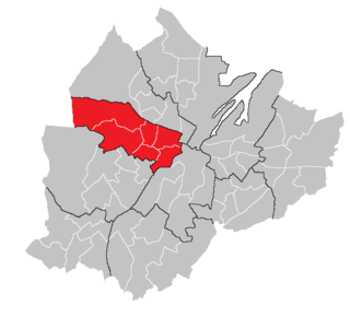
                      <span class="mw-page-title-main">Court (District Electoral Area)</span>

                      Court is one of the ten district electoral areas (DEA) in Belfast, Northern Ireland. Located in the north and west of the city, the district elects six members to Belfast City Council and contains the wards of Ballygomartin, Clonard, Falls, Forth River, Shankill, and Woodvale. Court is split between the Belfast North and Belfast West constituencies for the Northern Ireland Assembly and UK Parliament.
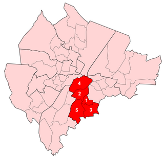
                      <span class="mw-page-title-main">Laganbank (District Electoral Area)</span> Human settlement in Northern Ireland

                      Laganbank was one of the nine district electoral areas in Belfast, Northern Ireland which existed from 1985 to 2014. Located in the south of the city, the district elected five members to Belfast City Council and contained the wards of Ballynafeigh, Botanic, Shaftesbury, Stranmillis, and Rosetta. Laganbank, along with neighbouring Balmoral, formed the greater part of the Belfast South constituencies for the Northern Ireland Assembly and UK Parliament.
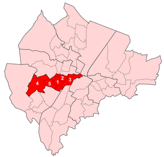
                      <span class="mw-page-title-main">Oldpark (District Electoral Area)</span> Electoral division in Belfast, Northern Ireland

                      Oldpark is one of the ten district electoral areas (DEA) in Belfast, Northern Ireland. Located in the north of the city, the district elects six members to Belfast City Council and contains the wards of Ardoyne; Ballysillan; Cliftonville; Legoniel; New Lodge and Water Works. Oldpark forms part of the Belfast North constituency for the Northern Ireland Assembly and UK Parliament.
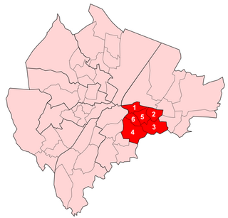
                      <span class="mw-page-title-main">Pottinger (District Electoral Area)</span> Human settlement in Northern Ireland

                      Pottinger was one of the nine district electoral areas (DEA) in Belfast, Northern Ireland from 1985 to 2014. Located in the east of the city, the district elected six members to Belfast City Council and contained the wards of Ballymacarrett, Bloomfield, Orangefield, Ravenhill, The Mount, and Woodstock.

                      <span class="mw-page-title-main">2011 Belfast City Council election</span> 2011 Northern Irish local government election

                      Elections to Belfast City Council were held on 5 May 2011 on the same day as the other Northern Irish local government elections. The election used nine district electoral areas to elect a total of 51 councillors, most representing the more heavily populated north and west.

                      Area C was one of the eight district electoral areas (DEA) which existed in Belfast, Northern Ireland from 1973 to 1985. Located in the south of the city, the district elected six members to Belfast City Council and contained the wards of Finaghy; Malone; Stranmillis; University; Upper Malone; and Windsor. The DEA largely formed part of the Belfast South constituency.

                      Area F was one of the eight district electoral areas (DEA) which existed in Belfast, Northern Ireland from 1973 to 1985. Containing the inner parts of west and south Belfast, the district elected six members to Belfast City Council and contained the wards of Clonard; Cromac; Donegall; Falls; Grosvenor; and Saint George's wards. Most of the DEA formed part of the Belfast West constituency, with a small part in Belfast South.
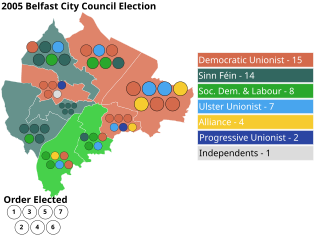
                      <span class="mw-page-title-main">2005 Belfast City Council election</span>

                      Elections to Belfast City Council were held on 5 May 2005 on the same day as the other Northern Irish local government elections. The election used nine district electoral areas to elect a total of 51 councillors, most representing the more heavily populated north and west.

                      <span class="mw-page-title-main">2001 Belfast City Council election</span> Northern Ireland local election

                      Elections to Belfast City Council were held on 7 June 2001 on the same day as the other Northern Irish local government elections. The election used nine district electoral areas to elect a total of 51 councillors, most representing the more heavily populated north and west.

                      Elections to Belfast City Council were held on 21 May 1997 on the same day as the other Northern Irish local government elections. The election used nine district electoral areas to elect a total of 51 councillors, most representing the more heavily populated north and west.

                      <span class="mw-page-title-main">Castlereagh South (District Electoral Area)</span> Electoral area in Northern Ireland

                      Castlereagh South is one of the seven district electoral areas (DEA) in Lisburn and Castlereagh, Northern Ireland. The district elects five members to Lisburn and Castlereagh City Council and contains the wards of Beechill, Cairnshill, Carryduff East, Carryduff West, Galwally, Knockbracken and Newtownbreda. Castlereagh South forms part of the Belfast South constituencies for the Northern Ireland Assembly and UK Parliament.

                      <span class="mw-page-title-main">Dunmurry Cross (District Electoral Area)</span> District electoral areas in Ards, Northern Ireland

                      Dunmurry Cross was one of the district electoral areas in Lisburn, Northern Ireland which existed from 1985 to 2014. It was one of four Lisburn DEAs until 1993, and one of five until 2014. The district elected seven members to Lisburn City Council and formed part of Belfast West constituencies for the Northern Ireland Assembly and UK Parliament and part of the Lagan Valley constituencies for the Northern Ireland Assembly and UK Parliament.

                      <span class="mw-page-title-main">Antrim Line (District Electoral Area)</span> District electoral areas in Newtownabbey, Northern Ireland

                      Antrim Line was one of the district electoral areas in Newtownabbey, Northern Ireland which existed from 1985 to 2014, one of five DEAs until 1993 and one of four DEAs until 2014. The district elected five members to Newtownabbey Borough Council until 1993 and seven members until 2014, and formed part of the South Antrim constituencies for the Northern Ireland Assembly and UK Parliament and part of the Belfast North constituencies for the Northern Ireland Assembly and UK Parliament.

                      <span class="mw-page-title-main">Banbridge (District Electoral Area)</span> District electoral area in Northern Ireland

                      Banbridge is one of the seven district electoral areas (DEA) in Armagh City, Banbridge and Craigavon, Northern Ireland. The district elects seven members to Armagh City, Banbridge and Craigavon Borough Council and contains the wards of Banbridge East, Banbridge North, Banbridge South, Banbridge West, Gilford, Loughbrickland and Rathfriland. Banbridge forms part of the Upper Bann constituencies for the Northern Ireland Assembly and UK Parliament.

                      <span class="mw-page-title-main">Lurgan (District Electoral Area)</span> District electoral area in Northern Ireland

                      Lurgan is one of the seven district electoral areas (DEA) in Armagh City, Banbridge and Craigavon, Northern Ireland. The district elects seven members to Armagh City, Banbridge and Craigavon Borough Council and contains the wards of Aghagallon, Knocknashane, Lough Road, Magheralin, Mourneview, Parklake and Shankill. Lurgan forms part of the Upper Bann constituencies for the Northern Ireland Assembly and UK Parliament.

                      <span class="mw-page-title-main">The Mournes (District Electoral Area)</span> District electoral area in Northern Ireland

                      The Mournes is one of the seven district electoral areas (DEA) in Newry, Mourne and Down, Northern Ireland. The district elects seven members to Newry, Mourne and Down District Council and contains the wards of Annalong, Binnian, Donard, Kilkeel, Lisnacree, Murlough and Tollymore. The Mournes forms part of the South Down constituencies for the Northern Ireland Assembly and UK Parliament.

                      <span class="mw-page-title-main">Enniskillen (District Electoral Area)</span> District electoral area in Northern Ireland

                      Enniskillen is one of the seven district electoral areas (DEA) in Fermanagh and Omagh, Northern Ireland. The district elects six members to Fermanagh and Omagh District Council and contains the wards of Castlecoole, Erne, Lisbellaw, Lisnarrick, Portora and Rossory. Enniskillen forms part of the Fermanagh and South Tyrone constituencies for the Northern Ireland Assembly and UK Parliament.

                      <span class="mw-page-title-main">Waterside (District Electoral Area)</span> District electoral area in Northern Ireland

                      Waterside is one of the seven district electoral areas (DEA) in Derry and Strabane, Northern Ireland. The district elects seven members to Derry and Strabane District Council and contains the wards of Caw, Clondermot, Drumahoe, Ebrington, Kilfennan, Lisnagelvin and Victoria. Waterside forms part of the Foyle constituencies for the Northern Ireland Assembly and UK Parliament.

                      References

                      1. "Ward Information for Blackstaff ward 95GG10". NISRA. Retrieved 22 December 2013.
                      2. "Ward Information for Finaghy ward 95GG23". NISRA. Retrieved 22 December 2013.
                      3. "Ward Information for Malone ward 95GG33". NISRA. Retrieved 22 December 2013.
                      4. "Ward Information for Musgrave ward 95GG34". NISRA. Retrieved 22 December 2013.
                      5. "Ward Information for Upper Malone ward 95GG45". NISRA. Retrieved 22 December 2013.
                      6. "Ward Information for Windsor ward 95GG49". NISRA. Retrieved 22 December 2013.
                      7. "Northern Ireland council election: List of all the candidates in the May 2023 poll". Belfast Live. Retrieved 6 May 2023.
                      8. "Balmoral". Belfast City Council. Retrieved 19 May 2023.
                      9. "Balmoral - Election results 2019". Belfast City Council.
                      10. "Balmoral - Election results 2014". Belfast City Council. Archived from the original on 28 May 2014.
                      11. "Balmoral Result Sheet" (PDF). EONI. Retrieved 8 July 2021.
                      12. "Local Government Results 2005". EONI. Retrieved 8 July 2021.
                      13. "Local Government Results 2001". EONI. Retrieved 8 July 2021.
                      14. "Local Government Results 1997". EONI. Retrieved 8 July 2021.
                      15. "Local Government Results 1993". EONI. Retrieved 8 July 2021.
                      16. "Local Government Results 1989". EONI. Retrieved 8 July 2021.
                      17. "Local Government Results 1985". EONI. Retrieved 8 July 2021.

                      54°34′01″N5°58′01″W / 54.567°N 5.967°W / 54.567; -5.967