
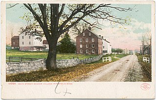
A town is a type of a human settlement. Towns are generally larger than villages and smaller than cities, though the criteria to distinguish between them vary considerably in different parts of the world.

A hamlet is a human settlement that is smaller than a town or village. This is often simply an informal description of a smaller settlement or possibly a subdivision or satellite entity to a larger settlement.

Birpur is a city and a notified area in Supaul district in the state of Bihar, India. It is a small town on the Indo-Nepal border near the historic Koshi Barrage on the Koshi River. It has an airstrip, which is being modernised and later on will be utilized for commercial as well defence use. It had been made when first prime minister of India Jawaharlal Nehru had landed here to lay the foundation stone of Koshi Barrage. There has been a new helipad constructed next to the airstrip for multi purpose use.
Bhatni Bazar is a town and a Nagar Panchayat in the Deoria district in the Indian state of Uttar Pradesh. It is the capital of the Development block Bhatni.

Piro is a nagar parishad town and corresponding community development block in Bhojpur District, in the Indian state of Bihar. Piro is 39 KM from the Ara Railway Station. Jitaura is 6 KM from Piro.
In the United States, the meaning of village varies by geographic area and legal jurisdiction. In formal usage, a "village" is a type of administrative division at the local government level. Since the Tenth Amendment to the United States Constitution prohibits the federal government from legislating on local government, the states are free to have political subdivisions called "villages" or not to and to define the word in many ways. Typically, a village is a type of municipality, although it can also be a special district or an unincorporated area. It may or may not be recognized for governmental purposes.

Sonatala Upazila is an upazila of Bogra District in the Division of Rajshahi, Bangladesh. Sonatala Thana was established in 1981 from Sariakandi Thana and was converted into an upazila in 1984. It is named after its administrative center, the town of Sonatala.
Mithapukur is an upazila of Rangpur District in the division of Rangpur, Bangladesh. The upazila is situated in the middle of Rangpur, surrounded by Rangpur Sadar to the north, Pirganj to the south, Badarganj and Phulbari to the west and Pirgachha and Sundarganj to the east. Mithapukur is famous for being the birthplace of Begum Rokeya and its sweet mango Harivanga.

Pirganj is an upazila of Rangpur District in the division of Rangpur, Bangladesh. Pirganj Upazila area 411.35 km2, located in between 25°18' and 25°31' north latitudes and in between 89°08' and 89°25' east longitudes. It is bounded by mithapukur upazila on the north, Palashbari, Ghoraghat and Nawabganj Sadar (Dinajpur) upazilas on the south, Sadullapur upazila on the east, Mithapukur, Nawabganj Sadar (Dinajpur) and Ghoraghat upazilas on the west.
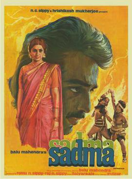
Sadma (transl. Trauma) is a 1983 Indian Hindi-language tragedy romantic drama film, written and directed by Balu Mahendra. It stars Kamal Haasan and Sridevi in lead roles, with the music composed by Ilaiyaraaja. The film tells the story of Nehalata Malhotra, a young woman who regresses to childhood as result of retrograde amnesia after suffering a head injury in a car crash. She was lost, and ended up trapped in a brothel before being rescued by Somu, a lonely school teacher who falls in love with her. The film was released on 8 July 1983.
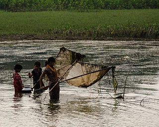
Tanguar Haor, located in the Dharmapasha and Tahirpur upazilas of Sunamganj District in Bangladesh, is a unique wetland ecosystem of national importance and has come into international focus. The area of Tanguar Haor including 46 villages within the haor is about 100 square kilometres (39 sq mi) of which 2,802.36 ha2 is wetland. It is the source of livelihood for more than 40,000 people. Bangladesh declared it an Ecologically Critical Area in 1999 considering its critical condition as a result of overexploitation of its natural resources.

Valmiki Nagar Assembly constituency is an assembly constituency in West Champaran district in the Indian state of Bihar. Dhirendra Pratap Singh alias Rinku Singh of JDU is the MLA.

Brahmpur is a large village and corresponding community development block in Buxar district of Bihar. It is known for its temple of Shiva, its religious practices, and its cattle fair. People visit Brahmapur to perform religious rituals in the temple of Shiva.
Tengraha is a village in Minapur Block in Muzaffarpur district of Bihar, India. It belongs to Tirhut Division. It is located 26 km north of the Muzaffarpur district headquarters, 8 km from Minapur, and 91 km from the state capital, Patna. It is surrounded by Gandak and Bagmati rivers. Most of the people in this village are farmers. This village, as well as the rest of Muzaffarpur district, is famous for its Lichee trees, which grow litchis fruit. Tengrari has a small shopping market. Balua Bazar is near Tengrari, which has a shopping market and Rishabh Vastralaya.
Balua is a village in Bhojpur Ara district in the Indian state of Bihar.
Guthani is a community development block and a revenue circle in Siwan district of the Indian state of Bihar, lying on the banks of river Chhoti Gandak. It is one of 13 blocks of Siwan Subdivision. The headquarters of the block is at Guthani town. The block is divided into ten gram panchayats and one city council, Nagar Panchayat Guthani.
Teznarayanpur is a railway terminus on Katihar–Teznarayanpur branch line of Barauni–Katihar section. It is located in Katihar district, Bihar state, India. The station consists of two platforms, which are not well sheltered.
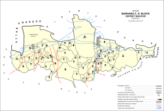
Balua is a village in Barhara block of Bhojpur district in Bihar, India. As of 2011, its population was 7,829, in 1,292 households.
Dhamdaha is a block of Purnia District, Bihar, India. Its seat of government is located in the village of Dhamdaha. In 2011, the block has a total population of 288,084.

