Bananera Airport | |||||||||||
|---|---|---|---|---|---|---|---|---|---|---|---|
| Summary | |||||||||||
| Airport type | Private | ||||||||||
| Serves | Morales, Guatemala | ||||||||||
| Elevation AMSL | 753 ft / 230 m | ||||||||||
| Coordinates | 15°28′30″N88°50′15″W / 15.47500°N 88.83750°W | ||||||||||
| Map | |||||||||||
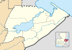 MGBN Location in Izabal Department  MGBN Location in Guatemala | |||||||||||
| Runways | |||||||||||
| |||||||||||
Bananera Airport( ICAO : MGBN) is an airport serving the city of Morales in Izabal Department, Guatemala.
Contents
The runway is within the city. The Puerto Barrios VOR-DME (Ident: IOS) is located 21.4 nautical miles (39.6 km) northeast of the airstrip. [3]