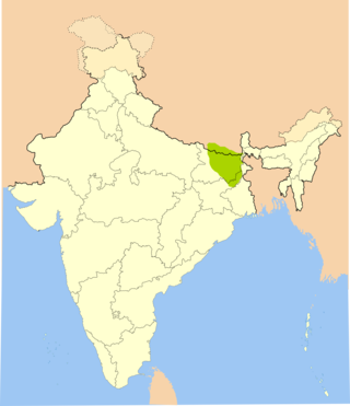
Maithili is an Indo-Aryan language spoken in parts of India and Nepal. It is native to the Mithila region, which encompasses parts of the eastern Indian states of Bihar and Jharkhand as well as the Nepal's Koshi and Madhesh Provinces. It is one of the 22 scheduled languages of India. It is the second most commonly spoken language of Nepal. It is also one of the fourteen provincial official languages of Nepal.

Rajbiraj is a mid-sized municipality located in the south-eastern part of Madhesh Province of Nepal. The city is also called the "Pink City of Nepal" because the township was designed in 1938 based on influence from the "Indian Pink City" Jaipur - thus making it the first township in Nepal to receive urban planning. Rajbiraj is the district headquarters of Saptari which is transferred from old district headquarter Hanumannagar in 1944 and is the eighth largest city in the province. It was declared a municipality in 1959. According to the 2021 census, the city had a population of 70,803 making it the 77rh largest municipality in Nepal. The city area is spread over 55.64 km2 (21.48 sq mi) and comprises 16 wards.
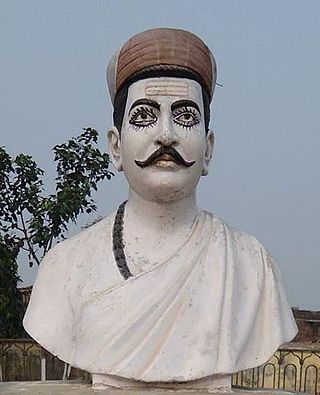
Vidyapati, also known by the sobriquet Maithil Kavi Kokil, was a Maithili and Sanskrit polymath-poet-saint, playwright, composer, biographer, philosopher, law-theorist, writer, courtier and royal priest. He was a devotee of Shiva, but also wrote love songs and devotional Vaishnava songs. He had knowledge of, and composed works in Sanskrit, Prakrit, Apabhramsha and Maithili.
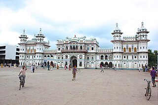
Dhanusha District,, a part of Madhesh Province, is one of the seventy-seven districts of Nepal. It is situated in the Outer Terai. The district, with Janakpurdham as its district headquarter, covers an area of 1,180.7 km2 (455.9 sq mi) and has a population (2021) of 838,084.
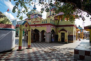
Mahottari District, a part of Madhesh Province, is one of the seventy-seven districts of Nepal. The district, with Jaleshwar as its district headquarter, covers an area of 1,002 km2 (387 sq mi) and had a population of 553,481 in 2001, 627,580 in 2011 and 705,838 in 2021 census. Its headquarters is located in Jaleshwar, a neighbouring town of the historical city of Janakpur. The name Jaleshwar means the 'God in Water'. One can find a famous temple of Lord Shiva in Water there. Jaleshwar lies at a few kilometres distance from the Nepal-India border and has a majority Maithili population.
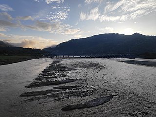
Sarlahi, a part of Madhesh Province, is one of the seventy-seven districts of Nepal. According to new laws, a combination of more than two or four villages makes a municipality, which covers an area of 1,259 km2 (486 sq mi) and had a population of 635,701 in 2001,769,729 in 2011 and 862,470 in 2021.

Maithils, also known as Maithili people, are an Indo-Aryan cultural and ethno-linguistic group from the Indian subcontinent, who speak the Maithili language as their native language. They inhabit the Mithila region, which comprises Northern and Eastern Bihar and Northeastern Jharkhand in India & in Nepal constituting Madhesh Province in addition to some terai districts of Bagmati and Koshi Provinces.

Janakpurdham or Janakpur, is the capital city of Madhesh Province. This sub-metropolitan city is a central hub for the Maithili language, as well as for religious and cultural tourism in Nepal.
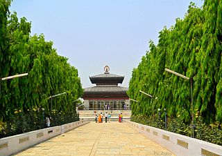
Mithila, also known as Tirhut, Tirabhukti and Mithilanchal, is a geographical and cultural region of the Indian subcontinent bounded by the Mahananda River in the east, the Ganges in the south, the Gandaki River in the west and by the foothills of the Himalayas in the north. It comprises certain parts of Bihar and Jharkhand of India and adjoining districts of the Koshi Province, Bagmati Pradesh and Madhesh Province of Nepal. The native language in Mithila is Maithili, and its speakers are referred to as Maithils.

Pipra (पिपरा) a village in Mahottari District, Janakpur Zone in the Central Region of Nepal.
Jaleshwar is a municipality in Janakpur Zone, Nepal, and the headquarters of Mahottari district of Madhesh Province in Nepal. It is located in the Terai, on the border with India at Bhitthamore, Bihar, and has a Customs checkpoint. The language most commonly spoken in Jaleshwar is "Mailthli". Side village of Jaleshwar is "Parkauli Phulatta".
Bhutahi Paterwa is a village development committee in Dhanusa District in the Janakpur Zone of south-eastern Nepal.Currently, it is situated in Mithila Bihari Municipality ward no. 01 of Madhesh Pradesh. At the time of the 2021 Nepal census it had a population of 4,736 persons living in more than 1000 individual households in 9.3 km2.Most people living in this village follow Hinduism.The main inhabitants are Mandal, Daha, Dhanuk, Yadav, Shah, Das, Thakur, Sharma, Sada (Mushahar) and many more.It has various religious and cultural places such as Maharani Mai Temple (Sthan), Ram Janaki Temple (Kutti), Bhuinya Baba Mandir, Mrigakund etc.There is a Ganesh Temple in the southern part of the village.There is a big and attractive temple of Maharani Mai on the bank of Chhath Pokhari.One of the exciting place in the village is Purni Pokhari.It includes Naga Baba Mandir, Hanuman Mandir, Mahadev(Shiv) Mandir, Dihabar Mandir etc.

Duhabi is a Village Development Committee in Dhanusa District in the Janakpur Zone of south-eastern Nepal. At the time of the 1991 Nepal census it had a population of 5,762 persons residing in 990 individual households.

Bardibas is a municipal area and a town located in Mahottari District of Nepal that connects the Kathmandu Valley with Madhesh Province and extends the connection to Koshi Province. It is located at latitude: 26°54'6.84" to 27°08'46.90" and longitude: 85°47'42.67" to 85°56'42.97" along the East West Highway, at the foothills of the Chure Range. The municipality is surrounded by Dhalkebar of Mithila Municipality, Dhanusha District in the East and Ishworpur municipality of Sarlahi District in the West, Kamalamai municipality of Sindhuli District, Bagmati Province falls in the North and Bhangaha, Aurahi and Gaushala municipalities are located in the South.
Kolhuwa Bagiya is a village in Ekdara Rural Municipality in Mahottari District in the Janakpur Zone of south-eastern Nepal. At the time of the 1991 Nepal census it had a population of 5193 people living in 947 individual households. It is located in Ekdara Rural Municipality Ward No 6. Especially Kolhuwa is Most visited village for holy Goddess Mahodari Mata in the village pond. On Sundays and Tuesdays people come to bathe in the pond and wish for their goodness. Village also connected with National Highway(B.P. Highway). One of Oldest Schools of Nepal Shree Janta Higher Secondary School situated in Kolhuwa.
Parsa is a rural municipality in Sarlahi District, a part of Madhesh Province in Nepal. It is situated 10 km East from Malangwa which is headquarter of Sarlahi district. It was formed in 2016 occupying current 6 sections (wards) from previous 6 former VDCs. It occupies an area of 23.12 km2 with a total population of 21,650. The major language spoken in the rural municipality are Maithili and Bajjika.

Madhesh Province is a province of Nepal in the Terai region with an area of 9,661 km2 (3,730 sq mi) covering about 6.5% of the country's total area. It has a population of 6,126,288 as per the 2021 Nepal census, making it Nepal's most densely populated province and the smallest province by area. It borders Koshi Pradesh to the east and the north, Bagmati Province to the north, and India’s Bihar state to the south and the west. The border between Chitwan National Park and Parsa National Park acts as the provincial boundary in the west, and the Kosi River forms the provincial border in the east. The province includes eight districts, from Parsa in the west to Saptari in the east.
Mithila Bihari is a municipality in Danusha District in Madhesh Province of Nepal. It was formed in 2016 occupying current 10 Sections (Wards) from previous 10 VDCs. It occupies an area of 37.60 km2 with a total population of 37,276. Dhanusha district, located in the central part of the Janakpur region, which is one of the development regions of Nepal, is bordered by southern India. There are 18 local levels located in the central part of the Dhanusha district, which were part of the Madhyamanchal Development Region. Among them, six Village Development Committees (VDCs) - Bhutahi Paterwa, Mithileshwar Nikas, Andupatti, Tarapatti Sirsiya, and Mithileshwar Mauwahi - have been merged to form the Mithila Bihari Municipality under the Madhesh Province of Nepal as of Falgun 27, 2073 B.S. Despite being situated in the easily accessible terrain of the Terai region in terms of geographical features, Mithila state has a densely populated settlement from the perspective of human development indicators and progress. In the historic pilgrimage of Mithila state, which includes two main Dolis (Processions) or travel camps, such as the Mela, established with the name of Lord Bihari from Mithila Bihari, the city of Janakpur, which is recognized as the holy place of the Hindu religion, meaning the father-in-law's place of Lord Ram, has given additional identity to the Mithila Bihari. From a religious point of view, Mithila Bihari has been named after Lord Ram, who is historically recognized, which has resulted in the naming of this local place as Mithila Bihari. Published in the Rajpatra on Jestha 11, 2074 B.S., upgrading the Mithila Bihari Rural Municipality to the Municipality level was not possible, but an interim order of the Supreme Court issued on Bhadra 27, 2074 B. S. resulted in the transformation of Mithila Bihari Rural Municipality into a Municipality.

Banauli Vidyapati Dih is a historical place related to the great Maithili poet Vidyapati. It is located at Banauli village of Mahottari district in Madhesh Pradesh of Mithila region in Nepal.
Raj Banauli or Banauli Raj was a small kingdom in the Mithila region of the Indian Subcontinent during the 14th - 15th century CE. It was ruled by Dronwara Dynasty. Puraditya of Dronwara Dynasty was the king of the Raj Banauli. He is also known as Dronwara Puraditya and Girinarayan. The king Puraditya defeated another ruler Arjun Singh, so he is also called as "Arjun Vijayee". He was contemporary to the emperor King Shivasimha of Mithila and the Maithili poet Vidyapati. The location of the Raj Banauli is disputed among the scholars. Some scholars believe Banauli Vidyapati Dih near south of the Janakpur city as the location of the Raj Banauli. Similarly some scholars believe Banauli of Saptari district as the location of the Raj Banauli. And some scholars claimed Banauli near Sursand as the location of the Raj Banauli.


