Bangert | |
|---|---|
Neighbourhood and former village | |
 | |
 Bangert Location in the Netherlands  Bangert Location in the province of North Holland in the Netherlands | |
| Coordinates: 52°44′9.72″N5°10′41.1″E / 52.7360333°N 5.178083°E | |
| Country | |
| Province | North Holland |
| Municipality | Medemblik |
| Village | Andijk |
| Area | |
• Total | 0.73 km2 (0.28 sq mi) |
| Elevation | −1.3 m (−4.3 ft) |
| Population (2021) [1] | |
• Total | 1,370 |
| • Density | 1,900/km2 (4,900/sq mi) |
| Time zone | UTC+1 (CET) |
| • Summer (DST) | UTC+2 (CEST) |
| Postal code | 1619 [1] |
| Dialing code | 0228 |
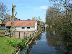
Bangert is a neighbourhood of Andijk and former village in northwest Netherlands, located in Medemblik, North Holland.
Throughout its history Bangert has been competing with surrounding municipalities (esp. Andijk and Kerkbuurt) for land and population. For instance, in 1667 neighbouring Kerkbuurt acquired a church and began pulling away some of Bangert's inhabitants. In the 19th and 20th centuries, poverty combined with landgrabbing by Wervershoof also diminished the village.[ citation needed ]
Andijk annexed Bangert, Kerkbuurt and Munnikij which are now considered neighbourhoods of Andijk. In 2011, it became part of the Medemblik municipality. [3]