Medemblik

Last updated • 3 min readFrom Wikipedia, The Free Encyclopedia
Medemblik
Medemblik.jpg
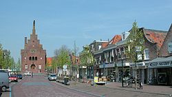
Medemblik city centre
Flag of Medemblik.svg
Coat of arms of Medemblik.svg
Map - NL - Municipality code 0420 (2019).svg
Location in North Holland
Coordinates: 52°41′N5°2′E / 52.683°N 5.033°E / 52.683; 5.033
Country Netherlands
Province North Holland
Government
[1]
  Body Municipal council
   Mayor Michiel Pijl (CDA)
Area
[2]
  Total257.56 km2 (99.44 sq mi)
  Land121.42 km2 (46.88 sq mi)
  Water136.14 km2 (52.56 sq mi)
Elevation
[3]
0 m (0 ft)
Population
 (January 2021) [4]
  Total45,165
  Density372/km2 (960/sq mi)
Time zone UTC+1 (CET)
  Summer (DST) UTC+2 (CEST)
Postcode
Parts of 1600 range
Area code 0227–0229
Website www.medemblik.nl
Map of Medemblik, June 2015 Gem-Medemblik-OpenTopo.jpg
Map of Medemblik, June 2015

Medemblik (Dutch pronunciation: [ˈmeːdəmblɪk] ) is a municipality and a city in the Netherlands, in the province of North Holland and the region of West-Frisia. [5] It lies immediately south of the polder and former municipality of Wieringermeer.

Contents

History

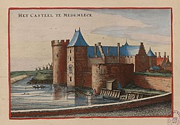
Medemblik was a prosperous trading town, when in 1282, Floris V, Count of Holland, successfully invaded West Friesland. He built several fortresses to control the region, one of which was Kasteel Radboud in Medemblik, and awarded Medemblik city rights in 1289. After Floris V was murdered in 1296, the local Frisians besieged the castle, but in 1297 an army from Holland thwarted their efforts to starve out the inhabitants, which included Medemblik citizens. [6]

Several more attacks took place in the following centuries. The most notorious of these happened in June 1517, when Medemblik was attacked from mainland Frisia by about 4000 pirates known as the Arumer Zwarte Hoop, led by Pier Gerlofs Donia and Wijard Jelckama. Many citizens fled to the castle, which the pirates unsuccessfully besieged. Eventually, they took out their fury on the town, which burned to the ground. After this the band continued their marauding path on land throughout present day North Holland. [7]

After Medemblik town walls were constructed in 1572, the castle lost its role as a refuge for the citizens, which led to its partially dismantling in 1578. Over the centuries the castle fell into decay, but in 1889 it became property of the crown and was restored to be used as a courthouse, which function it served until 1934. Anticipating the German invasion, the Rijksmuseum in September 1939 chose the castle as the initial hiding place of Rembrandt's Night Watch. [6]

On 1 January 2007 Medemblik merged with the municipalities of Noorder-Koggenland and Wognum. The new municipality was called Medemblik, even though it was the smallest of the three in population. Again, on 1 January 2011, Medemblik merged with Andijk and Wervershoof into the municipality Medemblik.

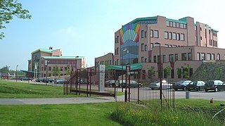
The new city hall is the former office building of the DSB Bank in Wognum.

Tourism

Medemblik is best known in Europe for its sailing events. Medemblik also has a picturesque small innercity with many 17th and 18th century houses, two big churches, an old orphanage, a town hall and, of course, castle Radboud, which is at the edger of the innercity. The city also hosts the Medemblik steam museum, housed in a decommissioned pumping station.

Transport

A heritage railway connects Medemblik with Hoorn.

Local government

The municipal council of Medemblik consists of 29 seats, which at the 2022 municipal elections divided as follows: [8]

Notable people

Yvonne Spigt, 2012 Yvonne-spigt-1356884719.jpg
Yvonne Spigt, 2012

Sport

Related Research Articles

<span class="mw-page-title-main">Vlaardingen</span> Town and municipality in South Holland, Netherlands

Vlaardingen is a large town and municipality in South Holland in the Netherlands. It is located on the north bank of the Nieuwe Maas river at the confluence with the Oude Maas. The municipality administers an area of 26.69 km2 (10.31 sq mi), of which 23.57 km2 (9.10 sq mi) is land, with 73,924 residents in 2021.

<span class="mw-page-title-main">Zwartewaterland</span> Municipality in Overijssel, Netherlands

Zwartewaterland is a municipality in the province Overijssel in the eastern Netherlands.

<span class="mw-page-title-main">Abcoude</span> Town and former municipality in Utrecht, Netherlands

Abcoude is a town and former municipality in the Netherlands, in the province of Utrecht. Since 2011 it has been part of the municipality of De Ronde Venen.

<span class="mw-page-title-main">Oirschot</span> Municipality in North Brabant, Netherlands

Oirschot is a municipality and town in the province of North Brabant (Noord-Brabant) in the southern Netherlands. It is 12 kilometres (7.5 mi) from Eindhoven and 20 kilometres (12 mi) from Tilburg. The municipality had a population of 18,842 in 2021.

<span class="mw-page-title-main">Andijk</span> Village in North Holland, Netherlands

Andijk is a former municipality and a village bordering Lake IJssel in the Netherlands, in the province of North Holland and the region of West-Frisia. Since 1 January 2011 Andijk has been part of Medemblik municipality.

<span class="mw-page-title-main">Beverwijk</span> Municipality in North Holland, Netherlands

Beverwijk is a municipality and a city in the Netherlands, in the province of North Holland. The town is located about 20 kilometres (12 mi) northwest of Amsterdam in the Randstad metropolitan area, north of the North Sea Canal very close to the North Sea coast. A railway tunnel and two motorway tunnels cross the canal between Beverwijk and the nearby city of Haarlem on the south side of the canal.

<span class="mw-page-title-main">Langedijk</span> Former municipality in North Holland, Netherlands

Langedijk is a former municipality in the Netherlands, in the province of North Holland and the region of West-Frisia. Langedijk received city rights in 1415.

<span class="mw-page-title-main">Opmeer</span> Municipality in North Holland, Netherlands

Opmeer is a municipality and town in the Netherlands, in the province of North Holland and the region of West-Frisia.

<span class="mw-page-title-main">Stede Broec</span> Municipality in North Holland, Netherlands

Stede Broec is a municipality in the Netherlands, in the province of North Holland and the region of West-Frisia. The name Stede Broec derives from stede and broec.
<span class="mw-page-title-main">Wervershoof</span> Village and former municipality in North Holland, Netherlands

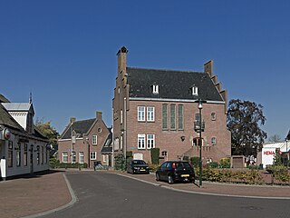
Wervershoof is a small town and former municipality in the north-western Netherlands, in the province of North Holland and the region of West-Frisia. Since 1 January 2011 it has been part of the municipality of Medemblik. The N240 and N302 roads run through the town.
<span class="mw-page-title-main">Wognum</span> Place in Netherlands, Kingdom of the Netherlands

Wognum is a former municipality and a town in the Netherlands, in the province of North Holland. Wognum received city rights in 1392 but lost them in 1426. In 2007 it merged with the municipalities of Medemblik and Noorder-Koggenland into an enlarged municipality of Medemblik.

<span class="mw-page-title-main">Lisse</span> Municipality in South Holland, Netherlands

Lisse is a town and municipality in the province of South Holland in the Western Netherlands. The municipality, which lies within the Duin- en Bollenstreek, covers an area of 16.05 km2 (6.20 sq mi) of which 0.36 km2 (0.14 sq mi) is water. Its population was 22,982 in 2021. Located within the municipal boundary is also the community De Engel.

<span class="mw-page-title-main">Voorschoten</span> Town and Municipality in South Holland, Netherlands

Voorschoten is a town and municipality in the western Netherlands, in the province of South Holland. It is a smaller town in the Randstad, enclosed by the cities of Leiden, Wassenaar and The Hague. The municipality covers an area of 11.56 km2 (4.46 sq mi) of which 0.42 km2 (0.16 sq mi) is covered by water.
<span class="mw-page-title-main">Echt-Susteren</span> Municipality in Limburg, Netherlands

Echt-Susteren is a municipality in the southeastern Netherlands. Echt-Susteren was created in 2003 by merging the former municipalities of Echt and Susteren.
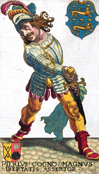
<span class="mw-page-title-main">Pier Gerlofs Donia</span> Frisian warrior, pirate, and rebel (1480–1520)

Pier Gerlofs Donia was a Frisian farmer, rebel leader, and pirate. He is best known by his West Frisian nickname Grutte Pier, or by the Dutch translation Grote Pier, which referred to his legendary size, strength, and bravery.

<span class="mw-page-title-main">Bronckhorst</span> Municipality in Gelderland, Netherlands

Bronckhorst is a municipality in Gelderland, the Netherlands. The municipality is the result of a merger of the former municipalities Hengelo, Hummelo en Keppel, Steenderen, Vorden and Zelhem, on 1 January 2005. The municipality is named after the medieval castle of the Bronckhorst family, who once ruled this area.

Wijerd Jelckama was a Frisian military commander, warlord and member of the Arumer Zwarte Hoop. He was the lieutenant of Pier Gerlofs Donia and fought along his side against the Saxon and Hollandic invaders. Jelckama took Donia's place as freedom fighter after Donia retired in 1519.

<span class="mw-page-title-main">Arumer Zwarte Hoop</span> Military group from 1515 to 1523

The Arumer Zwarte Hoop, meaning "Black Army of Arum" was an army of peasant rebels and mercenaries in Friesland fighting against the Habsburg authorities from 1515 to 1523. For four years they were successful under the former farmer Pier Gerlofs Donia. Led by his Lieutenant Wijerd Jelckama from 1519 they slowly lost ground and were captured and executed in 1523.

<span class="mw-page-title-main">De Fryske Marren</span> Municipality in Friesland, Netherlands

De Fryske Marren is a municipality of Friesland in the northern Netherlands. It was established 1 January 2014 and consists of the former municipalities of Gaasterlân-Sleat, Lemsterland, Skarsterlân and parts of Boarnsterhim, all four of which were dissolved on the same day. The municipality is located in the province of Friesland, in the north of the Netherlands, and has a population of 51,778 and a combined area of 559.93 km2 (216.19 sq mi).

<span class="mw-page-title-main">Radboud Castle</span> Castle in the Netherlands

Radboud Castle is a castle on the east bank of the harbour in Medemblik.
References

  1. "Michiel Pijl" (in Dutch). Gemeente Medemblik. Archived from the original on 7 December 2023. Retrieved 30 April 2024.
  2. "Kerncijfers wijken en buurten 2020" [Key figures for neighbourhoods 2020]. StatLine (in Dutch). CBS. 24 July 2020. Retrieved 19 September 2020.
  3. "Postcodetool for 1687CD". Actueel Hoogtebestand Nederland (in Dutch). Het Waterschapshuis. Archived from the original on 21 September 2013. Retrieved 6 March 2014.
  4. "Bevolkingsontwikkeling; regio per maand" [Population growth; regions per month]. CBS Statline (in Dutch). CBS. 1 January 2021. Retrieved 2 January 2022.
  5. "Gemeente Medemblik" (in Dutch). Retrieved 4 August 2010.
  6. 1 2 Ben Dijkhuis The Castle at Medemblik
  7. Ben Dijkhuis Grote Pier en de Zwarte Hoop in 1517 (in Dutch)
  8. "Medemblik municipal election 2022". verkiezingsuitslagen.nl (in Dutch). 16 March 2022. Retrieved 30 April 2024.
  9. IMDb Database retrieved 9 August 2019