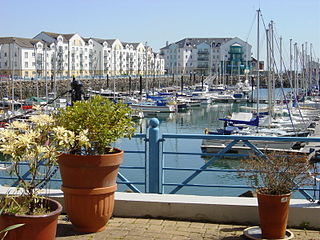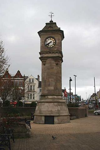
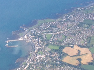
Bangor is a city and seaside resort in County Down, Northern Ireland, on the southern side of Belfast Lough. It is within the Belfast metropolitan area and is 13 miles (22 km) east of Belfast city centre, to which it is linked by the A2 road and the Belfast–Bangor railway line. The population was 64,596 at the 2021 Census. Bangor was granted city status in 2022, becoming Northern Ireland's sixth city.
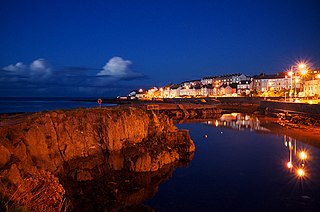
Donaghadee is a small town in County Down, Northern Ireland. It lies on the northeast coast of the Ards Peninsula, about 18 miles (29 km) east of Belfast and about six miles (10 km) south east of Bangor. It is in the civil parish of Donaghadee and the historic barony of Ards Lower. It had a population of 6,869 people in the 2011 Census.

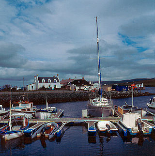
Portaferry is a small town in County Down, Northern Ireland, at the southern end of the Ards Peninsula, near the Narrows at the entrance to Strangford Lough. It is home to the Exploris aquarium and is well known for the annual Gala Week Float Parade. It hosts its own small Marina, the Portaferry Marina. The Portaferry – Strangford Ferry service operates daily at 30-minute intervals between the villages of Portaferry and Strangford, less than 1500 metres apart, conveying about 500,000 passengers per annum. It had a population of 2,514 people in the 2011 Census.

North Down Borough Council was a Local Council in County Down in Northern Ireland. It merged with Ards Borough Council in May 2015 under local government reorganisation in Northern Ireland to become North Down and Ards District Council.

A pastie is a large to medium-sized battered deep-fried round of minced meat and vegetables common to Northern Ireland. Generally served with chips to form a "pastie supper", or in a white roll as a "pastie bap" or "pastie burger" it is a common staple in most fish and chip shops in the country.
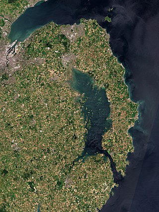
The Ards Peninsula is a peninsula in County Down, Northern Ireland, on the north-east coast of Ireland. It separates Strangford Lough from the North Channel of the Irish Sea. Towns and villages on the peninsula include Donaghadee, Millisle, Portavogie and Portaferry. The large towns of Newtownards and Bangor are at the mainland edge of the peninsula. Burr Point is the easternmost point on the island of Ireland. Approximately 30,000 people live on the peninsula.

Belfast Lough is a large, intertidal sea inlet on the east coast of Northern Ireland. At its head is the city and port of Belfast, which sits at the mouth of the River Lagan. The lough opens into the North Channel and connects Belfast to the Irish Sea.

Magheramorne is a hamlet in County Antrim, Northern Ireland. It is about 5 miles south of Larne on the shores of Larne Lough. It had a population of 75 people in the 2001 Census. Following the reform of Northern Ireland's local government system on 1 April 2015, Magheramorne lies within the Mid and East Antrim Borough Council area.

The Old Custom House of Bangor is a 17th-century tower and adjoining tower house. It is situated on the seafront in Bangor, County Down, Northern Ireland. It is a well-preserved reminder of Bangor's seafaring history alongside its modern marina.
Aith,, is a village on the Northern coast of the West Shetland Mainland, Scotland at the southern end of Aith Voe, some 21 miles west of Lerwick.
Clandeboye Park, known for commercial reasons as the Bangor Fuels Arena, is a football stadium in Bangor, Northern Ireland. It is the home ground of Bangor and Ards.
Kilcooley estate is a housing estate owned by the Northern Ireland Housing Executive on the outskirts of Bangor, Northern Ireland. The residents of the area are predominantly Protestant, and the area has strong links with loyalism.
The A21, also Comber road, is a road in County Down in Northern Ireland. The route commences in Bangor, passing through Newtownards, Comber, and Ballygowan, and finishes on the northern outskirts of Ballynahinch.

Great Victoria Street in Belfast, Northern Ireland, is a major thoroughfare located in the city centre and is one of the important streets used by pedestrians alighting from Belfast Great Victoria Street railway station and walking into shopping streets such as Royal Avenue.