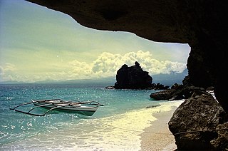
Negros Oriental, officially the Province of Negros Oriental, is a province in the Philippines located in the Negros Island Region. Its capital is the city of Dumaguete, one of the two regional centers of Negros Island Region. It occupies the southeastern half of the large island of Negros, and borders Negros Occidental, which comprises the northwestern half. It also includes Apo Island, a popular dive site for both local and foreign tourists.
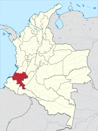
Cauca Department is a department of Southwestern Colombia. Located in the southwestern part of the country, facing the Pacific Ocean to the west, the Valle del Cauca Department to the north, Tolima Department to the northeast, Huila Department to the east, and Nariño Department to the south. Putumayo and Caqueta Departments border the southeast portion of Cauca Department as well. It covers a total area of 29,308 km2 (11,316 sq mi), the 13th largest in Colombia. Its capital is the city of Popayán. The offshore island of Malpelo belongs to the department. It is located in the southwest of the country, mainly in the Andean and Pacific regions plus a tiny part (Piamonte) in the Amazonian region. The area makes up 2.56% of the country.

Dumaguete, officially the City of Dumaguete, is a 2nd class component city and capital of the province of Negros Oriental, Philippines. According to the 2020 census, it has a population of 134,103 people. It is the most populous city and the smallest city by land area in Negros Oriental as well as one of the two regional centers in Negros Island Region.

Elías Piña is one of the 32 provinces of the Dominican Republic, located in the westernmost part of the country, along the border with Haiti. It is divided into 6 municipalities and its capital city is Comendador. The Cordillera Central is found in the northern part of the province, and the Sierra de Neiba runs across the southern half. Between those two mountain ranges, there are several valleys formed by the Artibonite River and its tributaries.

Valencia, officially the Municipality of Valencia, is a 1st class municipality in the province of Negros Oriental, Philippines. According to the 2020 census, it has a population of 38,733 people.

Basay, officially the Municipality of Basay, is a 4th class municipality in the province of Negros Oriental, Philippines. According to the 2020 census, it has a population of 28,531 people.

Guihulngan, officially the City of Guihulngan, is a 5th class component city in the province of Negros Oriental, Philippines. According to the 2020 census, it has a population of 102,656 people, the third-most populous city in Negros Oriental after the cities of Dumaguete and Bayawan. Guihulngan is also dubbed by its residents as the "rising city of the north".

Mabinay, officially the Municipality of Mabinay, is a 1st class municipality in the province of Negros Oriental, Philippines. According to the 2020 census, it has a population of 82,953 people, making it the most-populous municipality in Negros Oriental.

Santa Catalina, officially the Municipality of Santa Catalina, is a 1st class municipality in the province of Negros Oriental, Philippines. According to the 2020 census, it has a population of 77,501 people.

Sibulan, officially the Municipality of Sibulan, is a second class municipality in the province of Negros Oriental, Philippines. According to the 2020 census, it has a population of 64,343 people.
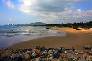
Sipalay, officially the City of Sipalay, is a 4th class component city in the province of Negros Occidental, Philippines. According to the 2020 census, it has a population of 72,448 people. It is the top tourist destination in the province of Negros Occidental.

Sibulan Airport, also known as Dumaguete Airport or Dumaguete–Sibulan Airport, is an airport serving the general area of the city of Dumaguete, located in the province of Negros Oriental in the Philippines. It is located 3 kilometers (1.9 mi) north of Dumaguete on a 63-hectare (160-acre) site in Barangay Agan-an in the nearby municipality of Sibulan. The airport is one of two major airports serving Negros Island, the other being Bacolod–Silay Airport in Silay, Negros Occidental.

The legislative districts of Negros Oriental are the representations of the province of Negros Oriental in the various national legislatures of the Philippines. The province is currently represented in the lower house of the Congress of the Philippines through its first, second, and third congressional districts.

The Roman Catholic Diocese of Dumaguete is a diocese of the Latin Church of the Roman Catholic Church in the Philippines. Its territory consists of the provinces of Negros Oriental and Siquijor with the exception of the municipalities of La Libertad and Vallehermoso, and the cities of Guihulngan and Canlaon.

Mount Talinis is a complex volcano in the Philippine province of Negros Oriental. At about 1,903 metres (6,243 ft) above sea level, it is the second highest mountain on Negros Island after Mount Kanlaon, and the tallest peak in the mountain range known as the Cuernos de Negros. The volcano is located 9 km (5.6 mi) southwest of the municipality of Valencia; and 20 km (12 mi) from Dumaguete, the capital of the province.
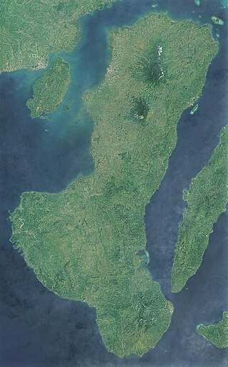
Negros is the fourth largest and third most populous island in the Philippines, with a total land area of 13,309 km2 (5,139 sq mi). The coastal zone of the southern part of Negros is identified as a site of highest marine biodiversity importance in the Coral Triangle.

Balinsasayao Twin Lakes Natural Park is a natural park in the Philippines surrounding Lake Balinsasayao and Lake Danao in the province of Negros Oriental, 14.5 kilometres (9.0 mi) west of Dumaguete. It covers an area of 8,016.05 hectares, with heights ranging from 830 to 846 metres. The park is located in the Mount Talinis range, also known as Cuernos de Negros, in the southern portion of Negros Island, and spans across the municipalities of Valencia, Sibulan and San Jose. It was declared a protected area in 2000.
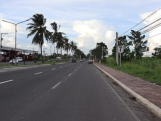
National Route 7 (N7) is a 398-kilometer (247 mi), two to six lane, major primary route that forms part of the Philippine highway network, running from Bacolod to Bayawan in the island of Negros.
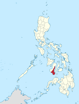
Negros Oriental's 3rd congressional district is one of the three congressional districts of the Philippines in the province of Negros Oriental. It has been represented in the House of Representatives since 1987. The district consists of the southernmost parts of the province that were previously included in Negros Oriental's 2nd district. It contains the city of Bayawan and the municipalities immediately to the south and west of the provincial capital city, Dumaguete, namely Bacong, Basay, Dauin, Santa Catalina, Siaton, Valencia and Zamboanguita. It is currently vacant for the 19th Congress since the expulsion of its most recent representative Arnolfo Teves Jr. on August 16, 2023.


