Baragounia

Last updated

Baragounia is a small village located in Bantala Tehsil of Angul district, Odisha, India, with a population of 2,310.

Contents

Baragounia
Village
Maapandurushuni1.jpg
Pandurushuni Temple, Baragounia, Angul
Nickname: 
Mystic Village
India Odisha location map.svg
Red pog.svg
Baragounia
Location in Odisha, Banatla India
India location map.svg
Red pog.svg
Baragounia
Baragounia (India)
Coordinates: 20°42′17″N85°04′9″E / 20.70472°N 85.06917°E / 20.70472; 85.06917
CountryFlag of India.svg  India
State Odisha
District Angul
Government
  Collector & District MagistrateShri Siddharth Shankar Swain, IAS
Population
 (2011) [1]
  Total2,310
Languages
  Official Oriya
Time zone UTC+5:30 (IST)
PIN
759129
Telephone code06764
Vehicle registration OD-19
Nearest city Cuttack, Bhubaneswar
Sex ratio 893 female per 1000 male /
Literacy68%
Lok Sabha constituency Angul
Climate according to weather (Köppen)
Avg. summer temperature47 °C (117 °F)
Avg. winter temperature10 °C (50 °F)
Website www.mihelpu.com

Geography

Baragounia is located at 20.70°N 85.06°E. It has an average elevation of 195 m (640 ft) above sea level. The total geographical area of the district is 2 km2. From the location point of view of area it is Bantala 12 km from Angul district. Baragounia consists of a total of four sahi/areas: Punapasi, Kimiridhara, Gothomala, Gna

Climate

The climatic condition of Angul is varied. It has mainly 4 seasons. The summer season is from March to mid-June, the period from mid-June to September is the Rainy season, October and November constitute the post-monsoon season and winter is from December to February.

The average annual rainfall of the district is 1421 mm. However, there is a great variation of rainfall from year to year. The rainfall in the district during the last 10 years varied between 896 mm & 1744 mm. There are 70 rainy days on an average in a year, but it varies from 66 at Angul to 80 at Bantala. The distribution of rainfall is also quite erratic causing widespread drought year after year. 2013 was marked by Cyclone Phailin that caused extensive rainfall resulting to floods.[ citation needed ]

There is a meteorological observatory in the district. The data of this observatory may be taken as representative of the meteorological condition of the whole village.[ citation needed ] The hot season commences by beginning of March. May is the hottest month with a mean daily maximum temperature at 44 degree Celsius. With the onset of monsoon, early in June day temperature drops appreciably. After withdrawal of monsoon by the 1st week of October both day and night temperature began to diminish steadily. December is usually coldest month of a year with a mean daily minimum temperature of 11 degree Celsius. In association with the passage of western disturbances across north India during winter months short spells of cold occur and the minimum temperature drops down to 10 degree Celsius. The lowest minimum temperature was 5.2 degree Celsius in Baragounia and neighborhood are hottest part of the district and have lower rainfall. The summer temperature has shown as increasing trend in recent past.[ citation needed ]

Winds are generally light to moderate with some increase in force in the summer and southwest monsoon seasons. Winds usually blow from southwest and northwest directions in the monsoon. In the post monsoon and cold seasons winds blow between the west and north. In the summer months the winds become variable in direction.2013 cyclone Phailin rose wind speed gusts to 100kmph.

Demographics

The Baragounia village has population of 2310 of which 1181 are males while 1129 are females as per Population Census 2011.

In Baragounia village population of children with age 0-6 is 282 which makes up 12.21% of total population of village. Average Sex Ratio of Baragounia village is 956 which is lower than Orissa state average of 979. Child Sex Ratio for the Baragounia as per census is 932, lower than Orissa average of 941.

Baragounia village has higher literacy rate compared to Orissa. In 2011, literacy rate of Baragounia village was 75.00% compared to 72.87% of Orissa. In Baragounia Male literacy stands at 85.41% while female literacy rate was 64.15%.

As per constitution of India and Panchyati Raaj Act, Baragounia village is administrated by Sarpanch (Head of Village) who is elected representative of village.

Caste factor

Baragounia village of Anugul has substantial population of Schedule Caste. Schedule Caste (SC) constitutes 27.66% while Schedule Tribe (ST) were 1.00% of total population in Baragounia village.

Work profile

In Baragounia village out of total population, 934 were engaged in work activities. 37.58% of workers describe their work as Main Work (Employment or Earning more than 6 Months) while 62.42% were involved in Marginal activity providing livelihood for less than 6 months. Of 934 workers engaged in Main Work, 145 were cultivators (owner or co-owner) while 126 were Agricultural labourer.

ParticularsTotalMaleFemale
Total No. of Houses550NANA
Population2,3101,1811,129
Child (0-6)282146136
Schedule Caste639332307
Schedule Tribe231112
Literacy75.00 %85.41 %64.15%
Total Workers934678256
Main Worker35100
Marginal Worker58300

Villages mapped

Sr. No.Census 2011 Village CodeCensus Village Name
1405215Ramachandrapur
2405226Kaleipada
3405227Baragounia
4405237Magurakhala
5405229Sanahinso
6405230Badahinso

Tourism

Maa Pandurushuni Thakurani, the temple of Pandurushuni Thakurani, is situated in opposite side hill which is in the best place of the Baragounia village.[ citation needed ] The Best Place is Pandurushuni Mundia where devotee come every year to pray to God. Bishnu temple which is situated top of the hill, two small stream (Bauli and kalapachal).[ citation needed ]

Political Party

There are 3 party political party in this village.

  1. Indian National Congress
  2. Biju Janata Dal
  3. Bharatiya Janata Party

Education

Baragounia has a few schools of HSC, CBSE and ICSE Curriculum.

  1. Baragounia G.P High School, Baragounia
  2. Baragounia U.P School, Baragounia
  3. Baragounia saraswati shishu mandir, Baragounia
  4. Gothamalasahi primary school, Baragounia
  5. Purunapasi project primary school, Baragounia

Related Research Articles

<span class="mw-page-title-main">Khalilabad, India</span> Place in Uttar Pradesh, India

Khalilabad is a city and a municipal board in Sant Kabir Nagar district in the Indian state of Uttar Pradesh. It is the district headquarters of Sant Kabir Nagar district.

<span class="mw-page-title-main">Mandsaur district</span> District of Madhya Pradesh in India

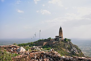
Mandsaur district is a District of Madhya Pradesh state in central India. The town of Mandsaur is the administrative headquarters of the district.The ancient Pashupatinath temple is situated in Mandsaur. Large quantities of opium are produced in Mandsaur district.

<span class="mw-page-title-main">Suryapet</span> City in Telangana, India

Suryapet is a city in the Indian state of Telangana. It is a municipality and the headquarters of its eponymous district. The Government of India announced Suryapet to be developed under the Atal Mission for Rejuvenation and Urban Transformation (AMRUT) scheme. Suryapet has been awarded the "Cleanest city" in South India by the Ministry of Urban development in Swachh Survekshan 2017. It is also known as "Gateway of Telangana". It is located about 134 kilometres (83 mi) east of the state capital, Hyderabad and also it is located about 138 kilometres (86 mi) West of Vijayawada.

<span class="mw-page-title-main">Sikar district</span> District in Rajasthan, India

Sikar district is a district of the Indian state Rajasthan in northern India. The city Sikar is the administrative headquarters of the district. Sikar, Laxmangarh, and Fatehpur Shekahwati are the largest cities and tehsils of the district.

<span class="mw-page-title-main">Asika</span> Town in Odisha, India

Asika or Aska (ଆସିକା)/(ଆସ୍କା) is a town and a Notified Area Council in Ganjam district in the state of Odisha, India. Fondly known as the Sugar city of Odisha. Asika is a major commercial and transportation hub of Ganjam .There are 2 National Highway's are pass across the town(157 & 59). It's famous for Maa Khambeswari Temple and Maa Khambeswari's Baishakhi Yatra which is celebrated every year.

<span class="mw-page-title-main">Belaguntha</span> Town in Odisha, India

Bellaguntha is a town and a Notified Area Council (N.A.C.) in Odisha, India which was the main market of South Odisha in the time of British India. Bellaguntha is also known as Brass Fish Town.

<span class="mw-page-title-main">Jaitu</span> City in Punjab, India

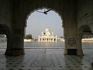
Jaitu is a historical city. Jaitu is a municipal council in Faridkot district in the Indian state of Punjab. It is subdivision in Ferozepur Division. It is 30 km (19 mi) from Bathinda, 130 km (81 mi) from Ludhiana, 150 km (93 mi)from Amritsar, 180 km (110 mi) from Patiala and 234 km (145 mi) from Chandigarh.

<span class="mw-page-title-main">Jajpur</span> Town in Odisha, India

Jajpur is a town and a municipality in Jajpur district in the Indian state of Odisha. It was the capital of the Kesari dynasty, later supplanted by Cuttack. Now, it is the headquarter of Jajpur district.

Melvisharam is a town and suburb of Vellore city in the Indian state of Tamil Nadu. It is 7 kilometres from Ranipet, 5 km from historic town of Arcot and 17 km from Vellore city.

Murbad is a census town within the administrative division (taluka) of Thane district in the Indian state of Maharashtra. Murbad city with its neighbouring villages jointly form the Murbad nagar panchayat, which is near the cities of Thane, Karjat and Kalyan. Nearby cities include Badlapur, Ambernath, Ulhasnagar, and Dombivli. It is a largely industrial town with private and public enterprises (MIDC).

Nagram is a town in Lucknow district, Uttar Pradesh, India. It is located between the two roads from Lucknow to Sultanpur and Raebareli. Raja Nal Pasi was the founder of Nagram.

<span class="mw-page-title-main">Naraingarh</span> City in Haryana, India

Naraingarh is a city, municipal committee and assembly constituency in the Ambala district of the Indian state of Haryana, located on the border with the Indian state of Himachal Pradesh. Due to its geographical location, the Naraingarh plays an important role in local tourism, being located 39 km from Ambala city, the district headquarter, 52 km of Chandigarh, the state capital, 144 km of Shimla, and 230 km of New Delhi.

Polasara is a town and a notified area council in Ganjam district in the Indian state of Odisha.

Purusottampur is a town and a Notified Area Council in Ganjam district in the Indian state of Odisha.

Rentachintala is a village in Palnadu district of the Indian state of Andhra Pradesh. It is located in Rentachintala mandal of Gurazala revenue division.

<span class="mw-page-title-main">Gauriganj, India</span> Town in Uttar Pradesh, India

Gauriganj is a city, tehsil and administrative headquarters of Amethi district in Ayodhya division, Uttar Pradesh, India. It is situated about 126 km from Lucknow, the capital of Uttar Pradesh. It is located in Eastern Uttar Pradesh. Before July 2010, Gauriganj was part of Sultanpur district and then taking Gauriganj, Amethi, Jais, Jagdispur and Salon, formed a new district called Chatrapati Sahuji Maharaj Nagar, later named Gauriganj and now Amethi. Gauriganj is connected with State Highway 34 and National Highway 128.

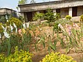
Mehath is a village in Madhubani District, Bihar State, India. It is a famous Village in Madhubani District. located 3.2 km from Jhanjharpur. The village comes under Jhanjharpur assembly constituency. Maithili is the local language here, according to the 2011 census, Maithili is the language spoken by 98.7% of the people here.

Jhuruli is a village in Basirhat II CD Block in Basirhat subdivision of North 24 Parganas district of the Indian state of West Bengal.

Apra also known as The Golden City Apra is a census town in Phillaur Tehsil in Jalandhar district of Punjab State, India. The town is known for gold jewelry and paddy crops which are produced in large amounts. It is located 46 kilometres (29 mi) towards East from Jalandhar, 12 kilometres (7.5 mi) from Phillaur and 110 kilometres (68 mi) from Chandigarh. Apra is the largest town as compared to other surrounding villages and has the main marketplace. The town is administrated by Sarpanch an elected representative of the village.

<span class="mw-page-title-main">Karisalkalampatti</span> Village in Tamil Nadu, India

Karisalkalampatti is a village in Near sivarakkottai NH7 Main road Thirumangalam Taluk in Madurai District of the Indian state of Tamil Nadu. It is located about 9 km from Thirumangalam, 30 km from Madurai and 520 km from State capital Chennai. As of 2011, the village population about 1158.

References

  1. "2011 Census Data: Search Details for Baragounia". Census of India Website. Ministry of Home Affairs, Government of India. 2011. Retrieved 5 June 2020.