
The East Coast Railway is one of the 19 railway zones of Indian Railways. It came into existence on 1 April 2003. The headquarters of the zone are at Bhubaneswar, Odisha

Bhubaneswar is the capital and largest city of the Indian state of Odisha, located in the Khordha district. The region, especially the old town, was historically often depicted as Chakra Kshetra and Ekamra Kshetra. Bhubaneswar is dubbed the "Temple City", a nickname earned because of the 700 temples which once stood there. In contemporary times, it has emerged as an education hub and an attractive business destination.

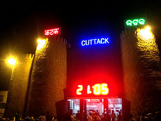
Cuttack in Odia, is the former capital and the second largest city in the Indian state of Odisha. It is the headquarters of the Cuttack district. The name of the city is an anglicised form of the Odia and Sanskrit name Kataka which literally means The Fort, a reference to the ancient Barabati Fort around which the city initially developed. Cuttack is known as the Millennium City as well as the Silver City due to its history of 1000 years and famous silver filigree works. The Orissa High Court is located there. It is the commercial capital of Odisha which hosts many trading and business houses in and around the city. Cuttack is famous for its Durga Puja which is one of the most important festivals of Odisha. Cuttack is also the birthplace of Indian nationalist & freedom fighter Netaji Subhas Chandra Bose from Bengal. The city is categorised as a Tier-II city as per the ranking system used by Government of India.

Sunabeda is an industrial town and a municipality in the state of Odisha, India, located in the valleys of the Koraput region. The Engine division and Sukhoi division of the aircraft manufacturing company Hindustan Aeronautics Limited (HAL), a public sector undertaking (PSU) of Ministry of Defence is in Sunabeda.

Bijayananda Patnaik was an Indian politician, aviator and businessman. He served as the 3rd Chief Minister of the State of Odisha from 1990 to 1995 and from 1961 to 1963. He was also the 14th Steel and mines and 1st Coal Union Minister of India from 1979 to 1980 and from 1977 to 1979 and a member of Lok Sabha from Kendrapara from 1977 to 1985. He was the father of Naveen Patnaik, who is the current CM of Odisha and currently the longest serving CM of Odisha.

Angul district; also known as Anugul, is one of the thirty districts of Odisha in eastern India. The city of Angul is the district headquarters of Angul district.

Jagatsinghpur District is one of the thirty districts of Odisha in the eastern coast of India. It became a new district on 1 April 1993 (Vide Government Notification No.14218/R dated 27.03.1993 and EOG No.459 dated 01.04.1993) being separated from Cuttack district. It lies between 860 3’ E to 860 45’ East longitude and between 19058' to 20023' north latitude. Its ancient name was Hariharapur. The town of Jagatsinghpur is the district headquarters. With 88.5% rate of male literacy and 68.5% of female literacy, the district ranks better than the national average in literacy and is one of the developed districts in Odisha. The district tops the list in male literacy and second in female literacy rate in Odisha.

Damanjodi is a town located in the Koraput district of Odisha, India. As of 2001 census, its population was 8,469. The town was founded as a residential area for employees of the National Aluminium Company (NALCO), a company that was established to harness the bauxite-rich deposits of the Panchpatmali Range. Damanjodi contains the NALCO Township, a residential area for NALCO employees, Mathalput, a semi-urban neighborhood with shops, and Bhejaput, a shopping complex. The population is considered cosmopolitan in nature with employees from all over India and locals from the tribal region.
National Aluminium Company Limited is an Indian public sector company having integrated and diversified operations in mining, metal and power. Presently, the Government of India holds a 51.5% equity stake in NALCO, while the Ministry of Mines has administrative control over the company.

Choudwar is a town and a municipality in Cuttack district in the Indian state of Odisha. It comes under Bhubaneswar-Cuttack commissionerate.
Rajgangpur is an industrial town situated in the Sundargarh District of Odisha. It is located 400 km to the north-west of the capital city, Bhubaneswar. It is located 30 km west of Rourkela. It is accessible by both road and rail. Rajgangpur Railway Station is on Mumbai-Rourkela line. Regular buses are available to Bhubaneswar, Cuttack, Rourkela and Angul. RGP Main Road is the main road of the town. The nearest functional airport is Veer Surendra Sai Airport, Jharsuguda which is approximately 95 km from Rajgangpur. Places of tourist interest in the vicinity of Rajgangpur include Mandira Dam, Chhatri Hill, Darjeeng, Vedvyas and Khandahar.

Athmallik is one of the sub-divisional headquarters in the district of Angul in Odisha, India and it is a Notified Area Council in Angul. Earlier it cames under the Dhenkanal District but now it is a part of Angul District. The Athmallik sub-division of Angul includes Athmallik and Kishorenagar blocks.
Previously a neglected aspect of the Indian Central government, Education in Odisha is witnessing a rapid transformation. Its capital city, Bhubaneswar, is emerging as a knowledge hub in India with several new public and private universities, including the establishment of an Indian Institute of Technology after five decades of demand.

The Board of Secondary Education, Odisha is a board of education for public and private schools under the state government of Odisha, India.
Kulei is a traditional Indian village belongs to Angul district of Odisha. Kulei is the 6th most populous village in Samal Barrage sub district of Angul district. The area of the village is 3 km2, making it the 17th largest village in the subdistrict. The population density of Kulei is 516 people per km2. 0.54 km2, (19%) of which is covered with forest.

Pratap Jena is an Indian politician and the Former Cabinet Minister in the Sixteenth Odisha Legislative Assembly with Panchayati Raj & Drinking Water, Law, Housing & Urban Development portfolios (2019–2022). He is elected as the Member of Legislative Assembly for the fifth consecutive time from Mahanga constituency of Kendrapara. He is also the General secretary of the farmers wing of Biju Janata Dal, Biju Krushak Janata Dal. Earlier, he had served as the Minister of School and Mass Education during his third term (2009–2012) and as the Minister of Health & Family Welfare, Law and Information & Public Relations in his fourth term (2017–2019) in the assembly.
The Cuttack–Sambalpur line is a railway line connecting the cities of Cuttack with the Sambalpur, in the Indian state of Odisha.


