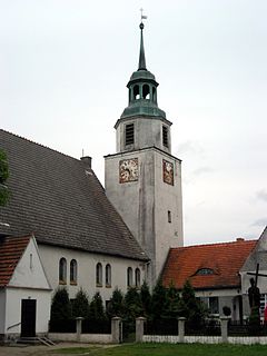
Niegosławice ; is a village in Żagań County, Lubusz Voivodeship, in western Poland. It is the seat of the gmina called Gmina Niegosławice. It lies approximately 28 kilometres (17 mi) east of Żagań and 42 km (26 mi) south of Zielona Góra.

Rynakowice is a village in the administrative district of Gmina Żórawina, within Wrocław County, Lower Silesian Voivodeship, in south-western Poland. Prior to 1945 it was in Germany. It lies approximately 6 kilometres (4 mi) south-east of Żórawina and 20 km (12 mi) south of the regional capital Wrocław.
Gapa is a village in the administrative district of Gmina Kowalewo Pomorskie, within Golub-Dobrzyń County, Kuyavian-Pomeranian Voivodeship, in north-central Poland.

Kęsowo is a village in Tuchola County, Kuyavian-Pomeranian Voivodeship, in north-central Poland. It is the seat of the gmina called Gmina Kęsowo. It lies approximately 11 kilometres (7 mi) south-west of Tuchola and 53 km (33 mi) north of Bydgoszcz.
Kłóbka-Nowy Młyn is a village in the administrative district of Gmina Lubień Kujawski, within Włocławek County, Kuyavian-Pomeranian Voivodeship, in north-central Poland.
Dąbrowa is a village in the administrative district of Gmina Narewka, within Hajnówka County, Podlaskie Voivodeship, in north-eastern Poland, close to the border with Belarus.

Powodów Pierwszy is a village in the administrative district of Gmina Wartkowice, within Poddębice County, Łódź Voivodeship, in central Poland. It lies approximately 8 kilometres (5 mi) east of Wartkowice, 14 km (9 mi) north-east of Poddębice, and 32 km (20 mi) north-west of the regional capital Łódź.

Dzierzązna is a village in the administrative district of Gmina Warta, within Sieradz County, Łódź Voivodeship, in central Poland. It lies approximately 4 kilometres (2 mi) north-east of Warta, 14 km (9 mi) north of Sieradz, and 55 km (34 mi) west of the regional capital Łódź.

Wojciechów is a village in the administrative district of Gmina Łaziska, within Opole Lubelskie County, Lublin Voivodeship, in eastern Poland. It lies approximately 3 kilometres (2 mi) south-west of Łaziska, 8 km (5 mi) west of Opole Lubelskie, and 52 km (32 mi) west of the regional capital Lublin.

Młotkowice is a village in the administrative district of Gmina Ruda Maleniecka, within Końskie County, Świętokrzyskie Voivodeship, in south-central Poland. It lies approximately 3 kilometres (2 mi) south-west of Ruda Maleniecka, 17 km (11 mi) south-west of Końskie, and 40 km (25 mi) north-west of the regional capital Kielce.

Gąsocin is a village in the administrative district of Gmina Sońsk, within Ciechanów County, Masovian Voivodeship, in east-central Poland. It lies approximately 5 kilometres (3 mi) south of Sońsk, 15 km (9 mi) south of Ciechanów, and 62 km (39 mi) north of Warsaw.
Korczówka-Kolonia is a village in the administrative district of Gmina Olszanka, within Łosice County, Masovian Voivodeship, in east-central Poland.

Przytuły Stare is a village in the administrative district of Gmina Rzekuń, within Ostrołęka County, Masovian Voivodeship, in east-central Poland. It lies approximately 8 kilometres (5 mi) north-east of Rzekuń, 11 km (7 mi) east of Ostrołęka, and 110 km (68 mi) north-east of Warsaw.

Starcz is a village in the administrative district of Gmina Lutocin, within Żuromin County, Masovian Voivodeship, in east-central Poland. It lies approximately 14 kilometres (9 mi) west of Żuromin and 126 km (78 mi) north-west of Warsaw.

Paruchów is a village in the administrative district of Gmina Żerków, within Jarocin County, Greater Poland Voivodeship, in west-central Poland. It lies approximately 8 kilometres (5 mi) north-east of Żerków, 20 km (12 mi) north-east of Jarocin, and 57 km (35 mi) south-east of the regional capital Poznań.
Stawki is a village in the administrative district of Gmina Dobra, within Turek County, Greater Poland Voivodeship, in west-central Poland.

Janowa is a village in the administrative district of Gmina Otmuchów, within Nysa County, Opole Voivodeship, in south-western Poland, close to the Czech border. It lies approximately 7 kilometres (4 mi) north-west of Otmuchów, 16 km (10 mi) west of Nysa, and 60 km (37 mi) west of the regional capital Opole.

Święciechów is a village in the administrative district of Gmina Drawno, within Choszczno County, West Pomeranian Voivodeship, in northwest Poland. It lies approximately 5 kilometres (3 mi) north-west of Drawno, 24 km (15 mi) north-east of Choszczno, and 78 km (48 mi) east of the regional capital Szczecin.
Rozwarówko is a former settlement in the administrative district of Gmina Bobolice, within Koszalin County, West Pomeranian Voivodeship, in north-western Poland. As of 2010 it no longer figures in the national database of places.

Kępiny is a village in the administrative district of Gmina Polanów, within Koszalin County, West Pomeranian Voivodeship, in north-western Poland. It lies approximately 10 kilometres (6 mi) south of Polanów, 40 km (25 mi) south-east of Koszalin, and 156 km (97 mi) north-east of the regional capital Szczecin.


