Related Research Articles

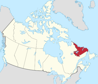
Labrador is a geographic and cultural region within the Canadian province of Newfoundland and Labrador. It is the primarily continental portion of the province and constitutes 71% of the province's area but is home to only 6% of the province's population. It is separated from the island of Newfoundland by the Strait of Belle Isle. It is the largest and northernmost geographical region in Atlantic Canada.

The Gulf of St. Lawrence is the outlet of the North American Great Lakes via the St. Lawrence River into the Atlantic Ocean. The gulf is a semi-enclosed sea, covering an area of about 226,000 square kilometres (87,000 sq mi) and containing about 34,500 cubic kilometres (8,300 cu mi) of water, which results in an average depth of 152 metres (499 ft).
Aviron Bay is natural bay on the island of Newfoundland in the province of Newfoundland and Labrador, Canada. The Friar, a castellated rock, is located between Aviron Bay and Cul-de-sac bay.
Charlottetown is a town in Labrador with a population of 292 in the Canadian province of Newfoundland and Labrador. It was said to be founded by Benjamin Powell in 1950 and named for Charlottetown, Prince Edward Island: "I thought that maybe someday the place would be the capital of the bay, the same way Charlottetown is the capital of Prince Edward Island."
Aillik Bay is a bay on the coast of Labrador in the province of Newfoundland and Labrador, Canada. The town of Aillik is located on the bay.

Mortier Bay is a natural bay on the Burin Peninsula on the south coast of the island of Newfoundland in the province of Newfoundland and Labrador, Canada. It is entered through a channel 1.5 miles (2.4 km) long and 0.5 miles (0.80 km)wide, at the north end of which the bay opens nearly 2 miles (3.2 km) in diameter with deep water and no anchorage, except in the harbors off it. The settlement of Marystown is located on the bay.
Little Bay is a natural bay on the island of Newfoundland in the province of Newfoundland and Labrador, Canada.
St. Barbe Bay is a natural bay off the island of Newfoundland in the province of Newfoundland and Labrador, Canada.
Sandy Bay is a natural bay off the island of Newfoundland in the province of Newfoundland and Labrador, Canada.
Médée Bay is a natural bay off the island of Newfoundland in the province of Newfoundland and Labrador, Canada. It faces the modern village and archeological site of L'Anse aux Meadows.
Marguerite Bay is a natural bay off the island of Newfoundland in the province of Newfoundland and Labrador, Canada.
Shoal Bay is a natural bay off the island of Newfoundland in the province of Newfoundland and Labrador, Canada.
Bay Bulls is a natural bay off the island of Newfoundland in the province of Newfoundland and Labrador, Canada.
Barren Bay is a natural bay on the coast of Labrador in the province of Newfoundland and Labrador, Canada. It is nearby to West Island, Drunken Cove Point and Salmon Bight Point. Barren Bay is also close to Frenchman Cove, Fenchman Cove and Hauling Cove.
Caplin Bay is a natural bay on the coast of Labrador in the province of Newfoundland and Labrador, Canada.
Partridge Bay is a natural bay on the coast of Labrador in the province of Newfoundland and Labrador, Canada. It lies to the north of Rocky Bay and to the south of Shoal Bay, with several small uninhabited islands across its entrance from the Labrador Sea.
Black Bear Bay is a natural bay on the coast of Labrador in the province of Newfoundland and Labrador, Canada.
Bay St. George South is a local service district and designated place in the Canadian province of Newfoundland and Labrador on the south coast of Bay St. George, a large bay on the west coast of the island of Newfoundland. Bay St. George South consists nine communities, namely Heatherton, Robinsons, Cartyville, McKay's, Jeffrey's, St. David's, St. Fintan's, Lock Leven en Highlands.
Division No. 1, Subdivision B is an unorganized subdivision on the Avalon Peninsula in Newfoundland and Labrador, Canada. It is in Division 1 and contains the unorganized communities of Iona, Little Barasway, Placentia Junction, Point Verde and Ship Harbour.
Division No. 1, Subdivision C is an unorganized subdivision on the Avalon Peninsula in Newfoundland and Labrador, Canada. It is in Division 1 and contains the unincorporated communities of Cape St. Mary's, Cuslett, Gooseberry Cove, Great Barasway, Lears Cove, Patrick's Cove-Angels Cove, Ship Cove and Stoney House.
References
- ↑ The name would come from (Atlantic Canada) French barachois (from basque barratxoa), and would mean (coastal) lagoon or coastal pond. Terminologist's opinion Archived June 9, 2011, at the Wayback Machine
- ↑ United States Hydrographic Office; Davenport, Richard G. (1884). Newfoundland and Labrador: The coast and banks of Newfoundland and the coast of Labrador, from Grand Point to the Koksoak River, with the adjacent islands and banks (Public domain ed.). Govt. print. off. pp. 174–. Retrieved 20 November 2011.
Coordinates: 46°51′58″N55°48′54″W / 46.866°N 55.815°W