Baronnies

Last updated
Les Baronnies viewed from Col de Perty Baronnies (Col de Perty).jpg
Les Baronnies viewed from Col de Perty

The Baronnies, in French Les Baronnies, is a historic name for the area East and North of Mont Ventoux in Southern France.

Contents

Today most of the Baronnies is part of the département Drôme (a part of the région Rhône-Alpes). Smaller areas in the East and South belong to the départements of Vaucluse, Hautes-Alpes and Alpes-de-Haute-Provence (part of the région Provence-Alpes-Côte d'Azur). The area of roughly 2,000 km2 (770 sq mi) is sparsely populated; the 1999 census counted only 22,000 inhabitants. Since the 17th century les Baronnies, especially its eastern parts, suffered from land flight due to harsh economic conditions. Starting in the 1980s land flight has stopped and the population is now increasing especially in and around the towns of Nyons, Buis-les-Baronnies, Mirabel-aux-Baronnies, Faucon and Puymeras. There are plans to create the Parc Naturel Régional des Baronnies. The area is paradise for hiking, mountaineering, rock climbing, cycling, mountain biking, horse-riding, hang gliding and paragliding.

History

Legend has it that Hannibal, the Carthaginian leader crossed les Baronnies with his elephants during the Second Punic War (218 - 201 B.C.). Later the area retired Roman soldiers were given land here. After the Roman Empire collapsed in the 3rd century, hundreds of years of invasions by Franks, Lombards, Saracens and marauding bands followed. During this period local fiefs started to fortify villages and consolidate power. In the 11th century the area was part of the Holy Roman Empire. During the Barons of Mévouillon consolidated their power over a large part of les Baronnies, they ruled for roughly 300 years from capital in Buis-les-Baronnies. As a result of a family feud in 1125, the western part of les Baronnies was ruled by a different line of Mévouillons. They called themselves Barons de Montauban, hence the name "les Baronnies" (plural). They established their capital in Nyons. Within a short period of time both had to sell their possessions to the Count of Vienne, nicknamed le Dauphin (the dolphin was his coat of arms), who ceded his territory to the King of France in 1349 to pay his debts.

Similar to the Luberon, the Baronnies was a stronghold of Protestantism in the Provence. It suffered heavily during the French Wars of Religion (1562-1598). Two of the most notable military leaders came from the Baronnies: Charles Dupuy-Montbrun, the Protestant leader from Montbrun-les-Bains and Faulque Thollon de Sainte Jalle, the Catholic leader from Sainte-Jalle. After a short lived economic revival the pest struck in 1629 and then again in 1652. The population was decimated.

The period from the 18th century to modern day was marked by economic decline and land flight. Only in the 1980s were the Baronnies "discovered". Tourism started to develop and the area between Vaison-la-Romaine and Nyons started to become very popular with tourists and retirees.

Towns and Villages

The Baronnies has two historic towns, Nyons and Buis-les-Baronnies. There are many rustic ancient villages, most notable are Brantes, Faucon, Mirabel-aux-Baronnies, Mollans-sur-Ouvèze, Montbrun-les-Bains, La Motte-Chalancon, Orpierre, Puymeras, Rémuzat, Rousset-les-Vignes, Sainte-Jalle, Séderon and Venterol. Also notable is the castle of Aulan near Montbrun-les-Bains.

Main economic activity is agriculture and tourism. Nyons is the center of the local olive tree cultivation with numerous oil mills, an olive oil cooperative and an olive tree/olive oil museum. The olives grown in Nyons and les Baronnies have an AOC (Appellation d'Origine Contrôlée) quality label.

Tourism has expanded, especially in the western parts of the Baronnies. It is important that the plan to create the Parc Naturel Régional des Baronnies is approved soon. It is however strongly opposed by many landowners and the real estate developers behind them.

Related Research Articles

<span class="mw-page-title-main">Loire (department)</span> Department in Auvergne-Rhône-Alpes, France

Loire is a landlocked department in the Auvergne-Rhône-Alpes region of France occupying the river Loire's upper reaches. Its prefecture is Saint-Étienne. It had a population of 765,634 in 2019.

<span class="mw-page-title-main">Drôme</span> Department in Auvergne-Rhône-Alpes, France

Drôme is the southernmost department in the Auvergne-Rhône-Alpes region of Southeastern France. Named after the river Drôme, it had a population of 516,762 as of 2019. Drôme's prefecture is Valence.

<span class="mw-page-title-main">Digne-les-Bains</span> Prefecture and commune in Provence-Alpes-Côte dAzur, France

Digne-les-Bains, or simply and historically Digne, is the prefecture of the Alpes-de-Haute-Provence department in the Provence-Alpes-Côte d'Azur region of Southeastern France. As of 2018, the commune had a population of 16,333. Its inhabitants are called Dignois (masculine) and Dignoises (feminine).

<span class="mw-page-title-main">Nyons</span> Subprefecture and commune in Auvergne-Rhône-Alpes, France

Nyons is a commune in the Drôme department in southeastern France.

<span class="mw-page-title-main">Banon, Alpes-de-Haute-Provence</span> Commune in Provence-Alpes-Côte dAzur, France

Banon is a commune in the department of Alpes-de-Haute-Provence in the Provence-Alpes-Côte d'Azur region of south-eastern France.

<span class="mw-page-title-main">Arrondissement of Nyons</span> Arrondissement in Auvergne-Rhône-Alpes, France

The arrondissement of Nyons is an arrondissement of France in the Drôme department in the Auvergne-Rhône-Alpes region. It has 149 communes. Its population is 148,049 (2016), and its area is 2,478.1 km2 (956.8 sq mi).

<span class="mw-page-title-main">Arrondissement of Forcalquier</span> Arrondissement in Provence-Alpes-Côte dAzur, France

The arrondissement of Forcalquier is an arrondissement of France in the Alpes-de-Haute-Provence department in the Provence-Alpes-Côte d'Azur region. It has 97 communes. Its population is 95,990 (2016), and its area is 2,605.4 km2 (1,006.0 sq mi).

<span class="mw-page-title-main">Les Plus Beaux Villages de France</span>

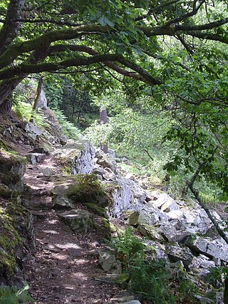
Les Plus Beaux Villages de France is an independent association created in 1982 for the promotion of the tourist appeal of small rural villages with a rich cultural heritage. As of September 2016, it numbers 156 member villages.

<span class="mw-page-title-main">Mirabel-aux-Baronnies</span> Commune in Auvergne-Rhône-Alpes, France

Mirabel-aux-Baronnies is a commune in the Drôme department in the Auvergne-Rhône-Alpes region in southeastern France.

<span class="mw-page-title-main">Mirabeau, Vaucluse</span> Commune in Provence-Alpes-Côte dAzur, France

Mirabeau is a commune in the Vaucluse department in the Provence-Alpes-Côte d'Azur region in southeastern France.

<span class="mw-page-title-main">Authon, Alpes-de-Haute-Provence</span> Commune in Provence-Alpes-Côte dAzur, France

Authon is a commune in the Alpes-de-Haute-Provence department in the Provence-Alpes-Côte d'Azur region of south-eastern France.

<span class="mw-page-title-main">Aubenas-les-Alpes</span> Commune in Provence-Alpes-Côte dAzur, France

Aubenas-les-Alpes is a commune in the Alpes-de-Haute-Provence department in the Provence-Alpes-Côte d'Azur region of south-eastern France.

<span class="mw-page-title-main">Aubignosc</span> Commune in Provence-Alpes-Côte dAzur, France

Aubignosc is a commune in the Alpes-de-Haute-Provence department in the Provence-Alpes-Côte d'Azur region of south-eastern France.

<span class="mw-page-title-main">Sigonce</span> Commune in Provence-Alpes-Côte dAzur, France

Sigonce is a commune in the Alpes-de-Haute-Provence department in southeastern France.

<span class="mw-page-title-main">Vinsobres</span> Commune in Auvergne-Rhône-Alpes, France

Vinsobres is a commune in the Drôme department in the Auvergne-Rhône-Alpes region in southeastern France.

<span class="mw-page-title-main">Lus-la-Croix-Haute</span> Commune in Auvergne-Rhône-Alpes, France

Lus-la-Croix-Haute is a commune in the Drôme department in southeastern France.

The canton of Valensole is an administrative division in southeastern France. At the French canton reorganisation which came into effect in March 2015, the canton was expanded from 4 to 10 communes:

<span class="mw-page-title-main">Alpes-de-Haute-Provence</span> Department in Provence-Alpes-Côte dAzur, France

Alpes-de-Haute-Provence or sometimes abbreviated as AHP is a department in the Provence-Alpes-Côte d'Azur region of France, bordering Alpes-Maritimes and Italy to the east, Var to the south, Vaucluse to the west, Drôme and Hautes-Alpes to the north. Formerly part of the province of Provence, it had a population of 164,308 in 2019, which makes it the 94th most populated French department.

<span class="mw-page-title-main">Normandie-Maine Regional Natural Park</span>

Normandie-Maine Regional Natural Park is a protected area of forest and bocage located in the French regions of Normandy and Pays de la Loire.

The canton of Nyons et Baronnies is an administrative division of the Drôme department, southeastern France. It was created at the French canton reorganisation which came into effect in March 2015. Its seat is in Nyons.

References