RED Mountain Resort is a ski resort in western Canada, located on Granite, Grey, Kirkup, and Red Mountains in Rossland, a former gold mining town in the West Kootenay region of southeastern British Columbia. RED Mountain is one of the oldest ski hills in North America, with a history dating back to the creation of the Red Mountain Ski Club (RMSC) in the first decade of the 1900s. RED Mountain is located in the Monashee Mountains just north of the U.S. border. Like other ski hills in the British Columbia Interior, it has a reputation for light, dry powder, with yearly snowfall of 750 cm (300 in).
Akamina-Kishinena Provincial Park is a provincial park located in the southeastern corner of British Columbia, Canada. The park was established by order-in-council on July 13, 1995 to protect the ecological integrity of a relatively narrow stretch of the Rocky Mountains in the southeastern corner of the province.

Champion Lakes Provincial Park is a provincial park in the West Kootenay region of British Columbia, Canada, northeast of the city of Trail in the province's West Kootenay region.
Kootenay Lake Provincial Park is a provincial park in British Columbia, Canada. It encompasses five widely dispersed parks around Kootenay Lake: Kootenay Lake Provincial Park, Kootenay Lake Provincial Park, Kootenay Lake Provincial Park, Kootenay Lake Provincial Park, and Kootenay Lake Provincial Park.
Syringa Park is a provincial park on the east shore of Lower Arrow Lake in the West Kootenay region of southeastern British Columbia. At the foot of the Norns Range, Tulip Creek passes through the centre, and Syringa Creek is closer to the southeastern boundary. The park is about 19 kilometres (12 mi) west of Castlegar via Broadwater Rd.

Montrose is in the West Kootenay region of southeastern British Columbia. The village lies 7 kilometres (4 mi) east of the city of Trail along Highway 3B.
The Slocan Valley Rail Trail is a multi-use recreational rail trail in the West Kootenay region of southeastern British Columbia.

The Salmo River is a tributary of the Pend d'Oreille River in the West Kootenay region of the Regional District of Central Kootenay in the Canadian province of British Columbia. The river is 60 km long and its source is 12 km south of Nelson in the Selkirk Mountains. The Salmo River is part of the Columbia River drainage basin, being a tributary of the Pend d'Oreille River, which flows into the Columbia River.
The Whatshan River is a tributary of the Columbia River in the West Kootenay region of southeastern British Columbia. The river's drainage basin is approximately 390 square kilometres (150 sq mi) in area.
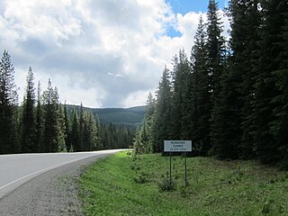
Monashee Pass, 1,189 m (3,901 ft), is a mountain pass in the Monashee Mountains of the Southern Interior of British Columbia, Canada. Located southeast of Cherryville, the pass is used by British Columbia Highway 6 connecting Vernon to Nakusp on Arrow Lake, and beyond to the cities of the West Kootenay. It is the "prominence col" for Big White Mountain, which is the highest mountain to its southwest.
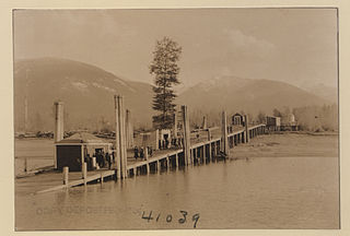
Burton is a settlement on the east shore of Lower Arrow Lake in the West Kootenay region of southeastern British Columbia.
The Kokanee Range is a subrange of the Selkirk Mountains in the West Kootenay region of southeastern British Columbia, Canada. It is located between the valley of the Slocan River (W) and that of Kootenay Lake (E), and to the north of the Kootenay River and the West Arm of Kootenay Lake. The range includes Kokanee Glacier Provincial Park, Kokanee Peak, and Grays Peak, notable as the mountain featured on the label of Kokanee beer. The name "Kokanee" refers to a land-locked variety of Sockeye salmon.
Columbia Gardens is in the West Kootenay region of southern British Columbia. The locality is east of Trail, and near the Boundary-Waneta Border Crossing.

Foster Peak is a 3,204-metre (10,512-foot) mountain summit located on the western border of Kootenay National Park. It is the highest point in the Vermilion Range, a sub-range of the Canadian Rockies of British Columbia, Canada. Its nearest higher peak is Mount Ball, 14.96 km (9.30 mi) to the northeast. The mountain is part of what is known as The Rockwall. Floe Lake, southeast of the peak, is one of the beauty spots of Kootenay National Park. The area is accessible via the Floe Lake Trail and Rockwall Trail. The Rockwall Trail is a scenic 55 kilometre traverse of alpine passes, subalpine meadows, hanging glaciers, and limestone cliffs, in some places in excess of 900 metres above the trail.

Ymir Mountain is a 2,398-metre (7,867 ft) summit in the West Kootenay region of southeastern British Columbia, Canada. The nearest higher neighbour is Wood Peak, about 31 kilometres (19 mi) to the southeast.
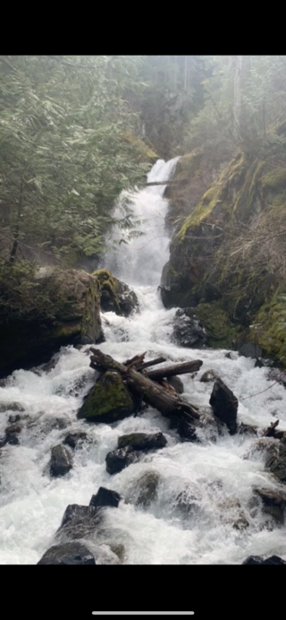
Stewart Creek is a small creek in the Regional District of Central Kootenay in the West Kootenay region of British Columbia, Canada. The creek is a tributary of the Salmo River and has its source in the Selkirk Mountains close to the town of Ymir. The name was adopted in 1930. Its source is the peaks of Round Mountain, the same source as that of Quartz Creek and is approximately 2 km north of Ymir. There is a rest area featuring a small waterfall with a picnic area on Highway 6 at Stewart Creek.
Hall Creek is a creek in the Selkirk Mountains in the West Kootenay region of the Regional District of Central Kootenay in British Columbia, Canada. The creek is a tributary of the Salmo River and flows east into the river in the community of Hall, a few kilometres north of the town of Ymir and a few kilometres south of Nelson. The creek and the community of Hall were named for the Osner and Winslow Hall; brothers from Colville, Washington. The brothers were pioneers in the silver rush occurring in the kootenays in the late 1880s and early 1890s In 1886, the brothers led the expedition to Toad Mountain which led to the creation of the Silver King mine, which in turn gave rise to the city of Nelson.

Barrett Creek is a creek in the Selkirk Mountains in the West Kootenay region of the Regional District of Central Kootenay in British Columbia, Canada. The creek flows east from Barrett Lake to the Salmo River in the community of Porto Rico a few kilometres north of Ymir. Porto Rico was the site of mines staked in 1896, and some early maps may refer to Barrett creek as Porto Rico creek.

Hall is a small community in the Selkirk Mountains in the West Kootenay region of the Regional District of Central Kootenay in British Columbia, Canada, south of Nelson and north of Ymir. Hall Creek flows into the Salmo River in the community. British Columbia Highway 6 runs through it.
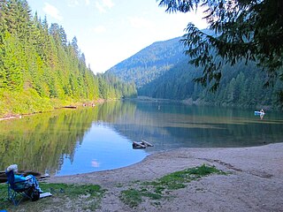
Cottonwood Lake is a lake in the Selkirk Mountains in the West Kootenay region of the Regional District of Central Kootenay in British Columbia, Canada.


