You can help expand this article with text translated from the corresponding article in Cebuano. (January 2019)Click [show] for important translation instructions.
|
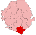
Barri Chiefdom | |
|---|---|
 Interactive map of Barri Chiefdom | |
| Country | |
| Province | Southern Province |
| District | Pujehun District |
| Capital | Potoru |
| Time zone | UTC+0 (GMT) |
Barri Chiefdom is a chiefdom in Pujehun District of Sierra Leone. [1] [2] Its capital is Potoru.