Pujehun District

Last updated

Pujehun District
Pujehun District in Sierra Leone 2018.svg
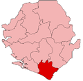
Location of Pujehun District in Sierra Leone
Coordinates: 7°20′N11°30′W / 7.333°N 11.500°W / 7.333; -11.500
Country Sierra Leone
Province Southern Province
Capital Pujehun
Largest city Pujehun
Government
  TypeDistrict Council
  Council Chairman Sheikh Siddy Sowa (SLPP) [1]
  Deputy Council ChairmanKalilu Fofanah (SLPP)
Area
  Total4,105 km2 (1,585 sq mi)
Population
 (2015 census) [2]
  Total345,577
  Density84/km2 (220/sq mi)
Time zone UTC-5 (Greenwich Mean Time)
HDI (2017)0.357 [3]
low · 13th

Pujehun District is a district in the Southern Province of Sierra Leone. Pujehun District is one of the sixteen Districts of Sierra Leone. Its capital and largest city is the town of Pujehun . [4] [5] The other major towns in the district include Gandorhun, Zimmi, Gendema, Masam, Bomi and Potoru. As of 2015, the district has a population of 345,577. [2]

Contents

The district of Pujehun borders the Atlantic Ocean in the southwest, the Republic of Liberia to the southeast, Kenema District to the northeast, Bo District to the north and Bonthe District to the west. It occupies a total space of 4,105 km2 and comprises twelve chiefdoms.

The population of Pujehun District is mainly from the Mende ethnic group, though minority ethnic groups are also found in the District. Pujehun District is a large Muslim majority district, though there is a significant Christian minority as well.

History

In 1982 the Ndogboyosoi (bush devil) War was fought in the district. [6]

Geography

Pujehun District is located at the southeast corner of Sierra Leone bordering Atlantic Ocean in the southwest and the Liberia to the southeast. The climate is tropical with a wet and dry seasons. At the 2004 census the population of Pujehun District was 234,234 [7] the estimated population in 2010 was 276,970. [7] The district has one of the lowest population densities of Sierra Leone, with most people living in villages of less than 2000 residents. [8]

Economy

Diamond mining is a major economic activity in the district, as well as agricultural production of cassava, coffee, and cacao.

Government

Pejehun District has six Representatives in the Sierra Leonean Parliament, of which five members were elected to a 5-year term. Below are Pejehun District Representatives in the Parliament:

Administrative divisions

Chiefdoms

Religion

Religion in Pujehun District (2015) [9]
ReligionPercent(%)
Islam
94.6%
Christianity
4.8%
Bahai
0.0%
Traditional African Religion
0.0%
Other
0.2%
No Religion
0.4%

Related Research Articles

<span class="mw-page-title-main">Sierra Leone</span> Country on the southwest coast of West Africa

Sierra Leone, officially the Republic of Sierra Leone, is a country on the southwest coast of West Africa. It shares its southeastern border with Liberia, and the northern half of the nation is surrounded by Guinea. Covering a total area of 71,740 km2 (27,699 sq mi), Sierra Leone has a tropical climate, with diverse environments ranging from savanna to rainforests. The country has a population of 7,092,113 as of the 2015 census. Freetown is the capital and largest city. The country is divided into five administrative regions, which are subdivided into 16 districts.

<span class="mw-page-title-main">Bo, Sierra Leone</span> Place in Southern Province, Sierra Leone

Bo, also commonly referred to as Bo Town, is the second largest city in Sierra Leone by landscape/geographical location and the largest city in the Southern Province. Bo is the capital and administrative centre of Bo District. The city of Bo had a population of 149,957 in the 2004 census and had a population of about 233,684 based on 2017 estimate. Bo is an urban centre, and lies approximately 160 miles (250 km) east-southeast of Freetown, and about 40 miles (71 km) to Kenema. Bo is the leading financial, educational and economic centre of southern Sierra Leone.

<span class="mw-page-title-main">Julius Maada Bio</span> President of Sierra Leone since 2018

Julius Maada Wonie Bio is a Sierra Leonean politician, and the current president of Sierra Leone since 4 April 2018. He is a retired brigadier in the Sierra Leone Army and was the military head of state of Sierra Leone from 16 January 1996 to 29 March 1996, in a military junta government known as the National Provisional Ruling Council (NPRC).

<span class="mw-page-title-main">Vai people</span> West African ethnic group

The Vai are Mandé peoples that live mostly in Liberia, with a small minority living in south-eastern Sierra Leone. The Vai are known for their indigenous writing system known as the Vai syllabary, developed in the 1820s by Momolu Duwalu Bukele and other Vai elders. Over the course of the 19th century, literacy in the writing system became widespread. Its use declined over the 20th century, but modern computer technology may enable a revival.

<span class="mw-page-title-main">Bo District</span> Place in Southern Province, Sierra Leone

Bo District is a district in the Southern Province of Sierra Leone. It is one of the sixteen Districts of Sierra Leone. Bo District is the second most populous District in Sierra Leone. Its capital and largest city is the city of Bo, which is also the second most populous city in Sierra Leone. other major towns in the district include Baoma, Bumpeh, Serabu, Sumbuya, Baiima and Yele.

<span class="mw-page-title-main">Moyamba District</span> Place in Province, Sierra Leone

Moyamba District is a district in the Southern Province of Sierra Leone, with a population of 318,064 in the 2015 census. Its capital and largest city is Moyamba. The other major towns include Njala, Rotifunk and Shenge. The district is the largest in the Southern Province by geographical area, occupying a total area of 6,902 km2 (2,665 sq mi) and comprises fourteen chiefdoms.

<span class="mw-page-title-main">Southern Province, Sierra Leone</span> Province of Sierra Leone

The Southern Province is one of the four provinces of Sierra Leone. It covers an area of 19,694 km² and has a population of 1,438,572. It consists of four districts. Its capital and administrative center is Bo, which is also the second largest and second most populated city in Sierra Leone after the nation's capital Freetown. The population of the southern province is largely from the Mende ethnic group.

<span class="mw-page-title-main">Kailahun</span> Place in Eastern Province, Sierra Leone

Kailahun is the capital of Kailahun District in the Eastern Province of Sierra Leone. Kailahun is a major business and commercial center of Kailahun District. The population was 13,108 in the 2004 census, a 2006 estimate of 18,411 and a current estimate of about 30,411. Kailahun lies in the far east of Sierra Leone, approximately 200 miles east of Freetown, about 51 miles north east of Kenema, and near the border of Liberia.

<span class="mw-page-title-main">Bombali District</span> Place in Northern Province, Sierra Leone

Bombali is a district in the Northern Province of Sierra Leone. Its capital and largest city is Makeni, which is also the largest city in the north. The Bombali district is one of the sixteen districts of Sierra Leone. Bombali is one of the largest districts in Sierra Leone by geographical area, after Koinadugu District, and is the second most populous district in the Northern part of Sierra Leone, after Port Loko district. In the 2015 Sierra Leone national census, the population of Bombali District was 606,183. Other major towns in Bombali District include Kamabai, Karina and Binkolo.

<span class="mw-page-title-main">Bonthe District</span> Place in Southern Province, Sierra Leone

Bonthe District is a district that comprises several islands and mainland of the Atlantic Ocean in the Southern Province of Sierra Leone. Bonthe is one of the sixteen districts of Sierra Leone. Its capital is the town of Bonthe Island and its largest city is Bonthe, on Sherbro Island. As of the 2015 census, the district had a population of 200,730. Bonthe District is one of the sixteen districts of Sierra Leone. Bonthe District is subdivided into eleven chiefdoms.

<span class="mw-page-title-main">Kono District</span> Place in Eastern Province, Sierra Leone

Kono District is a district in the Eastern Province of Sierra Leone. Its capital and largest city is Koidu Town. Motema is the second most populous city in the district. The other major towns in the district include Yengema, Tombodu, Jaiama Nimikor and Sewafe. The district is the largest diamond producer in Sierra Leone. The population of Kono District is 505,767. Kono District borders Kenema District to the southwest, The Republic of Guinea to the east, Koinadugu District to the northeast and Kailahun District to the southeast. Kono District is divided into fourteen chiefdoms.

<span class="mw-page-title-main">Koinadugu District</span> Place in Northern Province, Sierra Leone

Koinadugu District is a district in the Northern Province of Sierra Leone. It is the largest District in Sierra Leone in geographical area, and one of the least densely populated. Its capital and largest city is Kabala, which is also one of the main cities in Northern Sierra Leone. The District of Koinadugu has a population of 404,097, based on the 2015 Sierra Leone national census; and has a total area of 12,121 km2 (4,680 sq mi). Koinadugu District is subdivided into eleven chiefdoms.

<span class="mw-page-title-main">Kailahun District</span> Place in Eastern Province, Sierra Leone

Kailahun District is a district in the Eastern Province of Sierra Leone. Its capital and largest city is the town of Kailahun. The second most populous city in the district is Segbwema. Other major towns in Kailahun District include Koindu, Pendembu and Daru. As of the 2015 census, the district had a population of 525,372. Kailahun District is subdivided into fourteen chiefdoms.

<span class="mw-page-title-main">Kenema District</span> Place in Eastern Province, Sierra Leone

Kenema District is a district in the Eastern Province of Sierra Leone. Its capital and largest city is Kenema, which is the third most populous city in Sierra Leone, after Freetown and Bo. Tongo is the second most populous city in the district. Other major towns in Kenema District include Blama and Yomboma. The district is the most populous district in the Eastern province with a population 609,873. Kenema District has an area of 6,053 km2 (2,337 sq mi) and comprises sixteen chiefdoms.

<span class="mw-page-title-main">Western Area Rural District</span> Place in Western Area, Sierra Leone

The Western Area Rural District is one of the sixteen districts of Sierra Leone. It is located mostly around the peninsula in the Western Area of Sierra Leone. The Western Area Rural District has a 2015 census population of 442,951. The district capital and largest city is Waterloo. Other major towns in the district include Newton, Benguema, Leicester, Tombo and Regent. Most of the towns and villages in the Western area rural District are close to the capital Freetown; and are part of the Freetown Metropolitan Area.

<span class="mw-page-title-main">Outline of Sierra Leone</span> Overview of and topical guide to Sierra Leone

The following outline is provided as an overview of and topical guide to Sierra Leone:

<span class="mw-page-title-main">Religion in Sierra Leone</span>

Sierra Leone is officially a secular state, although Islam and Christianity are the two main and dominant religions in the country. The constitution of Sierra Leone provides for freedom of religion and the Sierra Leone Government generally protects it. The Sierra Leone Government is constitutionally forbidden from establishing a state religion, though Muslim and Christian prayers are usually held in the country at the beginning of major political occasions, including presidential inauguration.

Gendema is a rural town in Pujehun District in the Southern Province of Sierra Leone. Gendema lies in the far Southern part of Sierra Leone, on the international border with the Republic of Liberia.

Honorable Alhaji Ansumana Jaia Kaikai is a Sierra Leonean politician and the deputy minority leader of Sierra Leone Parliament. He is an elected member of Parliament from Pujehun District, representing constituency eighty seven. He is a prominent member of the Sierra Leone People's Party (SLPP). He is also the parliamentary chairman of the privileges and ethics committee.

<span class="mw-page-title-main">Ethnic groups in Sierra Leone</span> Ethnic groups living within the country of Sierra Leone

Sierra Leone is home to about sixteen ethnic groups, each with its own language. In Sierra Leone, membership of an ethnic group often overlaps with a shared religious identity.

References

  1. For 50th Independence anniversary celebrations… Pujehun District establishes coordinating committee « Awoko Newspaper
  2. 1 2 "GeoHive - Sierra Leone population statistics". Archived from the original on 12 December 2013. Retrieved 8 December 2013.
  3. "Sub-national HDI – Area Database – Global Data Lab". hdi.globaldatalab.org. Retrieved 13 September 2018.
  4. Remmert-Fontes, Inge (2006), (Extract from) Evaluation Report "Peace building projects in Sierra Leone" (PDF), Freetown, Sierra Leone, p. 32{{citation}}: CS1 maint: location missing publisher (link)
  5. Boland, Sarah (8 February 2011). "Sierra Leone: Buzz of excitement in the air in Pujehun". Save the Children. Retrieved 23 February 2011.
  6. Notholt, Stuart (2008). Fields of Fire – An Atlas of Ethnic Conflict. Lulu.com. p. 2.43. ISBN   978-0-9556876-0-0.
  7. 1 2 "Pujehun". World Gazetteer. 2010. Retrieved 23 February 2011.[ dead link ]
  8. Thomas, Christopher (1994). People's participation programme in Pujehun, Sierra Leone: post-project study. Food and Agriculture Organization of the United Nations. p. 5. ISBN   978-92-5-103466-8.
  9. "Population structure Report" (PDF). sierraleone.unfpa.org. Retrieved 12 September 2023.