Gandorhun

Last updated
Gandorhun

Gandorhun, Sierra Leone
Sierra Leone adm location map.svg
Red pog.svg
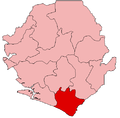
Location in Sierra Leone
Coordinates: 7°33′23″N11°41′33″W / 7.55639°N 11.69250°W / 7.55639; -11.69250 Coordinates: 7°33′23″N11°41′33″W / 7.55639°N 11.69250°W / 7.55639; -11.69250
Country Flag of Sierra Leone.svg Sierra Leone
Province Southern Province
District Pujehun District
Population
 (2010 [1] )
  Total12,288
Time zone UTC-5 (GMT)

Gandorhun is a major diamond-producing town in Sierra Leone and major town in the Pujehun District of the Southern Province. Gandorhun is one of the main cities in Southern Sierra Leone and lies about 45 miles southwest of Bo. The city has a population of around 12,288 [1] residents and is mainly inhabited by the Mende people.

Related Research Articles

Sierra Leone Country on the southwest coast of West Africa

Sierra Leone, officially the Republic of Sierra Leone, informally Salone, is a country on the southwest coast of West Africa. It is bordered by Liberia to the southeast and Guinea to the northeast. Sierra Leone has a tropical climate with a diverse environment ranging from savanna to rainforests, a total area of 71,740 km2 (27,699 sq mi) and a population of 7,092,113 as of the 2015 census. The capital and largest city is Freetown. The country is divided into five administrative regions which are subdivided into sixteen districts. Sierra Leone is a constitutional republic with a unicameral parliament and a directly elected president. Sierra Leone is a Muslim-majority country at approximately 78%, though with an influential Christian minority at about 21%. Muslims and Christians in Sierra Leone are extremely tolerant of each other, and all the major Muslim and Christian holidays are officially national holidays in the country.

Sierra Leone first became inhabited by indigenous African peoples at least 2,500 years ago.The Limba were the first tribe known to inhabit Sierra Leone. The dense tropical rainforest partially isolated the region from other West African cultures, and it became a refuge for peoples escaping violence and jihads. Sierra Leone was named by Portuguese explorer Pedro de Sintra, who mapped the region in 1462. The Freetown estuary provided a good natural harbour for ships to shelter and replenish drinking water, and gained more international attention as coastal and trans-Atlantic trade supplanted trans-Saharan trade.

Freetown Capital and chief port of Sierra Leone

Freetown is the capital and largest city of Sierra Leone. It is a major port city on the Atlantic Ocean and is located in the Western Area of the country. Freetown is Sierra Leone's major urban, economic, financial, cultural, educational and political centre, as it is the seat of the Government of Sierra Leone. The population of Freetown was 1,055,964 at the 2015 census.

Ahmad Tejan Kabbah 3rd President of Sierra Leone (1996-97, 1998-2007)

Alhaji Ahmad Tejan Kabbah was a Sierra Leonean politician who served twice as the 3rd President of Sierra Leone, from 1996 to 1997 and again from 1998 to 2007. An economist and attorney by profession, Kabbah spent many years working for the United Nations Development Programme. He retired from the United Nations and returned to Sierra Leone in 1992.

Bo, Sierra Leone Place in Southern Province, Sierra Leone

Bo, also commonly referred to as Bo Town, is the second largest city in Sierra Leone by landscape/geographical location and the largest city in the Southern Province. Bo is the capital and administrative centre of Bo District. The city of Bo had a population of 149,957 in the 2004 census and had a population of about 233,684 based on 2017 estimate. Bo is an urban centre, and lies approximately 160 miles (250 km) eastsoutheast of Freetown, and about 40 miles (71 km) to Kenema. Bo is the leading financial, educational and economic centre of southern Sierra Leone.

Koidu Place in Eastern Province, Sierra Leone

Koidu Town is the capital and largest city of the diamond-rich Kono District in the Eastern Province of Sierra Leone. The population of Koidu Town is 124,662 based on the 2015 Sierra Leone national census. Koidu Town is the fifth largest city in Sierra Leone by population, after Freetown, Kenema, Bo and Makeni. Koidu Town is a major urban, business, commercial and diamond trade center. Koidu Town lies approximately 280 miles east of Freetown, and about 60 miles north of Kenema.

Pujehun District Place in Southern Province, Sierra Leone

Pujehun District is a district in the Southern Province of Sierra Leone. Pujehun District is one of the sixteen Districts of Sierra Leone. Its capital and largest city is the town of Pujehun. The other major towns in the district include Gandorhun, Zimmi, Gendema, Masam, Bomi and Potoru. As of 2015, the district has a population of 345,577.

Bo District Place in Southern Province, Sierra Leone

Bo District is a district in the Southern Province of Sierra Leone. It is one of the sixteen Districts of Sierra Leone. Bo District is the fourth most populous District in Sierra Leone. Its capital and largest city is the city of Bo, which is the third most populous city in Sierra Leone. other major towns in the district include Baoma, Bumpeh, Serabu, Sumbuya, Baiima and Yele.

Moyamba District Place in Province, Sierra Leone

Moyamba District is a district in the Southern Province of Sierra Leone, with a population of 318,064 in the 2015 census. Its capital and largest city is Moyamba. The other major towns include Njala, Rotifunk and Shenge. The district is the largest in the Southern Province by geographical area, occupying a total area of 6,902 km2 (2,665 sq mi) and comprises fourteen chiefdoms.

Western Area Subdivision of Sierra Leone

The Western Area or Freetown Peninsula is one of five principal divisions of Sierra Leone. It comprises the oldest city and national capital Freetown and its surrounding towns and countryside. It covers an area of 557 km2 and has a population of 1,447,271. The Western Area is located mostly around the peninsula and is divided into two districts: the Western Area Rural and the Western Area Urban.

Port Loko Place in North West Province, Sierra Leone

Port Loko is the capital of Port Loko District and since 2017 the North West Province of Sierra Leone. The city had a population of 21,961 in the 2004 census and current estimate of 44,900. Port Loko lies approximately 36 miles north-east of Freetown. The area in and around Port Loko is a major bauxite mining and trade centre. The town lies on the main highway linking Freetown to Guinea's capital Conakry. It also lies on the over-land highway between Freetown and its major airport, Lungi International Airport, although most travellers complete this journey via the much shorter ferry or helicopter transit.

Leroy De Graft Rosenior is a football coach and pundit. He is a former footballer whose clubs included Fulham, Queens Park Rangers, Bristol City and West Ham United. Rosenior represented his birthplace England as a youth international, before formally switching to represent the Sierra Leone national football team.

Bonthe Place in Southern Province, Sierra Leone

Bonthe is a coastal town located on Sherbro Island in Bonthe District in the southern Province of Sierra Leone. The town lies on the eastern shore of Sherbro Island, on the Sherbro River estuary. Bonthe is about 60 miles south-west of Bo and 187 miles south-east of Freetown.

Guinean forest–savanna mosaic

The Guinean forest-savanna mosaic is an ecoregion of West Africa, a band of interlaced forest, savanna, and grassland running east to west and dividing the tropical moist forests near the coast from the West Sudanian savanna of the interior.

Kono District Place in Eastern Province, Sierra Leone

Kono District is a district in the Eastern Province of Sierra Leone. Its capital and largest city is Koidu Town. Motema is the second most populous city in the district. The other major towns in the district include Yengema, Tombodu, Jaiama Nimikor and Sewafe. The district is the largest diamond producer in Sierra Leone. The population of Kono District is 505,767. Kono District borders Kenema District to the southwest, The Republic of Guinea to the east, Koinadugu District to the northeast and Kailahun District to the southeast. Kono District is divided into fourteen chiefdoms.

Kailahun District Place in Eastern Province, Sierra Leone

Kailahun District is a district in the Eastern Province of Sierra Leone. Its capital and largest city is the town of Kailahun. The second most populous city in the district is Segbwema. Other major towns in Kailahun District unclude Koindu, Pendembu and Daru. As of the 2015 census, the district had a population of 525,372. Kailahun District is subdivided into fourteen chiefdoms.

Articles related to Sierra Leone include:

Zimmi, Sierra Leone Place in Southern Province, Sierra Leone

Zimmi is a small town in Pujehun District of southern Sierra Leone. As of 2009 it had an estimated population of 5,369. The town is a trade centre in particular relating to agriculture, mining and commercial business activities, and provides a link for trade with Liberia. Zimmi Community Bank, founded in 2005, is located in the town and serves both the local area and the surrounding Chiefdoms of Barri, Sorogbema and Tunkia.

Ethnic groups in Sierra Leone

Sierra Leone is home to about sixteen ethnic groups, each with its own language. In Sierra Leone, membership of an ethnic group often overlaps with a shared religious identity.

References

  1. 1 2 "Gandorhun". World Gazetteer. 2010. Archived from the original on February 9, 2013. Retrieved 23 February 2011.