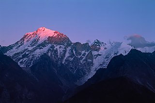
Himachal Pradesh is a state in the northern part of India. Situated in the Western Himalayas, it is one of the thirteen mountain states and is characterised by an extreme landscape featuring several peaks and extensive river systems. Himachal Pradesh is the northernmost state of India and shares borders with the union territories of Jammu and Kashmir and Ladakh to the north, and the states of Punjab to the west, Haryana to the southwest, Uttarakhand to the southeast and a very narrow border with Uttar Pradesh to the south. The state also shares an international border to the east with the Tibet Autonomous Region in China. Himachal Pradesh is also known as Dev Bhoomi, meaning 'Land of Gods' and Veer Bhoomi which means 'Land of the Brave'.
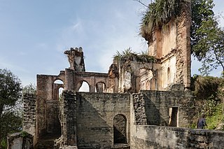
Hamirpur district is in the Indian state of Himachal Pradesh. The headquarters of the district are in the town of Hamirpur. With an area of 1,118 square kilometres or 432 square miles, it is the smallest district of Himachal Pradesh.

Una district is a district in the Indian state of Himachal Pradesh. Una shares its border with the Hoshiarpur and Rupnagar districts of Punjab and Kangra, Hamirpur, and Bilaspur districts of Himachal Pradesh. The terrain is generally plain with semi hills.
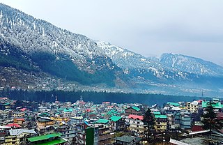
Manali is a resort town, near Kullu town in Kullu district in the Indian state of Himachal Pradesh. It is situated in the northern end of the Kullu Valley, formed by the Beas River. The town is located in the Kullu district, approximately 270 kilometres (170 mi) north of the state capital of Shimla and 544 kilometres (338 mi) northeast of the national capital of New Delhi. With a population of 8,096 people recorded in the 2011 Indian census Manali is the beginning of an ancient trade route through Lahaul (H.P.) and Ladakh, over the Karakoram Pass and onto Yarkand and Hotan in the Tarim Basin of China. Manali is a popular tourist destination in India and serves as the gateway to the Lahaul and Spiti district as well as the city of Leh in Ladakh.
Bilaspur is a town and a municipal council in Bilaspur district in the Indian state of Himachal Pradesh.

Kullu is a municipal council town that serves as the administrative headquarters of the Kullu district of the Indian state of Himachal Pradesh. It is located on the banks of the Beas River in the Kullu Valley about 10 kilometres (6.2 mi) north of the airport at Bhuntar, Kullu.

Una is a City and a Municipal Council in Una district in the Indian state of Himachal Pradesh. It serves as the headquarters of Una district. There are 11 wards under Municipal Council. Una City is home to the Kila, which is a historical fort and an ancestral home of the descendants of the first guru of the Sikhs, Guru Nanak.

Pathankot is a city and the district headquarters of the Pathankot district in Punjab, India. Pathankot is the 6th most populous city of Punjab, after Ludhiana, Amritsar, Jalandhar, Patiala and Bathinda. Its local government is a municipal corporation.

Hamirpur is a town, municipal council and the headquarters of Hamirpur district in the Indian state of Himachal Pradesh. It is covered by Shivalik Ranges. Hamirpur is located in the Lower West Central Outer Himalayas at an average elevation of 790 M above sea level. Far northern High Altitude Dhauladhar Ranges overlook the city. It is also a major junction on National Highway 3 while National Highway 103 starts at Here. Hamirpur is famous for its high literacy rate, educational institutions and traditional festival of Hamir Utsav. Hamirpur City is spread from Jhaniari to Bhota along NH 3 and NH 103 and is a prominent commercial centre for the district. It is Connected to the National Capital with regular HRTC Volvo and ordinary buses. The nearest airport is Kangra Airport and Mohali International Airport while the nearest railway is in Una at 79 km. Hamirpur City is surrounded by Pine tree forests and has a good city infrastructure ranging from quality educational institutions, NIT, State Universities and Skill Learning centres.
Budhan is a village in Sub Division Bijhari and Tehsil Barsar, District Hamirpur, Himachal Pradesh, India. The village is in the outer Sivalik Hills at an average elevation of 800 meters. It is located in Hamirpur, situated to the east of Bilaspur District in Himachal Pradesh. district Bilaspur. The village is known as "An Eye to The South."
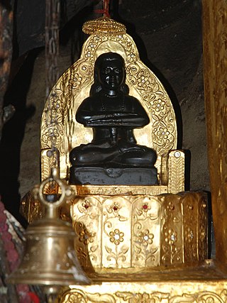
Baba Balak Nath is a Hindu deity, who is worshiped in the North-Indian state of Himachal Pradesh and Punjab. His main temple, known as Deotsidh, is in a cave on the hilltop of Chakmoh village in Hamirpur, Himachal Pradesh.
Gagret is a nagar panchayat in Tehsil Ghanari of Una district in the state of Himachal Pradesh, India. It is situated in plains of Jaswan valley of Una.
Ghumarwin is a town and a municipal council, near the town of Bilaspur in Bilaspur district in the North Indian State of Himachal Pradesh and is the second largest town of the entire district. The town is an anchor point for commuters between Bilaspur and Hamirpur and other parts of the state. Situated primarily between the Hills of Lower Central Himalayas, Ghumarwin is situated at an average elevation of 700 metres or about 2300 ft. above sea level. It is one of the biggest commercial centres of Bilaspur District and one can find all kinds of shops, stores, services etc. here.
Nadaun is a historical town and a nagar panchayat in the Hamirpur district of Himachal Pradesh, India. Previously a part of the princely state of Kangra, Nadaun is presently an independent small town located on NH 3 and NH 303 in the Sivalik range foothills. It is situated on the banks of the Beas.
Nurpur is a city and a municipal council in Kangra district in the Indian state of Himachal Pradesh. It was formerly part of the Nurpur State since the 11th century AD. The capital of the state was at Pathankot formerly known as Paithan, now in Punjab. It got its name from Nur Jahan, the wife of Mughal emperor Jahangir, when they visited Kangra (Nagarkot) after Jahangir's successful conquest of the Kangra Fort.
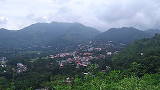
Sundar Nagar is a town and a municipal council in Mandi district in the Indian state of Himachal Pradesh. It was formerly a princely state, known as Suket.
The place of Sidh Baba Balak Nath's gufa Deotsidh is a pilgrimage town in Barsar tehsil, Hamirpur district, Himachal Pradesh, India. The nearest broad gauge railway station is in Una district, about 60 kilometres (37 mi) distant, and the nearest airport is about 172 kilometres (107 mi) away in Chandigarh.

Mandi is a major city and a municipal corporation in Mandi District in the Indian state of Himachal Pradesh. It is situated 145 kilometres (90 mi) north of state capital, Shimla in the north-west Himalayas at an average altitude of 880 m (2,890 ft) Mandi is connected to the Pathankot through National Highway 20 and to Manali and Chandigarh through National Highway 21. Mandi is approximately 184.6 km (114.7 mi) from Chandigarh, the nearest major city, and 440.9 km (274.0 mi) from New Delhi, the national capital. In the 2011 Indian census, Mandi city had a population of 26,422. Mandi district is currently the 4th largest economy in the state. Mandi has the second highest sex ratio of 1013 females per thousand males, in the state.
Sunhani is a village located in Jhanduta tehsil of Bilaspur, Himachal Pradesh, India. At the 2001 Census of India, it had a population of 2134 people and 452 families. It was the capital of the Kahlur kingdom from 1600 to 1650. Throughout history it has played an important role in the local area.

Bangana is a Tehsil of Una District in the state of Himachal Pradesh, India. It is located in the foothills of Solah Singhi Dhar in Una District of Himachal Pradesh, India. Ancient forts are located on the top of hill. It is said that Maharaja Sansar Chand built those forts. Lahore can be seen from these forts with the help of telescopes. District headquarters is 28km from here. Bangana has further two sub-tehsils Jol and Bihru


