Related Research Articles

The Fildes Peninsula is a 7 km (4.3 mi) long peninsula that forms the south-western end of King George Island in the South Shetland Islands of Antarctica. It was named from association with nearby Fildes Strait by the UK Antarctic Place-Names Committee in 1960; the strait was likely named for Robert Fildes, a British sealer of the 1800s.
Noel Hill is a conspicuous slate knob, 255 m, on Barton Peninsula in the west part of King George Island, in the South Shetland Islands. The name was used by Scottish geologist David Ferguson in a 1921 report based upon his investigations of King George Island in 1913–14.
Weaver Peninsula is a small peninsula between Collins Harbor and Marian Cove, Maxwell Bay, King George Island, terminating in North Spit. Named by the United Kingdom Antarctic Place-Names Committee (UK-APC) in 1977 after Stephen D. Weaver, geologist, University of Birmingham, with the British Antarctic Survey (BAS) party in this area in 1975.
Wesele Cove is a cove between Boy Point and Low Head on the south coast of King George Island, South Shetland Islands. Named in 1980 by the Polish Antarctic Expedition after Wesele, a play by Polish dramatist Stanislaw Wyspianski (1869–1907).
Jasper Point is the northeastern entrance point to Norma Cove, Fildes Peninsula, on King George Island in the South Shetland Islands. The point is bounded by cliffs of black and buff rocks, in which occur veins of red and green jasper. It was so named by the UK Antarctic Place-Names Committee following geological work by the British Antarctic Survey in 1975–76.
Krak Glacier is an outlet glacier of Kraków Dome at the head of Lussich Cove, Martel Inlet, Admiralty Bay, King George Island, in the South Shetland Islands.It was named by the Polish Antarctic Expedition, 1980, after the legendary prince Krak, founder of Kraków and killer of the Wawel Dragon.
Suffield Point is the south-west entrance point of Norma Cove, Fildes Peninsula, on King George Island in the South Shetland Islands of Antarctica. It was charted in the course of the Discovery Investigations, 1933–35, and named after boatswain William E. Suffield. The site is part of the Fildes Peninsula Antarctic Specially Protected Area, designated as such because of its paleontological values.
Platt Cliffs is a set of cliffs rising to about 100 m between Goulden Cove and Monsimet Cove in Ezcurra Inlet, Admiralty Bay, King George Island. Named by the United Kingdom Antarctic Place-Names Committee (UK-APC) after Eric Platt (1926–48), Falkland Islands Dependencies Survey (FIDS) base leader and geologist, Admiralty Bay, 1948. Platt died from exhaustion and exposure near Ternyck Needle, November 8, 1948, and is buried near the British station on Keller Peninsula.
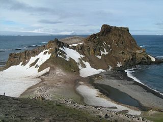
Potter Cove is a cove indenting the south-west side of King George Island to the east of Barton Peninsula, in the South Shetland Islands of Antarctica. An extinct volcano named Three Brothers Hill is located on its east side. Potter Cove was known to sealers as early as 1821, and the name is now well established in international usage.
Potter Peninsula is a low ice-free peninsula between Potter Cove and Stranger Point in south-west King George Island, in the South Shetland Islands of Antarctica. It is protected as ASPA 132, largely because of the richness and diversity of its flora and fauna.
Paradise Harbour is a wide embayment behind Lemaire Island and Bryde Island, indenting the west coast of Graham Land, Antarctica, between Duthiers Point and Leniz Point. The name was first applied by whalers operating in the vicinity and was in use by 1920.

Emm Rock is a conspicuous rock 30 metres (100 ft) high, lying 0.5 nautical miles (1 km) off the south coast of King George Island at the east side of the entrance to Potter Cove, in the South Shetland Islands. This rock, presumably known to early sealers in the area, was sketched by the French Antarctic Expedition, 1908–10, under Jean-Baptiste Charcot, and charted by Discovery Investigations personnel on the Discovery II in 1935. The name derives from the shape of the rock, which resembles the letter M.

Fourcade Glacier is a glacier at the head of Potter Cove, Maxwell Bay, on King George Island in the South Shetland Islands. It was named by the Polish Antarctic Expedition, 1980, after Nestor H. Fourcade of the Instituto Antartico Argentino, who made detailed geological investigations of Potter Cove and Fildes Peninsula in several seasons, 1957–58 to 1960–61.
Geographers Cove is a cove between Flat Top Peninsula and Exotic Point on the southwest side of Fildes Peninsula, King George Island, in the South Shetland Islands. The approved name is a translation of the Russian "Bukhta Geografov", applied in 1968 following Soviet Antarctic Expedition surveys from nearby Bellingshausen Station.
Goulden Cove is the southern of two coves at the head of Ezcurra Inlet, Admiralty Bay, on King George Island, in the South Shetland Islands. It was probably named by the French Antarctic Expedition under Jean-Baptiste Charcot, who surveyed Admiralty Bay in December 1909. Located at its head is an icefall called Doctors Icefall.
Low Head is a headland 1 nautical mile (2 km) south-southwest of Lions Rump, the west side of the entrance to King George Bay, on King George Island, in the South Shetland Islands, Antarctica. It was charted and given this descriptive name during 1937 by Discovery Investigations personnel on the Discovery II. Chopin Ridge runs between Lions Rump and Low Head.
Hydrographers Cove is a cove between the southwest side of Ardley Island and Fildes Peninsula, King George Island, in the South Shetland Islands. The approved name is a translation of the Russian "Bukhta Gidrografov", applied in 1968 following Soviet Antarctic Expedition surveys from Bellingshausen Station.
Marian Cove is a cove indenting the southwest part of King George Island between Collins Harbour and Potter Cove, in the South Shetland Islands, Antarctica. The name was used by Scottish geologist David Ferguson in a 1921 report based upon his investigations of King George Island in 1913–14, but may reflect an earlier naming.
Saunders Valley is a valley 0.9 nautical miles (1.7 km) in length and varying width, trending WNW-ESE in south Fildes Peninsula, King George Island. The valley mouth opens to Hydrographers Cove. Named by the United Kingdom Antarctic Place-Names Committee (UK-APC) in 1977 for Andrew D. Saunders, British geologist, University of Birmingham, working with the British Antarctic Survey (BAS) party in this area, 1975.
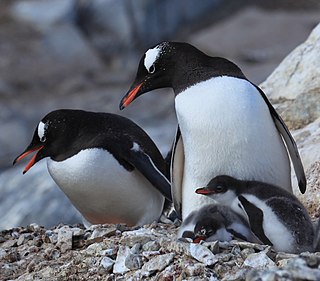
Narębski Point is a headland on the south-east coast of the Barton Peninsula, at the south-western end of King George Island, in the South Shetland Islands of Antarctica with an average elevation of 0 feet (0 m) above sea level. Korea’s King Sejong Station lies 2 km (1.2 mi) to the north-east.
References
![]() This article incorporates public domain material from "Barton Peninsula". Geographic Names Information System . United States Geological Survey.
This article incorporates public domain material from "Barton Peninsula". Geographic Names Information System . United States Geological Survey.
62°13′36″S58°44′29″W / 62.22661°S 58.74128°W
| | This King George Island (South Shetland Islands) location article is a stub. You can help Wikipedia by expanding it. |