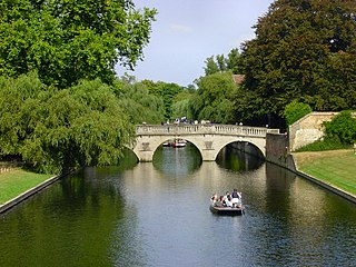
The River Cam is the main river flowing through Cambridge in eastern England. After leaving Cambridge, it flows north and east before joining the River Great Ouse to the south of Ely, at Pope's Corner. The total distance from Cambridge to the sea is about 40 mi (64 km) and is navigable for punts, small boats, and rowing craft. The Great Ouse also connects to England's canal system via the Middle Level Navigations and the River Nene. In total, the Cam runs for around 69 kilometres (43 mi) from its furthest source to its confluence with the Great Ouse.

Grantchester is a village and civil parish on the River Cam or Granta in South Cambridgeshire, England. It lies about two miles (3 km) south of Cambridge.

Coton is a small village and civil parish about three miles west of Cambridge in Cambridgeshire, England and about the same distance east of the Prime Meridian. It is in the district of South Cambridgeshire. The parish covers an area of 392 hectares. In the 2001 census it had a population of 773, with approximately 336 dwellings and 322 households. The population at the 2011 census was 910.

The N11 road is a national primary road in Ireland, running for 129 km (80 mi) along the east side of Ireland from Dublin to Wexford. It passes close to Bray, Greystones, Wicklow, Arklow, Gorey, and Enniscorthy. Beyond Wexford, the route continues to Rosslare as the N25. The road forms part of European route E01. As of July 2019 the N11/M11 is of dual carriageway or motorway standard from Dublin as far as Oilgate in County Wexford.

Newnham is a suburb of the city of Cambridge in England. Historically, the name refers to a hamlet centred on a mill on the River Cam, a short distance to the southwest of the city centre. The modern council ward of Newnham covers much of the west of the city. Several Cambridge University colleges are situated in this ward, including Newnham, Wolfson, Robinson, Selwyn and Darwin. In modern times Newnham has become one of the most affluent areas of Cambridge and sometimes features in national quality of life surveys.
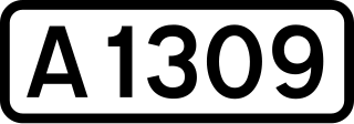
The A1309 is a short road which links the two ends of the A10 to north and south of Cambridge city centre in Cambridgeshire, England. It was numbered as part of the A10 prior to the construction of the Cambridge Western Bypass and the Northern Bypass.
The A428 road is a major road in central and eastern England. It runs between the cities of Coventry and Cambridge by way of the county towns of Northampton and Bedford. Together with the A421,, the eastern section of the A428 forms the route between Cambridge and Oxford. The A428 was formerly part of the main route from Birmingham to Felixstowe before the A14 was fully opened in 1993.

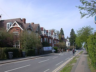
Barton is a village and civil parish in the South Cambridgeshire district of Cambridgeshire, England. It is about 4 miles (6.4 km) south-west of Cambridge, near junction 12 of the M11 motorway.
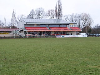
Grantchester Road is a rugby stadium in Cambridge, England. Situated on Grantchester Road, off Barton Road in the southwest of Cambridge, it is the home ground of Cambridge R.U.F.C., and is also used by University of Cambridge Rugby League Club.

The A1065 is a main road in the English region of East Anglia. It provides the principal road connection to parts of the west and north of the county of Norfolk from Newmarket and points south of there, including London. It runs from a junction near Mildenhall, to a junction on the western outskirt of Fakenham.

Bourn Brook is a minor tributary of the River Cam in Cambridgeshire, England.

Paradise is a 2.2 hectare Local Nature Reserve in Newnham, a suburb of Cambridge. It is owned and managed by Cambridge City Council.

Madingley Road is a major arterial road linking central Cambridge, England with Junction 13 of the M11 motorway. It passes by West Cambridge, a major new site where some University of Cambridge departments are being relocated.
Grange Road is a street in Cambridge, England. It stretches north–south, meeting Madingley Road (A1303) at a T-junction to the north and Barton Road (A603) to the south. It runs approximately parallel with the River Cam to the east. Grange Road is almost one mile long and has 17th-century origins. It contains several colleges of the University of Cambridge.

Queen's Road is a major road to the west of central Cambridge, England. It links with Madingley Road and Northampton Street to the north and with Sidgwick Avenue, Newnham Road and Silver Street to the south.

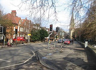
Regent Street is an arterial street in southeast central Cambridge, England. It runs between St Andrew's Street, at the junction with Park Terrace, to the northwest and Hills Road at the junction with the A603 to the southeast. Regent Terrace runs in parallel immediately to the northeast. Beyond that is Parker's Piece, a large grassed area with footpaths.
Hills Road is an arterial road in southeast Cambridge, England. It runs between Regent Street at the junction with Lensfield Road and Gonville Place to the northwest and a roundabout by the Cambridge Biomedical Campus, continuing as Babraham Road to the southeast.
Lensfield Road is a road in southeast central Cambridge, England. It runs between the junction of Trumpington Street and Trumpington Road to the west and the junction of Regent Street and Hills Road to the west. It continues as Gonville Place to the northeast past Parker's Piece, a large grassy area with footpaths.

Huntingdon Road is a major arterial road linking central Cambridge, England with Junction 14 of the M11 motorway and the A14 northwest from the city centre. The road, designated the A1307, follows the route of the Roman Via Devana, and is named after the town of Huntingdon, northwest of Cambridge.

Newmarket Road is an arterial road in the east of Cambridge, England. It is designated the A1134 at the western end, linked by a roundabout forming a junction with Barnwell Road (A1134) to the south. The eastern end links with the city's inner ring road at another roundabout, with Elizabeth Way (A1134) to the north and East Road (A603) to the southeast. Newmarket Road continues a short way towards the city centre, becoming Maid's Causeway and then Jesus Lane. To the east, the road becomes the A1303 and crosses the A14 at a major roundabout, continuing further east and parallel to the A14 out of the city. The road is named after the market town of Newmarket in Suffolk, east of Cambridge.

