
Biratnagar is the one of the largest city and the capital of Province No. 1 of Nepal. It has a population of 242,548 as per the 2011 census. Five prime ministers of Nepal have come from Biratnagar and the city has been host to a number of revolutionary incidents in the country including the first labor strike leading to the anti-Rana movement, the first plane hijack, being the stronghold for the Nepali Congress etc.
Solukhumbu District (Nepali: सोलुखुम्बु जिल्लाlisten , Sherpa: ཤར་ཁུམ་བུ་རྫོང་ཁ།, Wylie: shar khum bu dzong kha) is one of 14 districts of Province No. 1 of eastern Nepal. As the name suggests, it consists of the subregions Solu and Khumbu.

Khandbari is the district headquarters of Sankhuwasabha District in Province No. 1 of north-eastern Nepal. The 2011 Nepal census counted 26,301 population.
Birendranagar is a city in Surkhet District in Karnali province of Nepal.
Tumlingtar (टुम्लिङटार) is a region and a city, in Eastern Nepal, between the Arun and Sabha Rivers in Kosi Zone Province No. 1. It is located in Sankhuwasabha District. It is also the deepest valley and largest ṭār of Nepal. Its elevation is 285 meters.

Devghat is one of the famous religious and cultural centers in central Nepal. At the time of the 1991 Nepal census it had a population of 5786 people living in 1132 individual households.
Basantapur is a Village Development Committee in Baitadi District in Sudurpashchim Pradesh of western Nepal. At the time of the 1991 Nepal census it had a population of 2,141 and had 366 houses in the village.
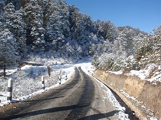
Basant pur is a place which is almost 50 kilometres (31 mi) away from the Daimadu. This village is very nice, and people there are very helpful. Many of the people from this village are settled in metro cities of India and in the large cities of the Nepal. Many of the people are settled in Delhi; some of them are businessmen, and a number of youngsters have joined the army in Nepal and are serving their nation. Those who are away from their village they come once in a year and see their native village. Many NGO's are working for the village. The village has its own high school and is having water supply to almost every house. Many festivals like "Gaura", "Dasai" (etc.) are celebrated round the year. The main earning of the people comes from agriculture. The village has many mills for the grinding of wheat. The public transport system is not connected to it, but maybe in the coming years, there will be a transport system of the village.
Patan is a municipality in Baitadi District in the Mahakali Zone of Far-western Nepal. The new municipality was formed by merging six existing villages Sakar, Silanga, Bhumeswor Gujar Basantapur and Patan on 2 December 2014. The office of the municipality is that of the former Patan village development committee.
Saurpani is Ward no.4 Sulikot Gaupalika in Gorkha District in the Gandaki Zone of northern-central Nepal. At the time of the 2011 Nepal census it had a population of 5,958 and had 1,325 houses in the town.
Gotikhel is a village and former Village Development Committee that is now part of Mahankal Rural Municipality in Province No. 3 of central Nepal. At the time of the 1991 Nepal census it had a population of 1654 living in 323 individual households.
Kumari is a village development committee in Nuwakot District in the Bagmati Zone of central Nepal. At the time of the 1991 Nepal census it had a population of 6458 people living in 1132 individual households.

Khiji Chandeshwari खिँजी/खिँचि, Chandeshowar mispronounce Chandeshwari or Original Name Khiji (jee/chee/ji) and Chandi-Showar became Chandeshwari खिजी चण्डेश्वरी is a village development committee in Okhaldhunga District in the Sagarmatha Zone of mid-eastern Nepal. At the time of the 1991 Nepal census it had a population of 3001 living in 590 individual households.
Kaskikot, commonly known as Kaski, is a Ward no. 24 of the Pokhara metropolitan city. It was earlier a part of the village development committee in Kaski District, a region in northern-central Nepal.
Duradanda is one of the mid-hills in Lamjung District between Kirenche river in the north and Paudi river to the south. Lamjung is one of the six districts in Gandaki Zone in central Nepal. Duradanda used to have six village development committees (VDCs) according to the older local body structure: Chandreshwor, Duradanda, Dhuseni, Ishaneshwor, Neta, and Purankot. The new constitution has restructured the local bodies and these VDCs are formally non-existent. The name 'Duradanda' is composed of two terms: Dura= historical Dura tribes + danda= hill in Nepali. Duras inhabited this place from the historical times and were important political game players in the past, especially when Nepal was fragmented into 22–24 tiny Kingdoms, known as Bayise Chaubisi rajyas. Duradanda is considered to be the place of origin of the 'Dura' tribe. Duras have their own language and culture but are being forgotten because of an increasing influence from other cultures. Dura language, in fact, is no longer in use as the tribe uses the Nepali language. Only old generations knows the language, and not many people of this generation are alive at this time. Thus, Dura culture is in danger of being lost completely. Apart from Duras, Duradanda is also known for famous historical movements called 'Halo Kranti ' and 'Siksha Kranti '. Sarvodaya High School was one of the oldest school in the entire region of Central Nepal. Thus, people from very far places used to come to Duradanda to gain formal school education from Sarvodaya High School. At that time, young people who wanted to come here seeking school education from far villages used to say: "Duradanda kei chhaina tadha, janchhu ma ta sikshya ko khojima" meaning that "Duradanda is no longer far and I want to go there seeking my education". There were no hostels, so the youngesters used to live as guests in locals' houses, preferably relatives. In return, they had to bring commodities or to provide labor services for household and/or farm works.

Sankhar is a village development committee in Chapakot Municipality of Syangja District in Gandaki Pradesh of central Nepal. At the time of the 2011 Nepal census it had a population of 4,630 people residing in 1,055 individual households. Majuwa, Mohami, Bhattarai Danda, Keladighat, Patasar, Panglung, Salghari, Manechaur, Khasa Bankata, Pipalchhap, Khardi, Samakot, Tangle, Gahate, Ajingare, and Hadiban are major villages in Sankhar.
Surunga is a trade center of Jhapa District. It is located in Kankai Municipality in Jhapa District in the Mechi Zone of south-eastern Nepal. At the time of the 1991 Nepal census it had a population of 16,747 people living in 2996 individual households. Surunga is one of the rapidly developing towns of Jhapa district. It is situated on the bank of the Kankai River.

Phidim Municipality is the headquarters of the Panchthar District in the Mechi Zone of eastern Nepal. Phidim was upgraded to a 'municipality' from a 'village', when a development committee merged with other VDCs - including the Phidim, Chokmagu and Siwa villages - on May 18, 2014. It offers a route for trekkers and locals, who travel to and from the Taplejung district bordering with the Tibetan Autonomous Region of China. It is also a commercial hub for the rural surroundings.
Basantapur is a village development committee in the Kapilvastu District in the Lumbini Zone of southern Nepal. At the time of the 1991 Nepal census it had a population of 2352.
Madhumalla is a village development committee in Morang District in the Koshi Zone of south-eastern Nepal. With a population of 21,482 as of the 2011 Nepal census and situated at the foothills of Raja rani mountain, Madhumalla is a village sandwiched by two rivers Mawa and Nunsari. Its neighbours are Urlabari municipality to its south, Damak municipality to its east and south, and Illam district to its north. This village is at a distance of 7.3 km north of Urlabari

Makalu is a rural municipality (gaunpalika) out of five rural municipality located in Sankhuwasabha District of Province No. 1 of Nepal. There are a total of 10 municipalities in Sankhuwasabha in which 5 are urban and 5 are rural.

