
Lyme is a town in New London County, Connecticut, United States, situated on the eastern side of the Connecticut River. The town is part of the Lower Connecticut River Valley Planning Region. The population was 2,352 at the 2020 census. Lyme is the eponym of Lyme disease.
Long Lake is a town in Hamilton County, New York, United States. The population was 791 at the 2020 census.

Springfield is a town in Otsego County, New York, United States. The population was 1,358 at the 2010 census. It is located at the northern county line of Otsego County and is approximately 50 mi (80 km) west of Schenectady.
Ellisburg is an incorporated town in Jefferson County, New York. The population was 3,352 at the time of the 2020 census. The town is in the southwestern corner of the county and is south of Watertown. Ellisburg is named after early European-American landowners. Among the villages in the town is Ellisburg.

Sandy Creek is a town in Oswego County, New York, United States. The population was 3,939 at the time of the 2010 census. The name is derived from a creek in the area.

The Oswegatchie River is a 137-mile-long (220 km) river in northern New York that flows from the Adirondack Mountains north to the Saint Lawrence River. The Oswegatchie River begins at Partlow Lake in Hamilton County, New York. The river continues through Cranberry Lake which was 'doubled in size' through construction of a dam in the late 1860s. The river continues from the dam to Gouverneur, to near Talcville in St. Lawrence County, where it joins the West Branch. Much of it is within Adirondack State Park. The city of Ogdensburg developed at the mouth of the river at its confluence with the St. Lawrence.

Hempstead Lake State Park is a 737-acre (2.98 km2) state park located in Nassau County, New York in the United States. The park is located in West Hempstead and is one of three state parks within the Town of Hempstead. There is a quick-access entrance at exit 18 from the Southern State Parkway. The park contains the largest freshwater lake in Nassau County.

The Sacandaga River is a 64-mile-long (103 km) river in the northern part of New York in the United States. Its name comes from the Native American Sa-chen-da'-ga, meaning "overflowed lands".

The Saranac River is an 81-mile-long (130 km) river in the U.S. state of New York.

The West Canada Creek is a 76-mile-long (122 km) river in upstate New York, United States. West Canada Creek is an important water way in Hamilton, Oneida, and Herkimer counties, draining the south part of the Adirondack Mountains before emptying into the Mohawk River near the Village of Herkimer. The name "Canada" is derived from an Iroquoian word for "village" (Kanata).
Popolopen is the name of several related landmarks mainly within the Hudson Highlands of Orange County, New York. These include a peak, Popolopen Torne—or simply "The Torne", and a short and steep-sided nearby valley officially called Hell Hole, but often Popolopen Gorge. Popolopen Creek runs through this valley. The Popolopen Bridge spans its mouth at the Hudson River and is crossed by Route 9W. Popolopen Lake feeds the headwaters of its namesake creek. Despite local usage, the United States Board on Geographical Names recognizes only the lake, creek and bridge as bearing the name "Popolopen."

Fishkill Creek is a tributary of the Hudson River in Dutchess County, New York, United States. At 33.5 miles (53.9 km) it is the second longest stream in the county, after Wappinger Creek. It rises in the town of Union Vale and flows generally southwest to a small estuary on the Hudson just south of Beacon. Part of its 193-square-mile (500 km2) watershed is in Putnam County to the south. Sprout Creek, the county's third-longest creek, is its most significant tributary. Whaley and Sylvan lakes and Beacon Reservoir, its largest, deepest and highest lakes, are among the bodies of water within the watershed.

Wappinger Creek is a 41.7-mile-long (67.1 km) creek which runs from Thompson Pond to the Hudson River at New Hamburg in Dutchess County, New York, United States. It is the longest creek in Dutchess County, with the largest watershed in the county.

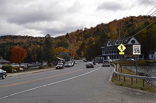
New York State Route 28N (NY 28N) is an east–west state highway in the North Country of New York in the United States. It extends for 50.95 miles (82.00 km) through the Adirondack Mountains from Blue Mountain Lake to North Creek. The route is a northerly alternate route to NY 28 between both locations; as such, it passes through several communities that NY 28 bypasses to the south. The westernmost 10 miles (16 km) of NY 28N overlap with NY 30 through the town of Long Lake. NY 28N and NY 30 split in the hamlet of Long Lake, from where NY 30 heads to the north and NY 28N proceeds eastward through mountainous regions of Adirondack Park.

Black Pond Wildlife Management Area is a 526-acre (213 ha) New York State Wildlife Management Area (WMA) that lies on the eastern shore of Lake Ontario, and at the northern limit of an unusual region of sandy barrier beaches and lagoons. Much of the barrier beach in Black Pond WMA has forested sand dunes that are about 60 feet (18 m) high; these are the highest sand dunes in the northeast United States excepting Cape Cod. Immediately north of the WMA is the 360-acre (150 ha) El Dorado Beach Preserve, which is a bird refuge owned by The Nature Conservancy. North of the outlet from Black Pond to Lake Ontario, the shoreline is a weathered, flat bedrock shelf that is "calcareous" instead of sandy.

Hayden Creek is a river in Otsego County, in the U.S. State of New York. It begins north-northwest of the Hamlet of East Springfield and flows generally southward before flowing into Otsego Lake south of the Hamlet of Springfield Center.
