Bridgetown is the capital and largest city of Barbados. Formerly The Town of Saint Michael, the Greater Bridgetown area is located within the parish of Saint Michael. Bridgetown is sometimes locally referred to as "The City", but the most common reference is simply "Town". As of 2014, its metropolitan population stands at roughly 110,000.

St. George's is the capital of Grenada. The town is surrounded by a hillside of an old volcano crater and is located on a horseshoe-shaped harbour.

Newquay is a town on the north coast in Cornwall, England, United Kingdom. It is a civil parish, seaside resort, regional centre for aerospace industries with a spaceport, and a fishing port on the North Atlantic coast of Cornwall, approximately 12 miles (19 km) north of Truro and 20 miles (32 km) west of Bodmin.

Biarritz is a city on the Bay of Biscay, on the Atlantic coast in the Pyrénées-Atlantiques department in the French Basque Country in southwestern France. It is located 35 kilometres (22 mi) from the border with Spain. It is a luxurious seaside tourist destination known for the Hôtel du Palais, its casinos in front of the sea and its surfing culture.

Perranporth is a seaside resort town on the north coast of Cornwall, England, United Kingdom. It is 2.1 miles east of the St Agnes Heritage Coastline, and around 7 miles south-west of Newquay. Perranporth and its 2 miles (3 km) long beach face the Atlantic Ocean. It has a population of 3,066, and is the largest settlement in the civil parish of Perranzabuloe. It has an electoral ward in its own name whose population was 4,270 in the 2011 census.

Kiama is a coastal country town 120 kilometres south of Sydney in the Illawarra. One of the main tourist attractions is the Kiama Blowhole. Kiama features several popular surfing beaches and caravan parks, and numerous alfresco cafes and restaurants. Its proximity to the south of Sydney makes it an attractive destination for many day-trippers and weekenders. Kiama also has historically been a farming and agricultural centre. Even to today it maintains a country and agricultural community with a weekly farmers markets held on Wednesday afternoons.

Palm Beach is a suburb in the Northern Beaches region of Sydney, in the state of New South Wales, Australia. Palm Beach is located 41 kilometres (25 mi) north of the Sydney central business district, in the local government area of Northern Beaches Council. Palm Beach sits on a peninsula at the end of Barrenjoey Road, between Pittwater and Broken Bay. The population of Palm Beach was 1,593 as at the 2016 census.

Llantwit Major is a town and community in Wales on the Bristol Channel coast. It is one of four towns in the Vale of Glamorgan, with the third largest population after Barry and Penarth, and ahead of Cowbridge. It is 4+1⁄2 miles (7.2 km) from Cowbridge, 9 miles (14 km) from Bridgend, 10 miles (16 km) from Barry, and 15 miles (24 km) from Cardiff. It had a population of 9,530 in 2021.

Torquay is a seaside resort in Victoria, Australia, which faces Bass Strait, 21 km south of Geelong and is the gateway to the Great Ocean Road. It is bordered on the west by Spring Creek and its coastal features include Point Danger and Zeally Bay. At the 2021 census, Torquay had a population of 18,534.
Ballybunion or Ballybunnion is a coastal town and seaside resort in County Kerry, Ireland, on the Wild Atlantic Way, 15 km (9 mi) from the town of Listowel. As of the 2022 census, Ballybunion had a population of 1,618.

Bundoran is a town in County Donegal, Ireland. The town is located near the N15 road near Ballyshannon, and is the most southerly town in Donegal. The town is a tourist seaside resort, and tourism has been at the heart of the local economy since the 18th century. Bundoran is a surfing destination and was listed by National Geographic magazine in 2012 as one of the world's top 20 surf towns.

The parish of Saint Joseph is a parish of Barbados on the eastern side of the island. The parish is home to two of the more notable botanic gardens in the country - Flower Forest and Andromeda Gardens. Parts of St. Joseph are also referred to as the Scotland District, a reference to the appearance of the landscape.
Saint Philip is a parish of Barbados at the easternmost end of the island. Saint Philip’s Parish Church was built as the Anglican parish church in 1640.

Caloundra is a coastal town and the southernmost town in the Sunshine Coast Region in South East Queensland, Australia.

Sandy Lane is a luxury five-star beachfront resort close to Holetown and Paynes Bay on the island of Barbados. Sandy Lane was opened in 1961 by Ronald Tree, a former British politician, as a luxury hotel and golf course on what had been a sugar plantation. In 1998, the hotel was put up for sale by Granada plc, and five Irish businessmen, including J. P. McManus, Dermot Desmond and John Magnier, bought it. The original resort was then demolished in a three-year, $450 million upgrade and renovation.
Hillaby is a community on the borders of parishes Saint Thomas and Saint Andrew in Barbados. Historically it has always been referred to as Hillaby in St. Thomas it is the top third of the village which is in St. Andrew, with the greater area in St. Thomas.
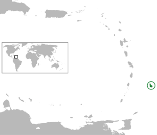
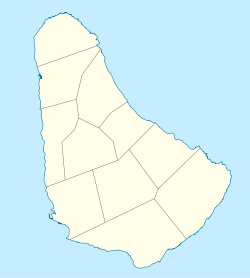
The following is an alphabetical list of topics related to the nation of Barbados.

Gerroa is a coastal town in the Municipality of Kiama, in the Illawarra region of New South Wales, Australia 133 kilometres south of Sydney. It is considered to be the southernmost town in the Illawarra region. Nearby towns are Gerringong, Kiama and Berry.

Doonbeg (Killard) (Irish: Cill Ard) is a civil parish on the Atlantic coast of County Clare in Ireland. It is also an ecclesiastical parish in the Roman Catholic Diocese of Killaloe. The largest population centre in the parish is the village of Doonbeg.