Natural region
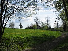
The territory of the Bavarian Forest Nature Park begins at the Danube at a height of about 320-metres above sea level. Here there are the last remains of riparian woodland and structurally rich ox-bow lakes. The Lallinger Winkel is well known for its scattered orchards. On the anterior chain of the Bavarian Forest, the so-called Danube Hills, the last examples of the threatened capercaillie still survive, as they do in the highlands of the inner Bavarian Forest.
An ecologically very rich rock formation is the Pfahl. It runs in a southeasterly direction for about 140 kilometres from the neighbouring Bavarian province of Upper Palatinate to the state of Upper Austria. The weather resistant quartz rock protrudes above the surrounding gneisses by several metres and offers a habitat for many warmth-loving animal and plant species. In the Inner Bavarian Forest there are still structure-rich mixed mountain woodlands and the typical highland spruce forests with raised bogs and areas of Schachten , the last relicts of mountain pasture.
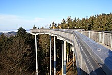
The Bavarian Forest is part of the largest contiguous forest in Central Europe and, together with the neighbouring Bohemian Forest, is of outstanding importance for nature and landscape conservation. The partly near-natural woods in the border region and the attractive, historical cultural landscape make the Bavarian Forest Nature Park an important component in the conservation of major landscapes.
Numerous animal and plant species which have become very rare or are threatened with extinction in Bavaria and Germany as a whole, have found their last refuge areas in this region.
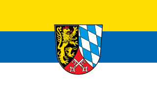
The Upper Palatinate is one of the seven administrative districts of Bavaria, Germany, and is located in the east of Bavaria. It consists of seven districts and 226 municipalities.
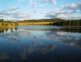
The Ore Mountains lie along the Czech–German border, separating the historical regions of Bohemia in the Czech Republic and Saxony in Germany. The highest peaks are the Klínovec in the Czech Republic at 1,244 metres (4,081 ft) above sea level and the Fichtelberg in Germany at 1,215 metres (3,986 ft).

The Fichtel Mountains, form a small horseshoe-shaped mountain range in northeastern Bavaria, Germany. They extend from the valley of the Red Main River to the Czech border, a few foothills spilling over into the Czech Republic. They continue in a northeasterly direction as the Elster Mountains, and in a southeasterly direction as the Upper Palatine Forest. The Fichtel Mountains contain an important nature park, the Fichtel Mountain Nature Park, with an area of 1,020 square kilometres (390 sq mi).

The Bavarian Forest is a wooded, low-mountain region in Bavaria, Germany that is about 100 kilometres long. It runs along the Czech border and is continued on the Czech side by the Bohemian Forest. Most of the Bavarian Forest lies within the province of Lower Bavaria, but the northern part lies within Upper Palatinate. In the south it reaches the border with Upper Austria.

The Bavarian Forest National Park is a national park in the Eastern Bavarian Forest immediately on Germany's border with the Czech Republic. It was founded on 7 October 1970 as the first national park in Germany. Since its expansion on 1 August 1997 it has covered an area of 24,250 hectares. Together with the neighbouring Czech Bohemian Forest the Bavarian Forest forms the largest contiguous area of forest in Central Europe.
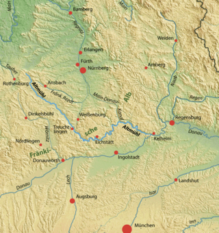
The Altmühl is a river in Bavaria, Germany. It is a left tributary of the river Danube and is approximately 230 kilometres (140 mi) long.

The Bohemian Forest, known in Czech as Šumava and in German as Böhmerwald, is a low mountain range in Central Europe. Geographically, the mountains extend from Plzeň Region and South Bohemia in the Czech Republic to Austria and Bavaria in Germany, and form the highest truncated uplands of the Bohemian Massif, up to 50 km wide. They create a natural border between the Czech Republic on one side and Germany and Austria on the other.

The Großer Arber ; Czech: Velký Javor, "Great Maple") or Great Arber, is the highest peak of the Bavarian/Bohemian Forest mountain range and in Lower Bavaria, with an elevation of 1,455.5 metres (4,775 ft). As a result, it is known in the Lower Bavarian county of Regen and the Upper Palatine county of Cham as the "King of the Bavarian Forest". Its summit region consists of paragneiss.
The Upper Palatine-Bavarian Forest, is a natural region in Germany in the northeast of Bavaria. It mainly comprises the low mountain ranges of the Bavarian Forest and Upper Palatine Forest which are up to 1456 m high and border on the Bohemian Massif immediately inside the Czech Republic's southwestern border with Germany.

The Steinwald is a mountain range up to 946 m above sea level (NN) in southern Germany and, at the same time, a nature park founded in 1970 with an area of 246 square kilometres (95 sq mi) in the province of Upper Palatinate, in North Bavaria.

The Einödriegel is a mountain, 1,120.6 m above sea level (NHN), in the Bavarian Forest in Germany. It rises southwest of the Lower Bavarian county town of Regen and northeast of the county town of Deggendorf. It is the highest point in the Danube Hills and the county of Deggendorf and lies in the municipality of Grafling.

On 8 March 1988 the Bavarian State Ministry for State Development and the Environment designated an area of 1,280 square kilometres (490 sq mi) in the Steigerwald in North Bavaria, Germany, as the Steigerwald Nature Park. About half the area consists of protected landscapes. The nature park is run by the Steigerwald Tourist Association and Steigerwald Nature Park.

The Schwandorf–Furth im Wald railway is a 67 km long mainline railway in the German state of Bavaria. It runs from Schwandorf via Cham to Furth im Wald. It is part of a long-distance connection between Germany and the Czech Republic.
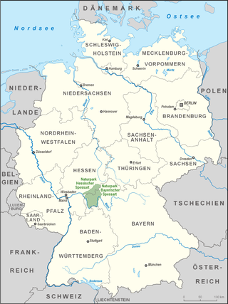
Spessart Nature Park is a nature park in Germany, managed by Naturpark Spessart e. V. The park spans the states of Hesse and Bavaria, and covers an area of 2,440 km² within the German hill range known as the Spessart. The geological foundation of the park is formed by a Bunter sandstone plate, up to about 400 metres thick, which tilts towards the southeast. The nature park includes the largest contiguous area of mixed forest in Germany. Deep valleys, gentle hillsides and heights characterise the landscape of the Spessart.
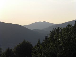
The Anterior Bavarian Forest, also variously called the Vorderer Forest, Vorderer Wald or Danube Hills, is part of the Bavarian Forest, a low mountain range in Germany.

The Bavarian Forest Club, or BWV, is a German club that promotes culture, local history and folklore, nature and landscape conservation, and walking in the Bavarian Forest. It has its head office in Zwiesel and is registered in the register of clubs and societies in the district office at Deggendorf.

The Upper Bavarian Forest Nature Park covers an area of 1,796 km² and is thus one of the largest nature parks in the German state of Bavaria.

The Neuburg Forest is a largely forested hill ridge and natural region in Lower Bavaria in the county of Passau and the borough of Passau. It is named after the village of Neuburg am Inn.
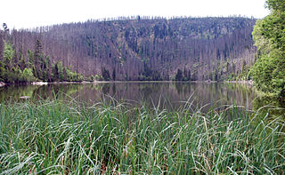
The Plöckenstein is a mountain, 1,379 m (AA) high, in the Bohemian Forest on the Austro-Czech border. Its summit is the highest point in the Bohemian Forest in both countries, and also the highest point in the regions of Mühlviertel and South Bohemia. It is well known as a result of stories by Adalbert Stifter.
The Falkensteiner Vorwald is the gently rolling westernmost part of the Bavarian Forest in northern Lower Bavaria and southern Upper Palatinate in the German state of Bavaria.


