
The North Island, also officially named Te Ika-a-Māui, is one of the two main islands of New Zealand, separated from the larger but less populous South Island by Cook Strait. With an area of 113,729 km2 (43,911 sq mi), it is the world's 14th-largest island, constituting 43% of New Zealand's land area. It has a population of 3,997,300, which is 77% of New Zealand's residents, making it the most populous island in Polynesia and the 28th-most-populous island in the world.

Hawke's Bay is a region on the east coast of New Zealand's North Island. The region is named for Hawke Bay, which was named in honour of Edward Hawke. The region's main centres are the cities of Napier and Hastings, while the more rural parts of the region are served by the towns of Waipukurau, Waipawa, and Wairoa.

Eastbourne is a suburb of Lower Hutt, a part of Wellington, New Zealand. Lying beside the sea, it is a popular local tourist destination via car from Petone or from ferry crossings from central Wellington. An outer suburb, it lies on the eastern shore of Wellington Harbour, five kilometres south of the main Lower Hutt urban area and directly across the harbour from the Miramar Peninsula in Wellington city. A narrow exposed coastal road connects it with the rest of Lower Hutt via the Eastern Bays and the industrial suburb of Seaview. It is named for Eastbourne in England, another seaside town known as a destination for day-trips.

Territorial authorities are the second tier of local government in New Zealand, below regional councils. There are 67 territorial authorities: 13 city councils, 53 district councils and the Chatham Islands Council. District councils serve a combination of rural and urban communities, while city councils administer the larger urban areas. Five territorial authorities also perform the functions of a regional council and thus are unitary authorities. The Chatham Islands Council is a sui generis territorial authority that is similar to a unitary authority.
Rotorua is a city in the Bay of Plenty Region of New Zealand's North Island. It is sited on the southern shores of Lake Rotorua, from which it takes its name. It is the seat of the Rotorua Lakes District, a territorial authority encompassing Rotorua and several other nearby towns. It has an estimated resident population of 58,900, making it the country's 13th largest urban area, and the Bay of Plenty's second-largest urban area behind Tauranga.

Whakatāne is a town located in the Bay of Plenty Region in the North Island of New Zealand, 90 kilometres (56 mi) east of Tauranga and 89 kilometres (55 mi) northeast of Rotorua. The town is situated at the mouth of the Whakatāne River. The Whakatāne District is the territorial authority that encompasses the town, covering an area to the south and west of the town, excluding the enclave of Kawerau District.
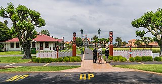
Ōpōtiki is a town in the eastern Bay of Plenty in the North Island of New Zealand. It houses the headquarters of the Ōpōtiki District Council, the mayor of Ōpōtiki and comes under the Bay of Plenty Regional Council.

Regional parks of New Zealand are protected areas administered by regional councils, the top tier of local government. Regional parks are found across five regions of New Zealand: the Auckland Region, Waikato Region, Bay of Plenty Region, Wellington Region and Canterbury Region. Regional parks in the Auckland and Waikato regions are administered by the Auckland Council, while parks in other areas are administered by regional councils: the Bay of Plenty Regional Council, Greater Wellington Regional Council, and Canterbury Regional Council.

Urban bus transport is the main form of public transport in New Zealand. Two of the country's largest cities, Auckland and Wellington, also have suburban rail systems, while some cities also operate local ferry services. There are no rapid transit metros and no remaining tram systems active anywhere in New Zealand, though trams once had a major role in New Zealand's public transport.
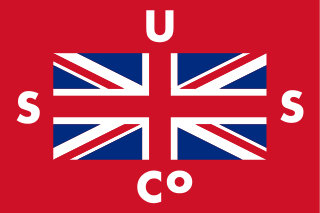
Union Steam Ship Company of New Zealand Limited was once the biggest shipping line in the southern hemisphere and New Zealand's largest private-sector employer. It was incorporated by James Mills in Dunedin in 1875 with the backing of a Scottish shipbuilder, Peter Denny. Bought by shipping giant P&O around the time of World War I it was sold in 1972 to an Australasian consortium and closed at the end of the twentieth century.
The Mayor of Tauranga is the head of the municipal government of Tauranga, New Zealand, and presides over the Tauranga City Council. There is currently no Mayor of Tauranga. On 9 February 2021, a Crown Commission appointed by the Minister of Local Government took over all of the council's governance responsibilities, including the vacant position of Mayor. Tenby Powell resigned as Mayor in November 2020.

Kaitoke Regional Park is regional park located at Kaitoke, northeast of Upper Hutt, in the Wellington Region of New Zealand's southern North Island. It is administered by Wellington Regional Council, alongside the adjacent Hutt Water Collection Area.
Tauranga City Council is the local government authority for Tauranga City in New Zealand. It is a territorial authority elected to represent the 158,000 people of Tauranga. The last Mayor of Tauranga was Tenby Powell, who resigned in November 2020. The council consists of 11 members elected from three wards and at-large, and is presided over by the Mayor, who is elected at large. Marty Grenfell is currently the CEO of Tauranga City Council.
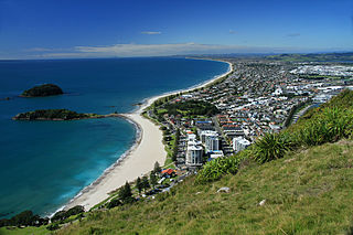
Tauranga is a coastal city in the Bay of Plenty Region and the fifth-most populous city of New Zealand, with an urban population of 161,800, or roughly 3% of the national population. It was settled by Māori late in the 13th century, colonised by Europeans in the early 19th century, and was constituted as a city in 1963.
The Wainui River is a river of the Bay of Plenty Region of New Zealand's North Island. It flows north from the Kaimai Range to reach Tauranga Harbour 10 kilometres (6 mi) south of Katikati. The catchment has 191 km (119 mi) of stream margins. 41% of the catchment remains covered in native bush, but 48% is under pasture and suffers soil erosion.

The North Island kōkako is an endangered forest bird which is endemic to the North Island of New Zealand. It is grey in colour, with a small black mask. It has blue wattles. Because of its wattle, the bird is sometimes locally called the blue-wattled crow, although it is not a corvid.

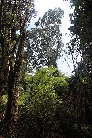
Papamoa Hills Regional Park is a protected area in the Bay of Plenty Region, owned and managed by Bay of Plenty Regional Council. It is located between Papamoa and Te Puke, on Poplar Lane off State Highway 2.
Onekawa Te Mawhai Regional Park is a protected area at Ōhiwa in the Bay of Plenty Region of New Zealand's North Island, owned and managed by Bay of Plenty Regional Council in partnership with the Upokorehe hapū.

Whitireia Park is a headland north of Tītahi Bay and Te Awarua-o-Porirua Harbour in Porirua, in the Wellington Region at the southern end of New Zealand's North Island. It is a park administered by the Whitireia Park Board, in collaboration with Wellington Regional Council. The park includes Onehunga Bay, Kaitawa Point and part of Rocky Bay.
Motunau / Plate Island is a small island in the Bay of Plenty, roughly 12 kilometres (7.5 mi) off New Zealand's North Island at Okurei Point and a similar distance east-south-east from the much larger Mōtītī Island. The island is split into northern and southern portions by a small channel as narrow as 2 metres across, with several small sea stacks surrounding the two main parts of the island. Like many of the other islands in the Bay of Plenty, Motunau is volcanic in origin and lacks any permanent fresh water source, and as a result has not seen permanent settlement by humans.