Bayou Talla is a stream in Jackcon County, Mississippi, United States, that is a tributary of the Old Fort Bayou. [1]
Talla is a name derived from the Choctaw language meaning 'palmetto'. [2]

Bolivar County is a county located on the western border of the U.S. state of Mississippi. As of the 2020 census, the population was 30,985. Its county seats are Rosedale and Cleveland. The county is named in honor of Simón Bolívar, early 19th-century leader of the liberation of several South American territories from Spain.

Kiln is an unincorporated community and census-designated place (CDP) in Hancock County, Mississippi, United States. The town is located about 50 miles (80 km) northeast of New Orleans, Louisiana. It is part of the Gulfport-Biloxi Metropolitan Statistical Area. The population was 2,238 at the 2010 census.
Bayou Teche is a 125-mile-long (201 km) waterway in south central Louisiana in the United States. Bayou Teche was the Mississippi River's main course when it developed a delta about 2,800 to 4,500 years ago. Through a natural process known as deltaic switching, the river's deposits of silt and sediment cause the Mississippi to change its course every thousand years or so.

Coden is an unincorporated community coastal fishing village in southern Mobile County, Alabama, United States. Located near Bayou la Batre, it lies across the Mississippi Sound from Dauphin Island.

In usage in the Southern United States, a bayou is a body of water typically found in a flat, low-lying area. It may refer to an extremely slow-moving stream, river, marshy lake, wetland, or creek. They typically contain brackish water highly conducive to fish life and plankton. Bayous are commonly found in the Gulf Coast region of the southern United States, especially in the Mississippi River Delta, though they also exist elsewhere.

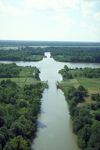
Bayou Lafourche, originally called Chetimachas River or La Fourche des Chetimaches, is a 106-mile-long (171 km) bayou in southeastern Louisiana, United States, that flows into the Gulf of Mexico. The bayou is flanked by Louisiana Highway 1 on the west and Louisiana Highway 308 on the east, and is known as "the longest Main Street in the world." It flows through parts of Ascension, Assumption, and Lafourche parishes. Today, approximately 300,000 Louisiana residents drink water drawn from the bayou.

The Tallahatchie River is a river in Mississippi which flows 230 miles (370 km) from Tippah County, through Tallahatchie County, to Leflore County, where it joins the Yalobusha River to form the Yazoo River, which ultimately meets the Mississippi River at Vicksburg, Mississippi. The river is navigable for about 100 miles (160 km). At Money, Mississippi, the river's flow measures approximately 7,861 cubic feet (222.6 m3) per second.

The Port of South Louisiana extends 54 miles (87 km) along the Mississippi River between New Orleans, Louisiana and Baton Rouge, Louisiana, centering approximately at LaPlace, Louisiana, which serves as the Port's headquarters location.

Assonet Bay is a lake in Assonet, a village within the town of Freetown, Massachusetts. The Assonet River connects the waters of the bay with the Taunton River.

The Atchafalaya Basin, or Atchafalaya Swamp, is the largest wetland and swamp in the United States. Located in south central Louisiana, it is a combination of wetlands and river delta area where the Atchafalaya River and the Gulf of Mexico converge. The river stretches from near Simmesport in the north through parts of eight parishes to the Morgan City southern area.

Louisiana Highway 1 (LA 1) is a state highway in Louisiana. At 431.88 miles (695.04 km), it is the longest numbered highway of any class in Louisiana. It runs diagonally across the state, connecting the oil and gas fields near the island of Grand Isle with the northwest corner of the state, north of Shreveport.
DeLisle is a census-designated place (CDP) in Harrison County, Mississippi, United States. It is part of the Gulfport–Biloxi Metropolitan Statistical Area. The population was 1,147 at the 2010 census.
Milburn is an unincorporated community in Carlisle County, Kentucky, United States. Its elevation is 482 feet (147 m), and it is located at 36°47′55″N88°53′59″W. Located along Kentucky Route 80 at its junction with Kentucky Routes 1371 and 1377, Milburn lies amid rolling countryside at the headwaters of Guess Creek, a tributary of Bayou du Chien; the nearest point on the Mississippi River is approximately 12 miles (19 km) to the west. Nearby cities include Arlington, 6 miles (9.7 km) by air to the west, and Bardwell, 8 miles (13 km) by air to the northwest; Milburn is connected to them by Kentucky Route 80 and Kentucky Route 1377 respectively. A state hunting preserve, the Obion Creek Wildlife Management Area, lies 2 miles (3.2 km) to the south. A fire station is located in Milburn, and a Creole cottage in the community, the George W. Stone House, is listed on the National Register of Historic Places.
Bayou Costapia is a stream in the U.S. state of Mississippi. It is a tributary to the Biloxi River.
Poticaw Bayou is a stream in the U.S. state of Mississippi. It is a tributary to the West Pascagoula River.
Bayou Talla is a stream in Hancock County, Mississippi, United States, that is a tributary of the Jourdan River.
Bayou Talla may refer to:
Tallabogue Creek is a stream in the U.S. state of Mississippi. It is a tributary to the Chickasawhay River.
Tallahaga Creek is a stream in the U.S. state of Mississippi.
30°25′16″N88°48′05″W / 30.42111°N 88.80139°W