The Garonne is a river of southwest France and northern Spain. It flows from the central Spanish Pyrenees to the Gironde estuary at the French port of Bordeaux – a length of 529 km (329 mi), of which 47 km (29 mi) is in Spain ; the total length extends to 602 km (374 mi) if one includes the Gironde estuary between the river and the sea. Its basin area is 56,000 km2 (22,000 sq mi), which increases to 84,811 km2 (32,746 sq mi) if the Dordogne River, which flows from the east and joins the Garonne at Bec d'Ambès to form the Gironde estuary, is included.

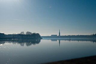
Toulouse is the prefecture of the French department of Haute-Garonne and of the larger region of Occitania. The city is on the banks of the River Garonne, 150 kilometres from the Mediterranean Sea, 230 km (143 mi) from the Atlantic Ocean and 680 km (420 mi) from Paris. It is the fourth-largest city in France after Paris, Marseille and Lyon, with 498,003 inhabitants within its municipal boundaries ; its metropolitan area has a population of 1,470,899 inhabitants. Toulouse is the central city of one of the 22 metropolitan councils of France. Between the 2014 and 2020 censuses, its metropolitan area was the third fastest growing among metropolitan areas larger than 500,000 inhabitants in France.

Aquitaine, archaic Guyenne or Guienne, is a historical region of southwestern France and a former administrative region of the country. Since 1 January 2016 it has been part of the region of Nouvelle-Aquitaine. It is situated in the southwest corner of Metropolitan France, along the Atlantic Ocean and the Pyrenees mountain range on the border with Spain, and for most of its written history Bordeaux has been a vital port and administrative center. It is composed of the five departments of Dordogne, Lot-et-Garonne, Pyrénées-Atlantiques, Landes and Gironde. Gallia Aquitania was established by the Romans in ancient times and in the Middle Ages, Aquitaine was a kingdom and a duchy, whose boundaries fluctuated considerably.

Gascony was a province of the southwestern Kingdom of France that succeeded the Duchy of Gascony (602–1453). From the 17th century until the French Revolution (1789–1799), it was part of the combined Province of Guyenne and Gascony. The region is vaguely defined, and the distinction between Guyenne and Gascony is unclear; by some they are seen to overlap, while others consider Gascony a part of Guyenne. Most definitions put Gascony east and south of Bordeaux.

Tarn-et-Garonne is a department in the Occitania region in Southern France. It is traversed by the rivers Tarn and Garonne, from which it takes its name. The area was originally part of the former provinces of Quercy and Languedoc. The department was created in 1808 under Napoleon, with territory taken from the neighbouring Lot, Haute-Garonne, Lot-et-Garonne, Gers and Aveyron departments.

The Canal du Midi is a 240 km (150 mi) long canal in Southern France. Originally named the Canal Royal en Languedoc and renamed by French revolutionaries to Canal du Midi in 1789, the canal is considered one of the greatest construction works of the 17th century.

Midi-Pyrénées is a former administrative region of France. Since 1 January 2016, it has been part of the new region of Occitania. It was the largest region of Metropolitan France by area, larger than the Netherlands or Denmark.

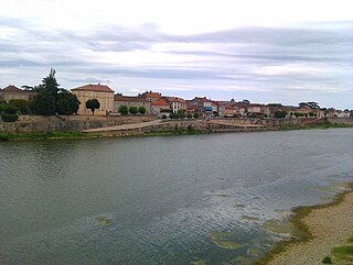
The commune of Agen is the prefecture of the Lot-et-Garonne department in Nouvelle-Aquitaine, southwestern France. It lies on the river Garonne 135 kilometres southeast of Bordeaux.

The Huron River is a 130-mile-long (210 km) river in southeastern Michigan, rising out of the Huron Swamp in Springfield Township in northern Oakland County and flowing into Lake Erie, as it forms the boundary between present-day Wayne and Monroe counties. Thirteen parks, game areas, and recreation areas are associated with the river, which passes through the cities of Dexter, Ann Arbor, Ypsilanti, Belleville, Flat Rock and Rockwood that were developed along its banks.

The Occitan cross is a heraldic cross, today chiefly used as a symbol of Occitania.

The Canal de Garonne, formerly known as Canal latéral à la Garonne, is a French canal dating from the mid-19th century that connects Toulouse to Castets-en-Dorthe. The remainder of the route to Bordeaux uses the river Garonne. It is the continuation of the Canal du Midi which connects the Mediterranean with Toulouse.

The Old Port of Marseille is at the end of the Canebière, the major street of Marseille. It has been the natural harbour of the city since antiquity and is now the main popular place in Marseille. It became mainly pedestrian in 2013.

The Indian Head River rises on the southern boundary of Hanover, Massachusetts and northern boundary line of Hanson, Massachusetts at the intersection of tributaries from Drinkwater River in Hanover and Indian Head Brook in Hanson. The river then flows east along the Hanover-Pembroke border. The river, 3.7 miles (6.0 km) long, is a tributary of the North River, which flows into Massachusetts Bay. The Indian Head River was an important fishing and water pathway for the Massachuset Indian village of Mattakeeset which was located around the Pembroke Ponds.

Baraigne is a commune in the Aude department in the Occitanie region of southern France.
Lamagistère is a commune in the Tarn-et-Garonne department in the Occitanie region in southern France. Inhabitants of the district are known as les Magistériens.

Grandselve Abbey was a Cistercian monastery in south-west France, at Bouillac, Tarn-et-Garonne. It was one of the most important Cistercian abbeys in the south of France.

The Ponts Jumeaux is the point at which the Canal du Midi joins the Canal de Garonne and the River Garonne, via the Canal de Brienne. It was built in 1774 by Joseph-Marie de Saget, a civil engineer in the province of Languedoc in Toulouse.

Harden Beck is a stream that flows from Hewenden Reservoir, over Goit Stock Waterfall to the River Aire in Bingley, West Yorkshire. The route starts out further up the valley as Denholme Beck, Hewenden Beck and Hallas Beck. Its waters are fed by Thornton Moor Reservoir, Stubden Reservoir, Doe Park Reservoir and Hewenden Reservoir.

The Society of Moulins du Bazacle, also known as Bazacle Company is a French watermill system founded in Toulouse in the 12th century by the citizens of the city to share the operation of a series of mills installed on the site of the Bazacle. The mills were used to process wheat harvested from the Toulouse Plain into flour.
Joseph Abeille was a French hydraulic and structural engineer. After 1730 he also worked as a municipal architect.

