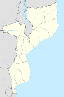
Inhambane is a province of Mozambique located on the coast in the southern part of the country. It has an area of 68,615 km2 and a population of 1,488,676. The provincial capital is also called Inhambane.
Protected areas in Mozambique are known as conservation areas, and are currently grouped into national parks, national reserves, forest reserves, wildlife utilisation areas (coutadas), community wildlife utilisation areas and private game farms. There are also a number of areas that have been declared as protected areas under a variety of different legislation, which for reasons of simplicity are here grouped together as "other protected areas." Under the Conservation Law of 2014, the protected areas will need to be reclassified into a much more flexible series of new categories which are closer to the international system used by the IUCN. International initiatives such as transfrontier parks are grouped at the end of the page.

The Bazaruto Archipelago is a group of six islands in Mozambique, near the mainland city of Vilankulo. It comprises the islands of Bazaruto, Benguerra, Magaruque, Banque, Santa Carolina and Shell. Nyati Island locates in further south.

Bazaruto is a sandy island located approximately 80 kilometres (50 mi) southeast of the mouth of the Save River, Mozambique. It is the largest island in the Bazaruto Archipelago and in the Bazaruto National Park.

Inhambane, also known as Terra de Boa Gente, is a city located in southern Mozambique, lying on Inhambane Bay, 470 km northeast of Maputo. It is the capital of the Inhambane Province and according to the 2017 census has a population of 79,724, growing from the 1997 census of 54,157. It is a beautiful charming town known for its serene atmosphere surrounded by beautiful seaside and the combination between modern local and rusting historic architecture, making it been popular among tourists.

Vilankulo is a coastal town in Mozambique, lying in the Vilanculos District of Inhambane Province. Vilankulo is named after local tribal chief Gamela Vilankulo Mukoke, and some of the "bairros" (suburbs) are named after his sons. Known as Vilanculos during colonial times, the name was changed to Vilankulo at independence. Today the district is called Vilanculos and the town Vilankulo.

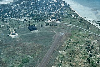
Indigo Bay Lodge Airport is an airport serving the former Indigo Bay Lodge on Bazaruto Island, Mozambique. The current facility is the Anantara Bazaruto Island Resort. The private facility has an airstrip and a helipad.

Federal Air is an airline headquartered in Hangar 14 on the grounds of OR Tambo International Airport in Kempton Park, Ekurhuleni, Gauteng, South Africa, near Johannesburg.

Inhassoro District is a district of Inhambane Province in south-east Mozambique. The district is located at the northeast of the province, and borders with Govuro District in the north, Vilanculos District in the southeast, Massinga District in the south, Funhalouro District in the southwest, and with Mabote District in the west. In the east, the district is bounded by the Indian Ocean. The area of the district is 4,480 square kilometres (1,730 sq mi). It has a population of 48,537 as of 2007.
Vilankulo District or Vilanculos District is a district of Inhambane Province in south-east Mozambique. Its principal town is Vilankulo. The district is located at the east of the province, and borders with Inhassoro District in the north and Massinga District in the south and in the west. In the east, the district is bounded by the Indian Ocean. The area of the district is 5,867 square kilometres (2,265 sq mi). It has a population of 135,710 as of 2007.
Benguerra Island in Mozambique is the second largest island in the Bazaruto Archipelago, which broke away from the mainland thousands of years ago. The island is approximately 55 square kilometers, and lies 14km offshore. Portuguese explorers also gave the island the name Santa Antonio. It is famous for its unspoiled white beaches, dive sites, luxury resorts, horseback riding and fishing.
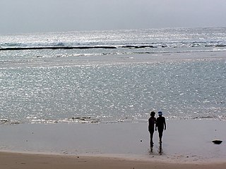
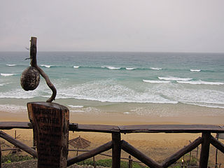
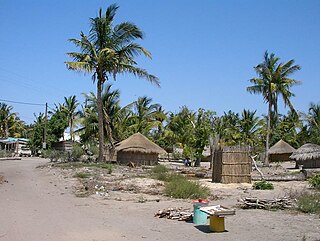
The tourism assets of Mozambique include the country's natural environment, wildlife, and cultural heritage, which provide opportunities for beach, cultural, and eco-tourism.
The Southern Zanzibar-Inhambane coastal forest mosaic, also known as the Southern Swahili coastal forests and woodlands, is a tropical moist broadleaf forest ecoregion of eastern Africa. It is a southern variation of Northern Zanzibar-Inhambane coastal forest mosaic. The ecoregion supports habitats of forest, savanna and swamps. The southern portion of the ecoregion is not as well studied due to the 1977-1992 civil war in Mozambique.
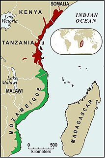
East African mangroves are an ecoregion consisting of mangrove swamps along the Indian Ocean coast of East Africa in southern Mozambique, Tanzania, Kenya and southern Somalia.
Santa Carolina is an island between the Mozambican mainland and Bazaruto Island in Mozambique. The closest town is called Inhassoro. It is just 2 by 0.3 miles in size. Santa Carolina is a true rock island with deep channels. Santa Carolina has three beaches with coral reefs close to the shore. The island, also known as Paradise Island is regarded as the ‘gem’ of the islands forming the Bazaruto Archipelago which is a proclaimed marine national park.

The Bazaruto Archipelago National Park (BANP) is a protected area in the Inhambane Province of Mozambique on the Bazaruto Archipelago. The park was proclaimed on 25 May 1971. It is off the coast of the Vilanculos and Inhassoro districts, covering a large expanse of ocean and six islands.
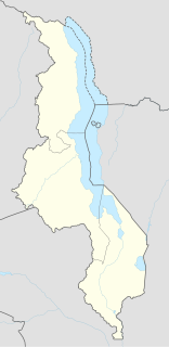
Likoma Airport is an airport on Likoma Island, Republic of Malawi. The island lies in Lake Malawi a few miles off the shore of Mozambique.
Lumbo Airport is an airport serving Lumbo, Mozambique and the island of Mozambique.
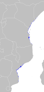
Delagoa is a marine ecoregion along the eastern coast of Africa. It extends along the coast of Mozambique and South Africa from the Bazaruto Archipelago to Lake St. Lucia in South Africa in South Africa's Kwazulu-Natal province. It adjoins the Bight of Sofala/Swamp Coast ecoregion to the north, and the Natal ecoregion to the south. It has Africa's southernmost tropical coral reefs and mangrove forests. It is the southernmost Indo-Pacific ecoregion, marking the transition from the tropical Indo-Pacific to Temperate Southern Africa.