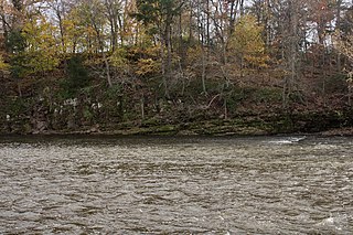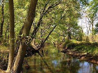
The Raritan River is a river of the U.S. state of New Jersey. Its watershed drains much of the central region of the state, emptying into the Raritan Bay near Staten Island on the Atlantic Ocean.

The Chenango River is a 90-mile-long (140 km) tributary of the Susquehanna River in central New York in the United States. It drains a dissected plateau area in upstate New York at the northern end of the Susquehanna watershed.

The Beaver Kill, sometimes written as the Beaverkill or Beaverkill River, is a tributary of the East Branch Delaware River, a main tributary of the Delaware River, approximately 44 miles (71 km) long, in the U.S. state of New York. The kill drains a 300-square-mile (780 km2) area of the Catskill Mountains and has long been celebrated as one of the most famous trout streams in the United States. Its preservation helped establish many of the basic conservation principles of rivers in the United States.

The East Branch Delaware River is one of two branches that form the Delaware River. It is approximately 75 mi (121 km) long, and flows through the U.S. state of New York. It winds through a mountainous area on the southwestern edge of Catskill Park in the Catskill Mountains for most of its course, before joining the West Branch along the northeast border of Pennsylvania with New York. Much of it is paralleled by State Route 30.

The West Branch Delaware River is one of two branches that form the Delaware River. It is approximately 90 mi (144 km) long, and flows through the U.S. states of New York and Pennsylvania. It winds through a mountainous area of New York in the western Catskill Mountains for most of its course, before joining the East Branch along the northeast border of Pennsylvania with New York. Midway or so it is empounded by the Cannonsville Dam to form the Cannonsville Reservoir, both part of the New York City water supply system for delivering drinking water to the City.
Raccoon Creek is a 22.6-mile-long (36.4 km) tributary of the Delaware River in Gloucester County, New Jersey.

Assunpink Creek is a 22.9-mile-long (36.9 km) tributary of the Delaware River in western New Jersey in the United States. The name Assunpink is from the Lenape Ahsën'pink, meaning "stony, watery place".

Wappinger Creek is a 41.7-mile-long (67.1 km) creek which runs from Thompson Pond to the Hudson River at New Hamburg in Dutchess County, New York, United States. It is the longest creek in Dutchess County, with the largest watershed in the county.

The Cooper River is a tributary of the Delaware River in southwestern New Jersey in the United States.

West Branch Sacandaga River is a river in Hamilton County in the state of New York. It begins northwest of Benson and flows west then northward then eastward before converging with the Sacandaga River south of Wells.
Cold Spring Creek is a river in Delaware County, New York. It originates from Clarks Pond and flows south before converging with the West Branch Delaware River in Stilesville.
East Branch Cold Spring Creek is a river in Delaware County, New York. It drains Beales Pond and converges with Cold Spring Creek north of Stilesville.
Merrick Pond is a small lake southwest of Rock Rift in Delaware County, New York. It drains east via Read Creek which flows into the East Branch Delaware River. Perkins Pond is located west and Trask Pond is located east of Merrick Pond.
Trask Pond is a small lake southwest of Rock Rift in Delaware County, New York. It drains south via an unnamed creek that flows into Read Creek, which flows into the East Branch Delaware River. Merrick Pond is located west and Rock Rift Mountain is located east of Trask Pond.
Perkins Pond is a small lake southwest of Rock Rift in Delaware County, New York. It drains southwest via an unnamed creek that flows into Cadosia Creek, which flows into the East Branch Delaware River. Merrick Pond is located east of Perkins Pond.
Clarks Pond is a small lake located south-southeast of the hamlet of Masonville in Delaware County, New York. Clarks Pond drains south via Cold Spring Creek which flows into the West Branch Delaware River.
Basket Pond is a small lake north-northwest of Rock Valley in Delaware County, New York. It drains south via an unnamed creek which flows into the North Branch Basket Creek.
Barbourville is a hamlet in Delaware County, New York, United States. It is located northeast of Stilesville on NY Route 8. The East Branch Cold Spring Creek flows south through the hamlet.
Upper Barbourville is a hamlet in Delaware County, New York, United States. It is located northeast of Stilesville on NY Route 8. The East Branch Cold Spring Creek flows south through the hamlet.


