Beaver in the Sierra Nevada

Last updated

A beaver lodge in McGee Creek, eastern Sierra Nevada, California. Mount Crocker.jpg
A beaver lodge in McGee Creek, eastern Sierra Nevada, California.

The North American beaver (Castor canadensis) had a historic range that overlapped the Sierra Nevada in California. Before the European colonization of the Americas, beaver were distributed from the arctic tundra to the deserts of northern Mexico. [1] The California Golden beaver subspecies (Castor canadensis subauratus) was prevalent in the Sacramento and San Joaquin River watersheds, including their tributaries in the Sierra Nevada. Recent evidence indicates that beaver were native to the High Sierra until their extirpation in the nineteenth century.

Contents

Historical range and distribution

A conifer felled by beaver on Meeks Creek, Lake Tahoe August, 2010 Beaver sign on Meeks Creek Aug 2010.jpg
A conifer felled by beaver on Meeks Creek, Lake Tahoe August, 2010

In 1916, Harold Bryant wrote in California Fish and Game, "The beaver of our mountain districts has been entirely exterminated and there are but a few hundred survivors to be found along the Sacramento, Colorado and San Joaquin Rivers." [2] Earlier, in 1906, Frank Stephens wrote in "California Mammals" that Castor canadensis' historic range was from the "Pacific slope from Alaska to central California east to and including the Sierra Nevada and Cascade Mountains" and adds "In most parts of California the presence of beavers is only made known by the stumps of the trees and saplings that they have cut." [3] McIntyre hypothesized that beaver were trapped out of the Sierra early in the nineteenth century by trappers before records could be kept. [4] Other early twentieth century naturalists (Grinnell, Tappe, etc.) questioned whether the California Golden beaver dwelt above 1,000 feet (300 m) of elevation in the Sierra. [5] [6] In 2012, physical evidence demonstrated that beaver were native to the Sierra until at least the mid-nineteenth century, via radiocarbon dating of buried beaver dam wood uncovered by deep channel incision in two locations in Red Clover Creek in the Feather River watershed. [7] That report was supported by a summary of indirect evidence of beaver including reliable observer accounts of beaver in multiple watersheds from the northern to the southern Sierra Nevada, including its eastern slope. [8]

Reintroduction to the Sierra

North American beaver on the bank of the Lower Kern River North American beaver on bank of the Kern River.jpg
North American beaver on the bank of the Lower Kern River

California Golden beaver taken from Snelling, California (elevation 256 ft or 78 m and Waterford, California (elevation 51 ft or 16 m) were stocked in 1940 at Mather Station (elevation 4,522 ft or 1,378 m) west of Yosemite National Park and in 1944 at Fish Camp (elevation 5,062 ft or 1,543 m) by the California Department of Fish and Game (CDFG). These native "Central Valley" beaver have been building dams and rearing young successfully for 70 years in and near Yosemite at elevations higher than 5,000 feet (1,500 m). [4] A second reference confirms that the CDFG re-introductions of beaver into Mariposa County in the Merced River watershed were all C. C. subauratus (Golden beaver) taken from near sea level elevations. [9] These lowland beaver adapted to the high Sierra without difficulty.

Castor canadensis were re-introduced to the Tahoe Basin by the CDFG and the U. S. Forest Service between 1934 and 1949 in order to prevent stream degradation and to promote wetland restoration. Descended from no more than nine individuals from the Snake River in Idaho, 1987 beaver populations on the upper and lower Truckee River had reached a density of 0.72 colonies (3.5 beavers) per kilometer. [10]

Ecology

A beaver dam on Meeks Creek, Lake Tahoe August, 2010 Beaver dam on Meeks Creek, Tahoe Aug 2010.jpg
A beaver dam on Meeks Creek, Lake Tahoe August, 2010

As of 2023, the California Department of Fish and Game recognizes the ecosystem services provided by beavers across the state. [11] In cases where beavers are harming human property, the DFG will first attempt to educate the human party, and only then issue a limited permit to kill the beaver. [11]

Beaver have been documented in the upper and lower Truckee River, Ward Creek, Cold Creek, Taylor Creek, Meeks Creek, Blackwood Creek, and King's Beach, so the descendants of the original nine beavers have apparently migrated around most of Lake Tahoe. [12] [13] [14] A 2007 study of Taylor Creek showed that the beaver dam removal decreased wetland habitat, increased stream flow, and increased total phosphorus pollutants entering Lake Tahoe - all factors which negatively impact the clarity of the lake's water. [15] In addition, beaver dams located in Ward Creek, located on the west shore of Lake Tahoe, were also shown to decrease nutrients and sediments traveling downstream. [15]

Effects on aspen, cottonwood and willow

In 1987, Beier reported that beaver had caused local extinction of Quaking aspen (Populus tremuloides) and Black cottonwood (Populus trichocarpa) on 4-5% of stream reaches on the lower Truckee River, however Willow (Salix spp.) showed good vigor despite heavy use in most reaches. He further speculated that without control of beaver populations that aspen and cottonwood could go extinct on the Truckee River. [16] However, not only have aspen and cottonwood survived ongoing beaver colonization but a recent study of ten Tahoe streams utilizing aerial multispectral videography has shown that deciduous, thick herbaceous, and thin herbaceous vegetation are more highly concentrated near beaver dams, whereas coniferous trees are decreased. [12]

Effects on salmonids

Until recently, beaver were considered pests who caused flooding and impaired the passage of spawning trout and salmon. However, it has been shown that trout and salmon move freely across beaver dams. [17] The presence of beaver dams has also been shown to either increase the number of fish, their size, or both, in a study of brook, rainbow and brown trout in Sagehen Creek, which flows into the Little Truckee River at an altitude of 5,800 feet (1,800 m). [18]

See also

Related Research Articles

<span class="mw-page-title-main">Lake Tahoe</span> Lake in California and Nevada, United States

Lake Tahoe is a freshwater lake in the Sierra Nevada of the Western United States, straddling the border between California and Nevada. Lying at 6,225 ft (1,897 m) above sea level, Lake Tahoe is the largest alpine lake in North America, and at 122,160,280 acre⋅ft (150.7 km3) it trails only the five Great Lakes as the largest by volume in the United States. Its depth is 1,645 ft (501 m), making it the second deepest in the United States after Crater Lake in Oregon.

<span class="mw-page-title-main">Truckee River</span> River in Nevada and California, United States

The Truckee River is a river in the U.S. states of California and Nevada. The river flows northeasterly and is 121 miles (195 km) long. The Truckee is the sole outlet of Lake Tahoe and drains part of the high Sierra Nevada, emptying into Pyramid Lake in the Great Basin. Its waters are an important source of irrigation along its valley and adjacent valleys.

<span class="mw-page-title-main">Carson River</span> River in Nevada, United States

The Carson River is a northwestern Nevada river that empties into the Carson Sink, an endorheic basin. The main stem of the river is 131 miles (211 km) long although the addition of the East Fork makes the total length 205 miles (330 km), traversing five counties: Alpine County in California and Douglas, Storey, Lyon, and Churchill Counties in Nevada, as well as the Consolidated Municipality of Carson City, Nevada. The river is named for Kit Carson, who guided John C. Frémont's expedition westward up the Carson Valley and across Carson Pass in winter, 1844. The river made the National Priorities List (NPL) on October 30, 1990 as the Carson River Mercury Superfund site (CRMS) due to investigations that showed trace amounts of mercury in the wildlife and watershed sediments.

<span class="mw-page-title-main">Coyote Creek (Santa Clara County)</span> Creek in California, United States

Coyote Creek is a river that flows through the Santa Clara Valley in Northern California. Its source is on Mount Sizer, in the mountains east of Morgan Hill. It eventually flows into Anderson Lake in Morgan Hill and then northwards through Coyote Valley to San Jose, where it empties into San Francisco Bay.

<span class="mw-page-title-main">Santa Ynez River</span> River in California, United States

The Santa Ynez River is one of the largest rivers on the Central Coast of California. It is 92 miles (148 km) long, flowing from east to west through the Santa Ynez Valley, reaching the Pacific Ocean at Surf, near Vandenberg Space Force Base and the city of Lompoc.

<span class="mw-page-title-main">Little Truckee River</span> River in [[Nevada County, California]] and [[Sierra County, California]], United States of America

The Little Truckee River is a 34.3-mile-long (55.2 km) river that is a tributary to its larger counterpart, the Truckee River, north of Lake Tahoe. It drains the eastern flank of the Sierra Nevada, flowing through Sierra County and Nevada County in eastern California.

<span class="mw-page-title-main">Lahontan cutthroat trout</span> Subspecies of fish

Lahontan cutthroat trout is the largest subspecies of cutthroat trout, and the state fish of Nevada. It is one of three subspecies of cutthroat trout that are listed as federally threatened.

<span class="mw-page-title-main">Sisquoc River</span> River in California, United States

The Sisquoc River is a westward flowing river in northeastern Santa Barbara County, California. It is a tributary of the Santa Maria River, which is formed when the Sisquoc River meets the Cuyama River at the Santa Barbara County and San Luis Obispo County border just north of Garey. The river is 57.4 miles (92.4 km) long and originates on the north slopes of Big Pine Mountain, at approximately 6,320 feet (1,930 m). Big Pine Mountain is part of the San Rafael Mountains, which are part of the Transverse Ranges.
<span class="mw-page-title-main">Los Gatos Creek (Santa Clara County)</span> River in California, United States

The Los Gatos Creek runs 24 miles (39 km) in California through Santa Clara Valley Water District's Guadalupe Watershed from the Santa Cruz Mountains northward through the Santa Clara Valley until its confluence with the Guadalupe River in downtown San Jose. The Guadalupe River then continues onward into San Francisco Bay.

<span class="mw-page-title-main">Pescadero Creek</span> River in California, United States

Pescadero Creek is a major stream in Santa Cruz and San Mateo counties in California, United States. At 26.6 miles (42.8 km), it is the longest stream in San Mateo County and flows all year from springs in the Santa Cruz Mountains. Its source is at 1,880 feet (570 m) above sea level on the western edge of Castle Rock State Park, with additional headwaters in Portola Redwoods State Park, and its course traverses Pescadero Creek County Park and San Mateo County Memorial Park before entering Pescadero Marsh Natural Preserve at Pescadero State Beach and thence to the Pacific Ocean 14.4 miles (23 km) south of Half Moon Bay.

<span class="mw-page-title-main">Martis Creek</span> River in California, United States

Martis Creek is a northward-flowing stream originating on Sawtooth Ridge, west of the peak of Mount Pluto in Placer County, California, United States. After crossing into Nevada County, California, it is a tributary to the Truckee River on the eastern side of Truckee.
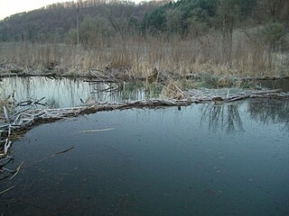
Red Clover Creek is a west-northwestward-flowing stream originating on Horton Ridge east of the Sierra Nevada crest in Plumas County, California, United States. It courses 27 miles (43 km) through Dotta Canyon and Red Clover Valley to its confluence with Last Chance Creek in Genesee Valley, just above its confluence with Indian Creek, which flows into the East Branch North Fork Feather River. The Red Clover Valley sits at an elevation of about 5,400 feet (1,600 m) and is located on the east side of the Sierra Nevada crest, approximately 60 miles (97 km) north of Truckee and 30 miles (48 km) east of Quincy.

<span class="mw-page-title-main">Griff Creek</span> River in California, United States

Griff Creek is a southward-flowing stream originating on Martis Peak in Placer County, California, United States. It culminates in north Lake Tahoe at Kings Beach, California.
<span class="mw-page-title-main">Trout Creek (Lake Tahoe)</span> River in California, United States

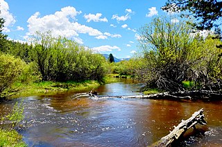
Trout Creek is a northward-flowing stream originating on the west side of Armstrong Pass on the Carson Range in El Dorado County, California, United States.

<span class="mw-page-title-main">Trout Creek (Truckee River tributary)</span> River in California, United States

Trout Creek is a small tributary of the Truckee River draining about 5.1 square miles (13 km2) along the eastern crest of the Sierra Nevada. It originates east of Donner Ridge and north of Donner Lake in the Tahoe–Donner Golf Course and flows through the town of Truckee, California, to its confluence with the Truckee River in Nevada County, California, just west of Highway 267.

Brown's Creek is a 9.7-mile-long (15.6 km) stream which originates about 5.5 miles northwest of the city of Stillwater and flows south for about half its length then east to its confluence with the St. Croix River just north of Stillwater in Washington County, Minnesota, United States. It is one of few creeks in the Minneapolis – Saint Paul "Twin Cities" metropolitan area that supports a fishable trout population.

<span class="mw-page-title-main">Taylor Creek (Lake Tahoe)</span> River in California, United States

Taylor Creek is a 2.2-mile-long (3.5 km) northward-flowing stream originating in the Fallen Leaf Lake and culminating at Baldwin Beach at Lake Tahoe, about 1 mile (1.6 km) west of Camp Richardson in El Dorado County, California.

<span class="mw-page-title-main">Blackwood Creek (California)</span> River in California, United States

Blackwood Creek, is a 8-mile-long (13 km) eastward-flowing stream originating on the southwest flank of Ellis Peak in the Sierra Nevada. The creek flows into Lake Tahoe 4.2 miles (6.8 km) south of Tahoe City, California, between the unincorporated communities of Idlewild and Tahoe Pines in Placer County, California, United States.

<span class="mw-page-title-main">Independence Lake (California)</span> Lake in the state of California, United States

Independence Lake is a natural glacial lake in the Sierra Nevada of California. At an elevation of 6,949 feet (2,118 m) in the upper reaches of the Truckee River basin, it has been less affected by development than most lakes in the area. The Nature Conservancy owns a 2,325 acres (9.41 km2) parcel of land around it, which it manages privately as the Independence Lake Preserve for the purposes of conservation and low-impact recreation.

<span class="mw-page-title-main">Environmental impacts of beavers</span>

The beaver is a keystone species, increasing biodiversity in its territory through creation of ponds and wetlands. As wetlands are formed and riparian habitats enlarged, aquatic plants colonize newly available watery habitat. Insect, invertebrate, fish, mammal, and bird diversities are also expanded. Effects of beaver recolonization on native and non-native species in streams where they have been historically absent, particularly dryland streams, is not well-researched.

References

  1. Naiman, Robert J.; Johnston, Carol A.; Kelley, James C. (December 1988). "Alteration of North American Streams by Beaver" (PDF). BioScience. 38 (11): 753–762. doi:10.2307/1310784. JSTOR   1310784. Archived from the original (PDF) on March 4, 2012. Retrieved February 28, 2010.
  2. Bryant, H.C. (1915). California's fur-bearing mammals. San Francisco, California: State of California, Resources Agency, Dept. of Fish and Game. p. 96. Retrieved March 17, 2010.
  3. Stephens, Frank (1906). California Mammals in West Coast Nature Series. San Diego, California: The West Coast Publishing Company. p.  97 . Retrieved June 19, 2010.
  4. 1 2 McIntyre, Robert N. (April 1948). "A New Park Resident" (PDF). Yosemite Nature Notes. Retrieved January 23, 2010.
  5. Grinnell, Joseph; Dixon, Joseph S.; Linsdale, Jean M. (1937). Fur-Bearing Mammals of California: Their Natural History, Systematic Status and Relations to Man. Berkeley, California: University of California Press. p. 636. ISBN   978-0-7812-5041-2.
  6. Tappe, Donald T. (1942). "The Status of Beavers in California" (PDF). Game Bulletin No. 3. California Department of Fish & Game. Archived from the original (PDF) on July 27, 2011. Retrieved April 11, 2010.
  7. James, C.D.; Lanman, R.B. (Spring 2012). "Novel physical evidence that beaver historically were native to the Sierra Nevada" (PDF). California Fish and Game. 98 (2): 129–132.
  8. Lanman, RB; Perryman, H; Dolman, B; James, CD (Spring 2012). "The historical range of beaver in the Sierra Nevada: a review of the evidence" (PDF). California Fish and Game. 98 (2): 65–80.
  9. Hensley, Arthur L. (1946). "A Progress Report on Beaver Management in California". California Fish and Game. 32 (2): 87–99. Retrieved March 26, 2010.
  10. Beier, Paul; Barrett, Reginald H (1989). "Beaver Distribution in the Truckee River Basin, California" (PDF). California Fish and Game. Archived from the original (PDF) on July 20, 2011. Retrieved January 17, 2010.
  11. 1 2 "Beaver Depredation Policy in California". California Department of Fish and Wildlife. June 5, 2023. Departmental Bulletin 2023-02.
  12. 1 2 Ayers, Michael Benson (October 1997). Aerial Multispectral Videography for Vegetation Mapping and Assessment of Beaver Distribution within Selected Riparian Areas of the Lake Tahoe Basin (Thesis). University of Nevada at Reno. p. 71. Retrieved August 26, 2010.
  13. "The Beavers of the Truckee River". Tahoe Arts and Mountain Culture. July 20, 2009. Archived from the original on June 9, 2011. Retrieved January 19, 2010.
  14. Van Lom, Keaven (January 16, 2010). "This is Wildlife Management in the 21st Century?". Moonshine Ink. Archived from the original on March 3, 2012. Retrieved January 17, 2010.
  15. 1 2 Muskopf, Sarah (October 2007). The Effect of Beaver (Castor canadensis) Dam Removal on Total Phosphorus Concentration in Taylor Creek and Wetland, South Lake Tahoe, California (PDF) (Thesis). Humboldt State University, Natural Resources. hdl:2148/264.
  16. Beier, Paul; Barrett, Reginald H. (October 1987). "Beaver Habitat Use and Impact in Truckee River Basin, California". Journal of Wildlife Management. 51 (4): 794–799. doi:10.2307/3801743. JSTOR   3801743.
  17. Pollock, Michael M.; Heim, Morgan; Werner, Danielle (2003). "Hydrologic and geomorphic effects of beaver dams and their influence on fishes" (PDF). American Fisheries Society Symposium. 37: 213–233. Archived from the original (PDF) on July 7, 2011. Retrieved January 17, 2010.
  18. Gard, R (1961). "Effects of beaver on trout in Sagehen Creek, California". Journal of Wildlife Management. 25 (3): 221–242. doi:10.2307/3797848. JSTOR   3797848.