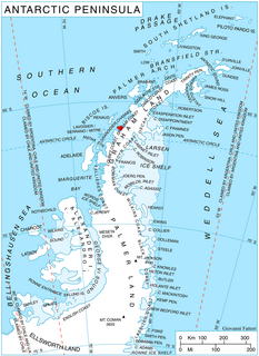
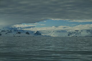
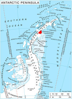
Martin Glacier is a glacier, 3 nautical miles (6 km) wide and 9 nautical miles (17 km) long, which flows west and then northwest from the south side of Mount Lupa to the southeast corner of Rymill Bay where it joins Bertrand Ice Piedmont, on the west coast of Graham Land, Antarctica. It was first surveyed in 1936 by the British Graham Land Expedition (BGLE) under John Riddoch Rymill, and was resurveyed in 1948–1949 by the Falkland Islands Dependencies Survey. The glacier was named for James H. Martin, a member of the British Australian and New Zealand Antarctic Research Expedition (1929–1931) under Sir Douglas Mawson, and first mate of the Penola during the BGLE.

Prospect Point is a headland at the west extremity of Velingrad Peninsula on Graham Coast in Graham Land, nearly 2 nautical miles (3.7 km) south of Ferin Head and immediately east of the Fish Islands. Roughly charted by the British Graham Land Expedition (BGLE) under Rymill, 1934-37. Photographed by Hunting Aerosurveys Ltd. in 1956-57. The name was suggested in 1957 by E. P. Arrowsmith, Governor of the Falkland Islands.
Woolpack Island is a narrow island 1.5 nautical miles (2.8 km) long, lying 4 nautical miles (7 km) northeast of Vieugue Island at the west side of Grandidier Channel, off the west coast of Graham Land. Discovered and named by the British Graham Land Expedition (BGLE), 1934–37, under Rymill.

Anderton Glacier is a tributary glacier, 7 nautical miles (13 km) long, descending the south slopes of the Eisenhower Range to enter Reeves Glacier between Mount Matz and Andersson Ridge, in Victoria Land, Antarctica. The glacier is situated on the Pennell Coast, a portion of Antarctica lying between Cape Williams and Cape Adare. It was mapped by the United States Geological Survey from surveys and from U.S. Navy air photos, 1955–63, and was named by the Advisory Committee on Antarctic Names for Peter W. Anderton, a glaciologist at McMurdo Station, summer 1965–66.

Balch Glacier is a glacier 9 nautical miles (17 km) long, on the east coast of Graham Land, flowing southeast into Mill Inlet, to the south of Gould Glacier. It was first surveyed by the Falkland Islands Dependencies Survey in 1946–47, and named "East Balch Glacier". With "West Balch Glacier" it was reported to fill a transverse depression across Graham Land, but further survey in 1957 showed that there is no close topographical alignment between the two. The name "Balch", for Edwin S. Balch, an American Antarctic historian, has been limited to this glacier and an entirely new name, Drummond Glacier, approved for the west glacier.

Beascochea Bay is a bay, 10 nautical miles (19 km) long and 5 nautical miles (9 km) wide, indenting the Graham Coast of Graham Land, Antarctica, between Kiev Peninsula and Barison Peninsula, and entered south of Cape Perez. The glaciers Lever, Funk, Cadman, Talev and Butamya feed the bay.
Clements Island is an island 1 nautical mile (2 km) long lying immediately south of Rabot Island in the Biscoe Islands. The French Antarctic Expedition, 1903–05, under Jean-Baptiste Charcot, gave the name Ile Clements Markham for Sir Clements Markham, President of the Royal Geographical Society, 1893–1905. Charcot applied this name to an incompletely defined island northeast of Renaud Island, in what is now the Pitt Islands. The recommended application, however, is based upon the map of the British Graham Land Expedition, 1934–37, which provided a more reliable chart of the area. The first part of the name, rather than the last, has been retained to distinguish this feature from Markham Island in Terra Nova Bay, Victoria Land.
Cliff Island is a narrow cliffed island at the south side of Mutton Cove, lying immediately south of Upper Island and 8 nautical miles (15 km) west of Prospect Point, off the west coast of Graham Land, Antarctica. It was charted and named by the British Graham Land Expedition under John Rymill, 1934–37.

Mutton Cove is an anchorage 0.5 nautical miles (0.9 km) northeast of the south end of Beer Island in the Biscoe Islands. The cove is formed by four small islands, Harp, Upper, Cliff and Girdler Islands. Beer Island shelters the cove from the west. Charted in 1936 by the British Graham Land Expedition (BGLE) under Rymill and, at the suggestion of Lieutenant R.G.D. Ryder, Royal Navy, captain of the days in a training ship at Devonport.

Stubb Glacier is a glacier 11 nautical miles (20 km) long in Aristotle Mountains on the east coast of Graham Land, flowing east into Scar Inlet between Mount Queequeg and Tashtego Point. The lower reaches of this glacier were surveyed and photographed by the Falkland Islands Dependencies Survey (FIDS) in 1947, and the upper reaches were surveyed in 1955. Named by the United Kingdom Antarctic Place-Names Committee (UK-APC) in 1956 after the second mate on the Pequod in Herman Melville's Moby Dick.
Trigonia Island is a small island immediately off the south tip of Beer Island, lying 8 nautical miles (15 km) west of Prospect Point, off the west coast of Graham Land, Antarctica. It was charted and named by the British Graham Land Expedition (BGLE), 1934–37, under Rymill.
Mount Poster is a mountain lying west of the Latady Mountains and 9 nautical miles (17 km) northwest of Mount Tenney, in Palmer Land. Mapped by United States Geological Survey (USGS) from surveys and U.S. Navy air photos, 1961-67. Named by Advisory Committee on Antarctic Names (US-ACAN) for Carl K. Poster, geophysicist with the United States Antarctic Research Program (USARP) South Pole—Queen Maud Land Traverse III, summer 1967-68.
Phantom Point is a point within Darbel Bay, lying 1.5 nautical miles (2.8 km) west of Shanty Point on the west coast of Graham Land. Photographed by Hunting Aerosurveys Ltd. in 1955-57, and mapped from these photos by the Falkland Islands Dependencies Survey (FIDS). The name arose because the position of the point was only vaguely known when first visited by an FIDS sledge party in 1957, and it was obscured by thick fog from which it finally loomed like a phantom.
Finback Massif is a massif in Antarctica, rising to more than 1,000 metres (3,300 ft) between Stubb Glacier and Flask Glacier. It stands 6 nautical miles (11 km) west-northwest of Tashtego Point on the east side of Graham Land. The name is one of several applied by the UK Antarctic Place-Names Committee in this vicinity that reflects a whaling theme, the finback being a species of baleen whale.
Gibbs Glacier is a glacier, 15 nautical miles (28 km) long, flowing southeast into the northern part of Mercator Ice Piedmont on the east side of the Antarctic Peninsula. This feature together with Neny Glacier, which flows northwest, occupy a transverse depression between Mercator Ice Piedmont and Neny Fjord on the west side of the Antarctic Peninsula. Gibbs Glacier was photographed from the air and first mapped by the United States Antarctic Service, 1939–41, and the Ronne Antarctic Research Expedition, 1947–48. It was named by the UK Antarctic Place-Names Committee for Peter M. Gibbs of the Falkland Islands Dependencies Survey, a surveyor at Horseshoe Island, 1957, and leader at Stonington Island, 1958, who was responsible for the first ground survey of the glacier.
McClary Glacier is a glacier 10 nautical miles (19 km) long and 2 nautical miles (4 km) wide on the west coast of Graham Land, Antarctica. It flows southwest along the north side of Butson Ridge into Marguerite Bay between Cape Calmette and the Debenham Islands. The glacier was first roughly surveyed by the British Graham Land Expedition, 1936–37, and resurveyed by the Falkland Islands Dependencies Survey, 1946–50. It was named by the UK Antarctic Place-Names Committee for George B. McClary, father of Nelson McClary, mate on the Port of Beaumont during the Ronne Antarctic Research Expedition, 1947–48.
Marker Rock is a rock lying 1.5 nautical miles (3 km) north-northwest of Turnabout Island in the Saffery Islands, off the west coast of Graham Land, Antarctica. It was charted by the British Graham Land Expedition under John Rymill, 1934–37, and was so named by the UK Antarctic Place-Names Committee in 1959 because it marks the ships' passage through the Saffery Islands.
Holmes Island is an island 1.5 nautical miles (3 km) long, lying south of Vieugue Island in the Biscoe Islands of Antarctica. It was charted by the British Graham Land Expedition under John Rymill, 1934–37, and was named by the UK Antarctic Place-Names Committee for Bryan Holmes, a Falkland Islands Dependencies Survey surveyor at Prospect Point in 1957, who was attached to the British Naval Hydrographic Survey Unit in this area, 1957–58.

Holtedahl Bay is a bay, 10 nautical miles (19 km) long in a northwest–southeast direction and averaging 6 nautical miles (11 km) wide, between Velingrad Peninsula and Stresher Peninsula along the west coast of Graham Land, Antarctica. The bay is entered southwest of Prospect Point and northeast of Black Head, and has its head fed by Hugi Glacier.


