Beeston Town Hall

Last updated

Beeston Town Hall
Beeston Town Hall (geograph 5122735).jpg
Beeston Town Hall
LocationFoster Avenue, Beeston
Coordinates 52°55′38″N1°13′07″W / 52.9271°N 1.2186°W / 52.9271; -1.2186 Coordinates: 52°55′38″N1°13′07″W / 52.9271°N 1.2186°W / 52.9271; -1.2186
Built1938
Architect Evans, Clark and Woollatt
Architectural style(s) Neo-Georgian style
Nottinghamshire UK location map.svg
Red pog.svg
Shown in Nottinghamshire

Beeston Town Hall is a municipal building in Foster Avenue in Beeston, Nottinghamshire, England. The building was formerly the offices of Beeston and Stapleford Urban District Council and is now used by the Redeemer Church.

History

The council offices on Church Street erected in 1897 The Square, Beeston, Nottinghamshire.jpg
The council offices on Church Street erected in 1897

Following significant population growth, largely associated with the lace and hosiery industries, the area became an urban district in 1894. [1] The early meetings of the new council were held at the Board Schools until the council commissioned its own offices at a site on Church Street in 1897. [2] In the mid-1930s, the council decided that the old council offices were inadequate: the site they selected for the new town hall was open land on the west side of Foster Avenue. [3] The old council officers were demolished during a wave of the redevelopment in the late 1960s and early 1970s. [4]

The new town hall was designed by Evans, Clark and Woollatt in the Neo-Georgian style, built by Hofton and Son in red brick with stone dressings at a cost of £18,500 and was officially opened on 24 March 1938. [5] The design involved a symmetrical main frontage with seven bays facing onto Foster Avenue; the central bay featured a double-panelled doorway flanked by brick pilasters and brackets supporting a stone balcony with an ogive-shaped window on the first floor. The middle bays in the outer sections featured sash windows on the ground floor and terracotta carvings of beehives, a play on the name of the town, on the first floor, while the other bays in the outer sections were fenestrated by sash windows. At roof level, there was a frieze and a cornice, broken by a central pediment. Internally, the principal room was the council chamber. [6]

The town hall continued to serve as the meeting place of Beeston Urban District Council until 1935, of the enlarged Beeston and Stapleford Urban District from 1935 to 1974 [7] and of the further enlarged Broxtowe Borough Council from 1974. [8] In 1980, the town hall was the venue for the public inquiry into the proposed demolition of the Bennerley Viaduct which was ultimately saved. [9]

The council established new council offices on the opposite side of Foster Avenue and moved its headquarters there in the early 1990s. [10] In 2005, the first annual Beeston Carnival took place: the focal point of the event was the parade, led by Beeston Pipe Band, from the town hall to Broadgate Park. [11] [12] The council decided that the town hall was surplus to requirements in 2018 and, despite opposition from local community groups, sold the building to the Redeemer Church for £425,000 in January 2020. [13] [14]

Related Research Articles

<span class="mw-page-title-main">Beeston, Nottinghamshire</span> Town in Nottinghamshire, England

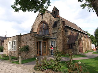
Beeston is a town in the Borough of Broxtowe, Nottinghamshire, England, 3.4 miles (5.5 km) south-west of Nottingham city centre. To its north-east is the University of Nottingham's main campus, University Park. The pharmaceutical and retail chemist group Boots has its headquarters 0.6 miles (1 km) east of the centre of Beeston, on the border with Broxtowe and the City of Nottingham. To the south lie the River Trent and the village of Attenborough, with extensive wetlands.

<span class="mw-page-title-main">Borough of Broxtowe</span> Borough in England

Broxtowe is a local government district with borough status in Nottinghamshire, England, west of the City of Nottingham. The population of the district as taken at the 2011 Census was 109,487. It is part of the Nottingham Urban Area. Broxtowe's neighbour to the west is the borough of Erewash, which is in Derbyshire.

<span class="mw-page-title-main">West Bridgford</span> Town in Rushcliffe, Nottinghamshire, England

West Bridgford is a town and the administrative centre of the Borough of Rushcliffe in the county of Nottinghamshire, England. It lies immediately south of the city of Nottingham, from which the River Trent divides it. Forming part of the Nottingham Urban Area, West Bridgford is a commuter town for the city. The population was estimated at 48,225 in 2018. The town is part of the constituency of Rushcliffe, which is held by Ruth Edwards of the Conservative Party.

<span class="mw-page-title-main">Chilwell</span> Village in Broxtowe, Nottinghamshire, England

Chilwell is a village and residential suburb of Nottingham, in the borough of Broxtowe of Nottinghamshire, west of Nottingham city. Until 1974 it was part of Beeston and Stapleford Urban District, having been in Stapleford Rural District until 1935.

<span class="mw-page-title-main">Rushcliffe (UK Parliament constituency)</span> Parliamentary constituency in the United Kingdom, 1885 onwards

Rushcliffe is a constituency in Nottinghamshire represented in the House of Commons of the UK Parliament from 2019 by Ruth Edwards, a Conservative.

<span class="mw-page-title-main">Broxtowe (UK Parliament constituency)</span> Parliamentary constituency in the United Kingdom, 1983 onwards

Broxtowe is a parliamentary constituency in Nottinghamshire, England, represented in the House of Commons of the UK Parliament since 2019 by Darren Henry, a Conservative.

<span class="mw-page-title-main">Stapleford, Nottinghamshire</span> Human settlement in England

Stapleford is a town and civil parish in the Borough of Broxtowe in Nottinghamshire, England, 5.6 miles (9.0 km) west of Nottingham. The population at the 2011 census was 15,241.

<span class="mw-page-title-main">Attenborough, Nottinghamshire</span> Village in Nottinghamshire, England

Attenborough is a village in the Borough of Broxtowe in Nottinghamshire, England. It forms part of the Greater Nottingham area, and is 4+12 miles (7.2 km) to the southwest of the city of Nottingham, between Long Eaton and Beeston. It adjoins the suburbs of Toton to the west and Chilwell to the north. The population of the ward, as at the 2011 Census, was 2,328.

Bramcote is a suburban village in the Broxtowe district of Nottinghamshire, England, between Stapleford and Beeston. It is in Broxtowe parliamentary constituency. The main Nottingham–Derby road today is the A52, Brian Clough Way. Nearby are Beeston, Wollaton, Chilwell and Stapleford. One of the main roads between Nottingham and Derby used to pass through the village centre, entering a cutting that formed a blind bend. A country house to the north of the village became publicly owned and was demolished in 1968. Its grounds became a public area of park and hillside, now known as Bramcote Hills Park.

<span class="mw-page-title-main">Beeston and Stapleford Urban District</span> Urban district in Nottinghamshire, England

Beeston and Stapleford was an urban district in Nottinghamshire, England, from 1935 to 1974.

Broxtowe Borough Council elections are held every four years. Broxtowe Borough Council is the local authority for the non-metropolitan district of Borough of Broxtowe in Nottinghamshire, England. Since the last boundary changes in 2015, 44 councillors are elected from 20 wards.

<span class="mw-page-title-main">Diocese of Southwell and Nottingham</span> Diocese of the Church of England

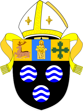
The Diocese of Southwell and Nottingham is a Church of England diocese in the Province of York, headed by the Bishop of Southwell and Nottingham. It covers all the English county of Nottinghamshire and a few parishes in South Yorkshire. It is bordered by the dioceses of Derby, Leicester, Lincoln and Sheffield. The cathedral, Southwell Minster, is in the town of Southwell, 15 miles north of Nottingham.

Beeston was an urban district in Nottinghamshire, England, from 1894 to 1935.

William Herbert Higginbottom JP was an architect based in Nottingham.

<span class="mw-page-title-main">George Francis Grimwood</span> English engineer and architect

George Francis Grimwood LRIBA was an 20th century engineer and architect based in Nottingham.

<span class="mw-page-title-main">John Frederick Dodd</span> English architect

John Frederick Dodd LRIBA was an architect based in Long Eaton, Derbyshire.

<span class="mw-page-title-main">Alexander Wilson (British architect)</span>

Alexander Wilson LRIBA was an architect based in Nottingham. Some of his most significant work include the 900 houses built on the Beeston Rylands estate in the late 1930s.

Douglas Leonard Booth was an architect, surveyor and civil engineer based in Beeston, Nottinghamshire.

<span class="mw-page-title-main">Warsop Town Hall</span> Municipal building in Warsop, Nottinghamshire, England

Warsop Town Hall is a municipal building in Church Street in Warsop, Nottinghamshire, England. The building is home to Warsop Parish Council, and was formerly the offices of Warsop Urban District Council and the local offices of Nottinghamshire County Council.

References

  1. "Beeston UD". Vision of Britain. Retrieved 20 March 2022.
  2. "The High Road in Beeston - The Square". Exploring Beeston's History. Retrieved 20 March 2022.
  3. "Ordnance Survey Map". 1900. Retrieved 20 March 2022.
  4. Earp, Frank E.; Earp, Joseph (2017). Secret Beeston. Amberley Publishing. ISBN   978-1445664897.
  5. "Beeston's New Town Hall". Beeston Gazette and Echo. England. 25 March 1838. Retrieved 5 July 2020.
  6. "Safer NeighbourhoodCommittee Meeting - The Beeston cluster - West/ Town Centre/ Rylands/ Central and North". Nottinghamshire Police. 27 October 2014. Retrieved 20 March 2022.
  7. "No. 46019". The London Gazette . 29 June 1973. p. 7679.
  8. "No. 47115". The London Gazette . 7 January 1977. p. 231.
  9. "Sir Neil Cossons OBE accepts invitation to be Friends of Bennerley Viaduct Patron". Friends of Bennerley Viaduct. 25 February 2020. Retrieved 20 March 2022.
  10. "No. 53387". The London Gazette . 30 July 1993. p. 12809.
  11. "Beeston all set for this year's carnival". Nottingham Local News. 13 June 2019. Retrieved 20 March 2022.
  12. "Carnival atmosphere in Town". Nottingham Post. 15 July 2019. Retrieved 20 March 2022.
  13. "New café and nursery revealed for Beeston Town Hall as part of plans by church". Nottingham Post. 17 May 2019. Retrieved 20 March 2022.
  14. "Town Hall Project". Redeemer Church. Retrieved 20 March 2022.