
Beinn Ìme is the highest mountain in the Arrochar Alps, in the Southern Highlands of Scotland. There are three usual routes of ascent. From Succoth, one may follow the same path that is used to reach The Cobbler before taking the right fork near the base of the Cobbler's main crags and continuing up the glen, across the bealach and up Ben Ìme's eastern ridge. Alternatively, the summit can be reached from the pass of Rest and be Thankful and from the Loch Lomond side, using the private road that leads to Loch Sloy. Beinn Ìme separates the Dunbartonshire landscape of Loch Lomond in the East and the Argyll Highlands of Loch Fyne and Loch Goil anywhere north, west, south west. Beinn Ìme is the landmark to the entrance to Argyll.
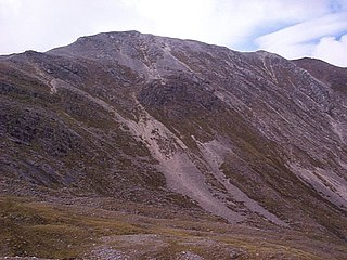
Beinn Liath Mhòr is a Scottish mountain situated in the mountainous area between Strath Carron and Glen Torridon in Wester Ross in the Highland region. Geologically Beinn Liath Mhòr is made up of Cambrian quartzite scree and Torridonian sandstones giving the mountain a distinctive colour contrast of light and dark. The mountain's other main characteristic is its two kilometre long undulating summit ridge which does not drop below 800 metres for its entire length. This culminates at the summit at its far western end at a height of 926 metres (3038 feet) making Beinn Liath Mhòr the 258th highest Munro.

Sgorr Ruadh is a mountain situated in the mountainous area between Strath Carron and Glen Torridon in Wester Ross in the Highland Region of Scotland. It is located in Coire Lair near Achnashellach along with two other fine mountains, Beinn Liath Mhòr and Fuar Tholl, and is often climbed in conjunction with one or both of these other mountains.

Maol Cheann-dearg is a Scottish Mountain situated between Upper Loch Torridon and Loch Carron, in the Coulags deer forest in Wester Ross, Highland region. It is one of three Munros in this area and reaches a height of 933 metres (3,060 feet), it is slightly isolated from the other two being separated by a low col of 420 metres and therefore tends to be ascended separately. The mountain is typical of the region in that geologically it is made up of a mixture of sandstone and quartzite, it has a steep flanks and is rock-strewn. The dome shaped summit is littered with red sandstone boulders and lacking in vegetation making its translated name of “Bald Red Head” especially appropriate. The mountain is not to be confused with Maol Chinn-dearg, another Munro on the south Glen Shiel ridge.

Ben Bhuidhe is a Scottish mountain at the head of Loch Fyne, Argyll and Bute.
Beinn Resipol is a mountain of the Northwest Highlands, Scotland, in the Ardnamurchan area of Lochaber.

Beinn Udlaidh is a mountain in the Grampian Mountains, Scotland. It is located near the village of Tyndrum in Argyll and Bute.
Beinn Trilleachean is a mountain in the Grampian Mountains, north of the village of Taynuilt at the head of Loch Etive. It lies on the border of Highland and Argyll and Bute.

Beinn Lair is a mountain in the Northwest Highlands, Scotland. It lies in the Letterewe estate on the northeastern shore of Loch Maree in Wester Ross.

Beinn a' Chlachair is a mountain in the Grampian Mountains of Scotland. It lies south of Loch Laggan, near the remote hamlet of Kinloch Laggan.

Beinn nan Aighenan is a 960-metre (3,150 ft) high mountain in the Grampian Mountains of Scotland. It lies in Argyll and Bute, north of the village of Taynuilt.
Beinn Eunaich is a mountain in the Grampian Mountains of Scotland, located north of the village of Dalmally in Argyll and Bute.
Ruadh-stac Beag is a mountain in the Northwest Highlands of Scotland. An outlier of the Munro Beinn Eighe but a mountain in its own right, it is located in the Torridon Hills of Wester Ross.

Beinn Bhreac is a mountain in Argyll and Bute, Scotland. It is part of the Luss Hills, a southern subrange of the Grampian Mountains.

Beinn na Gucaig is a mountain in the Grampian Mountains of Scotland, located south of Fort William in Lochaber.

Creach-Beinn is a mountain in the south of the Isle of Mull, Scotland. It rises above the northern shore of Loch Spelve.

Beinn a' Chochuill is a mountain in the Grampian Mountains of Scotland, located east of Loch Etive in Argyll and Bute.

Beinn Bheoil is a mountain in the Grampian Mountains of Scotland, located on the western shore of Loch Ericht in Highland.
Beinn a' Mhanaich is a hill in the southern Grampian Mountains of Scotland. It is located in Argyll and Bute, in the southern Luss Hills north of the town of Helensburgh.
Beinn a' Choin is a mountain in the Grampian Mountains of Scotland. It lies on the border of the Stirling region and Argyll at the northern end of Loch Lomond.
