Benbecula is an island of the Outer Hebrides in the Atlantic Ocean off the west coast of Scotland. In the 2011 census, it had a resident population of 1,283 with a sizable percentage of Roman Catholics. It is in a zone administered by Comhairle nan Eilean Siar or the Western Isles Council.

Eriskay, from the Old Norse for "Eric's Isle", is an island and community council area of the Outer Hebrides in northern Scotland with a population of 143, as of the 2011 census. It lies between South Uist and Barra and is connected to South Uist by a causeway which was opened in 2001. In the same year Ceann a' Ghàraidh in Eriskay became the ferry terminal for travelling between South Uist and Barra. The Caledonian MacBrayne vehicular ferry travels between Eriskay and Ardmore in Barra. The crossing takes around 40 minutes.

Uist, or The Uists, are a group of six islands and are part of the Outer Hebridean Archipelago, part of the Outer Hebrides of Scotland.

Beinn Dearg is the fourth highest of the Torridon Hills in the highlands of Scotland. Beinn Dearg offers all the typical features of a Torridon hill, with steeply terraced rocky sides dissected by near vertical gullies. The summit ridge is an airy crest that offers some easy scrambling; alternatively this can be avoided by following a path that traverses the terraces on the southern side.

Ben Macdui is the second highest mountain in Scotland after Ben Nevis, and the highest in the Cairngorms National Park. The summit elevation is 1,309 meters AMSL. Ben Macdui lies on the southern edge of the Cairn Gorm plateau, on the boundary between the historic counties of Aberdeenshire and Banffshire.

Ronay is an island in the Outer Hebrides of Scotland, which lies a short distance off the east coast of Grimsay.

Beinn Ruigh Choinnich is a hill which overlooks the port of Lochboisdale on the east coast of the island of South Uist in the Outer Hebrides Scotland. Its name is sometimes given in English as Ben Kenneth, although a literal translation would be 'the hill of Kenneth's slope'. The origin of the name is unknown. The hill is 275 m in height and can be climbed quite easily.
The Northwest Highlands are located in the northern third of Scotland that is separated from the Grampian Mountains by the Great Glen. The region comprises Wester Ross, Assynt, Sutherland and part of Caithness. The Caledonian Canal, which extends from Loch Linnhe in the south-west, via Loch Ness to the Moray Firth in the north-east splits this area from the rest of the country. The city of Inverness and the town of Fort William serve as gateways to the region from the south.
Ceann a' Ghàraidh is the location of the ferry terminal on the south-western side of the island of Eriskay in the Outer Hebrides of Scotland. It provides a service across the Sound of Barra to Ardmore on the island of Barra The placename literally means "The head of the garden". This location is so called due to the presence of the old crofting boundary walls, which can no longer be seen.

Beinn Fhada or Ben Attow is a mountain in the Scottish Highlands.

Gighay an uninhabited island off the northeast coast of Barra. It is one of ten islands in the Sound of Barra, a Site of Community Importance for conservation in the Outer Hebrides of Scotland.

Fuday is an uninhabited island of about 232 hectares and is one of ten islands in the Sound of Barra, a Site of Community Importance for conservation in the Outer Hebrides of Scotland. It lies just east of Scurrival Point on Barra and west of Eriskay. Fuday is owned by the Scottish Government. Deserted since 1901, its peak population is recorded only as seven.

Calvay, is a currently uninhabited island situated in the Sound of Eriskay in the Outer Hebrides, at grid reference NF810126. It is one of ten islands in the Sound of Barra, a Site of Community Importance for conservation.

Wiay is an uninhabited island in the Outer Hebrides.

Hellisay is a currently uninhabited island It is one of ten islands in the Sound of Barra, a Site of Community Importance for conservation in the southern Outer Hebrides of Scotland. The narrow Sound of Gighay lies between Hellisay and its neighbouring island.

Beinn a' Bhùird is a Munro in the Cairngorm mountain range of Scotland.

Lingay is an uninhabited island in Scotland, one of ten islands in the Sound of Barra, a Site of Community Importance for conservation in the Western Isles. It lies between South Uist, Eriskay, Fuday and Fiaraidh, once anglicized as Fiaray. Its maximum height is 51 metres.

Ben Bhuidhe is a Scottish mountain at the head of Loch Fyne, Argyll and Bute.

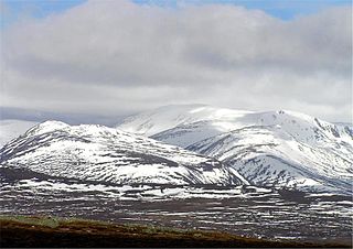
Beinn Bhreac is a twin-peaked Scottish mountain located above Glen Derry in the Cairngorm Mountains approximately 11 kilometres (7 mi) north-west of Braemar.

The Sound of Barra is a large ocean inlet or sound situated to the north of the isle of Barra and to the south of South Uist in the Outer Hebrides in Scotland. Since 2014 it has been designated as a Special Area of Conservation (SAC). The Sound of Barra is composed of 98.91% marine and inlet areas, 1.07% mudflats and other semi-submerged areas and 0.02% sea cliffs and islets. There are ten islands in the sound, with only Eriskay still being inhabited:


