Derwent derives from the Brythonic term Derventio, meaning "valley thick with oaks". It may refer to:

The Derwent is a river in Derbyshire, England. It is 66 miles (106 km) long and is a tributary of the River Trent, which it joins south of Derby. Throughout its course, the river mostly flows through the Peak District and its foothills.

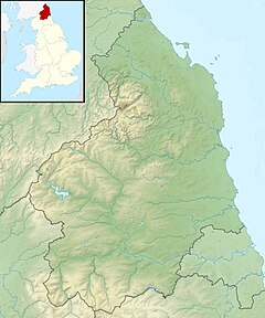
The River Derwent is a river which flows between the boundaries of County Durham and Northumberland in the north east of England. It broadens into the Derwent Reservoir, west of Consett. The Derwent is a tributary of the River Tyne, which it joins near the MetroCentre near Gateshead. The river flows for 35 miles from its origin, where two streams, Beldon Burn and Nookton Burn meet approximately a mile west of Blanchland, to Derwenthaugh where it flows into the River Tyne. On its journey, the river flows through places such as Allensford, Shotley Bridge, Blackhall Mill and Rowlands Gill. The Derwent Walk Country Park at Rowlands Gill is named after the river.

The Derwent is a river in the county of Cumbria in the north of England; it rises in the Lake District and flows northwards through two of its principal lakes, before turning sharply westward to enter the Irish Sea at Workington The name Derwent is shared with three other English rivers and is thought to be derived from a Celtic word for "oak trees".

Derwentwater, or Derwent Water, is one of the principal bodies of water in the Lake District National Park in north west England. It lies wholly within the Borough of Allerdale, in the county of Cumbria.

The Derwent is a river in Yorkshire in the north of England. It flows from Fylingdales Moor in the North York Moors National Park, then southwards as far as its confluence with the River Hertford then westwards through the Vale of Pickering, south through Kirkham Gorge and the Vale of York, joining the River Ouse at Barmby on the Marsh. The confluence is unusual in that the Derwent converges on the Ouse at a shallow angle in an upstream direction.

The Howden Reservoir is a Y-shaped reservoir, the uppermost of the three in the Upper Derwent Valley, England. The western half of the reservoir lies in Derbyshire and the eastern half is in Sheffield, South Yorkshire; the county border runs through the middle of the reservoir, following the original path of the River Derwent. The longest arm is around 1.25 miles (2 km) in length. The reservoir is bounded at the southern end by Howden Dam; below this, the Derwent flows immediately into Derwent Reservoir and subsequently the Ladybower Reservoir. Other tributaries include the River Westend, Howden Clough and Linch Clough.
The River Wye is a limestone river in the Peak District of Derbyshire, England. It is 22 miles in length, and is one of the major tributaries of the River Derwent, which flows into the River Trent, and ultimately into the Humber and the North Sea.

Stamford Bridge is a village and civil parish on the River Derwent in the East Riding of Yorkshire, England, approximately 5 miles (8 km) east of York and 22 miles (35 km) west of Driffield. The village lies on the borders with the Ryedale district of North Yorkshire and with the City of York unitary authority.

Derwent Reservoir is a reservoir on the River Derwent, on the border between County Durham and Northumberland, in England. It is west of Consett. It is one of the biggest inland waters in England. It is 3.5 miles (5.6 km) long) and covers an area of 4 km2 and has a maximum depth of 100 ft (30m) and when full, holds 11,000 million gallons (50,000,000m³).

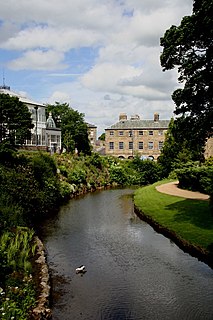
Rowlands Gill is a town situated along the A694, between Winlaton Mill and Hamsterley Mill, on the north bank of the River Derwent, in the Metropolitan Borough of Gateshead, Tyne and Wear, England. Within Gateshead's greenbelt, the village has a picturesque setting with much open space and views across the valley to Gibside Estate, now owned by the National Trust.

Rowsley is a village on the A6 road in the English county of Derbyshire. The population as at the 2011 census was 507.
Wressle is a village and civil parish in the East Riding of Yorkshire, England, lying on the eastern bank of the River Derwent approximately 3 miles (5 km) north-west of Howden.

Breighton is a village in the East Riding of Yorkshire, England. It is situated on the east bank of the River Derwent, approximately 5 miles (8 km) north-west of Howden. It forms part of the civil parish of Bubwith.

Burnhope Burn is a Site of Special Scientific Interest in the Wear Valley district of north County Durham, England. It consists of a 12.6-acre (5.1 ha) area of woodland, carr, fen and mire in the valley of Burnhope Burn, just below the dam of the Derwent Reservoir, a mile (1.6 km) north-east of the village of Edmundbyers.

Derwent Gorge and Horsleyhope Ravine is a Site of Special Scientific Interest in the Derwentside district of north County Durham and the Tynedale district of south Northumberland, England. It consists of two separate areas of woodland, one in the gorge of the River Derwent and the other in the ravine of its tributary, the Horsleyhope Burn, south-east of the village of Muggleswick.
The River Hertford is a river in Yorkshire in the north of England. It is part of the River Derwent catchment area. The River Hertford starts close to Muston near the seaside town of Filey. Despite being only 1.2 miles (2 km) from the North Sea the river flows westwards for 9.9 miles (16 km) into the River Derwent at Haybridge, North Yorkshire, near Wykeham. It has been referred to as a 'backward-flowing river' because it flows away from the sea. Ekwall suggests the name derives from a ford over the river, which became the name by back formation.