Belfast, Nebraska

Last updated

Belfast, Nebraska
Belfast, NE.jpg
USA Nebraska location map.svg
Red pog.svg
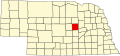
Belfast
Location within the state of Nebraska
Coordinates: 41°38′15″N98°37′00″W / 41.63750°N 98.61667°W / 41.63750; -98.61667
Country United States
State Nebraska
County Greeley
Elevation
2,178 ft (664 m)
Time zone UTC-6 (Central (CST))
  Summer (DST) UTC-5 (CDT)
ZIP code
68842
FIPS code 31-03800
GNIS feature ID827292

Belfast is a ghost town in Greeley County, Nebraska, in the United States. [1]

History

The railroad was extended to Belfast in the late 19th century. [2] The community takes its name from Belfast, in Northern Ireland. [3]

Belfast had a post office briefly from 1908 until 1909. [4]

While no buildings are still standing at the site, deep holes indicate foundations and cellars. Numerous concrete floors can be seen and large pieces of metal are scattered throughout the site. The railroad grade is very clear to someone looking down from a nearby hill. The area is now used for grazing cattle.

Related Research Articles

<span class="mw-page-title-main">South Platte River</span> River in Colorado and Nebraska, United States

The South Platte River is one of the two principal tributaries of the Platte River. Flowing through the U.S. states of Colorado and Nebraska, it is itself a major river of the American Midwest and the American Southwest/Mountain West. Its drainage basin includes much of the eastern flank of the Rocky Mountains in Colorado, much of the populated region known as the Colorado Front Range and Eastern Plains, and a portion of southeastern Wyoming in the vicinity of the city of Cheyenne. It joins the North Platte River in western Nebraska to form the Platte, which then flows across Nebraska to the Missouri. The river serves as the principal source of water for eastern Colorado. In its valley along the foothills in Colorado, it has permitted agriculture in an area of the Colorado Piedmont and Great Plains that is otherwise arid.

<span class="mw-page-title-main">Wheeler County, Nebraska</span> County in Nebraska, United States

Wheeler County is a county in the U.S. state of Nebraska. As of the 2020 United States Census, the population was 774. Its county seat is Bartlett. The county was formed in 1877 and organized in 1881. The county was named for Major Daniel H. Wheeler, longtime secretary of the Nebraska State Board of Agriculture.

<span class="mw-page-title-main">Greeley County, Nebraska</span> County in Nebraska, United States

Greeley County is a county in the U.S. state of Nebraska. As of the 2020 census, the population was 2,188. Its county seat is Greeley.

<span class="mw-page-title-main">Fillmore County, Nebraska</span> County in Nebraska, United States

Fillmore County is a county located in the U.S. state of Nebraska. As of the 2020 United States Census, the population was 5,551. Its county seat is Geneva. The county was named for President Millard Fillmore.

<span class="mw-page-title-main">Larimer County, Colorado</span> County in Colorado, United States

Larimer County is a county located in the U.S. state of Colorado. As of the 2020 census, the population was 359,066. The county seat and most populous city is Fort Collins. The county was named for William Larimer, Jr., the founder of Denver.

<span class="mw-page-title-main">Greeley Center, Nebraska</span> Village in Greeley County, Nebraska, United States

Greeley Center, often shortened to simply Greeley, is a village in and the county seat of Greeley County, Nebraska, United States. The population was 466 at the 2010 census.

<span class="mw-page-title-main">Wolbach, Nebraska</span> Village in Greeley County, Nebraska, United States

Wolbach is a village in Greeley county, Nebraska, United States. The population was 283 at the time of the 2010 census.

<span class="mw-page-title-main">Republican River</span> River in Colorado, United States

The Republican River is a river in the central Great Plains of North America, rising in the High Plains of eastern Colorado and flowing east 453 miles (729 km) through the U.S. states of Nebraska and Kansas.

<span class="mw-page-title-main">Nebraska Territory</span> Former organized incorporated territory of the United States (1854–1867)

The Territory of Nebraska was an organized incorporated territory of the United States that existed from May 30, 1854, until March 1, 1867, when the final extent of the territory was admitted to the Union as the state of Nebraska. The Nebraska Territory was created by the Kansas–Nebraska Act of 1854. The territorial capital was Omaha. The territory encompassed areas of what is today Nebraska, Wyoming, South Dakota, North Dakota, Colorado, and Montana.

<span class="mw-page-title-main">Edwin C. Johnson</span> American politician

Edwin Carl Johnson was an American politician of the Democratic Party who served as both governor of and U.S. senator from the state of Colorado.

<span class="mw-page-title-main">Index of Nebraska-related articles</span>

The following is an alphabetical list of articles related to the U.S. State of Nebraska.

<span class="mw-page-title-main">Belfast and Moosehead Lake Railroad (1871–2007)</span>

The Belfast & Moosehead Lake Railroad was a standard-gauge shortline railroad that operated from 1871 to 2007 over a single-track grade from Belfast to Burnham Junction in Maine.

<span class="mw-page-title-main">Stoneham, Colorado</span> Unincorporated community in Colorado, United States

Stoneham is an unincorporated community and a U.S. Post Office located in Weld County, Colorado, United States. The Stoneham Post Office has the ZIP Code 80754, and has been in operation since 1907.

<span class="mw-page-title-main">Keystone, Nebraska</span> Census-designated place in Nebraska, United States

Keystone is an unincorporated community and census-designated place in central Keith County, Nebraska, United States. As of the 2010 census its population was 59.

<span class="mw-page-title-main">Lemoyne, Nebraska</span> Census-designated place in Nebraska, United States

Lemoyne is an unincorporated community and census-designated place in northwestern Keith County, Nebraska, United States. As of the 2010 census it had a population of 82.

Gibson Bend of the Missouri River is a meander located in Pottawattamie County, Iowa and Douglas County, Nebraska, located at 41°11′15″N95°55′15″W. The Gibson neighborhood is a community area in Omaha, Nebraska abutting the Gibson Bend.

<span class="mw-page-title-main">California Junction, Iowa</span> Census-designated place in Iowa, United States

California Junction is an unincorporated community and census-designated place (CDP) in Harrison County, Iowa, United States. It lies just east of the junction between the east–west and north–south lines of the former Sioux City and Pacific Railroad. In the 2010 census it had a population of 85 inhabitants and a population density of 184.38 people per square mile.

Horace is an unincorporated community in Greeley County, Nebraska, in the United States.

O'Connor is an unincorporated community in Greeley County, Nebraska, in the United States.

Brayton is an unincorporated community in Greeley County, Nebraska, in the United States.

References

  1. U.S. Geological Survey Geographic Names Information System: Belfast, Nebraska
  2. George L. Burr; O. O. Buck (1921). History of Hamilton and Clay Counties, Nebraska. S.J. Clarke Publishing Company. p.  115.
  3. Federal Writers' Project (1938). Origin of Nebraska place names. Lincoln, NE: Works Progress Administration. p. 6.
  4. "Greeley County". Jim Forte Postal History. Retrieved August 9, 2014.