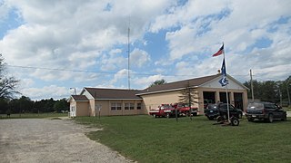
Goodar Township is a civil township of Ogemaw County in the U.S. state of Michigan. The population was 398 at the 2010 census, which makes it the least-populated municipality in the county.

The Greenbelt is a 203.5-square-kilometre (78.6 sq mi) protected green belt traversing Ottawa, Ontario, Canada. It includes green space, forests, farms, and wetlands from Shirleys Bay in the west and to Green's Creek in the east. It is the largest publicly owned green belt in the world and the most ecologically diverse area in Eastern Ontario. The National Capital Commission (NCC) owns and manages 149.5 square kilometres (57.7 sq mi), and the rest is held by other federal government departments and private interests. Real estate development within the Greenbelt is strictly controlled.
The Upper Similkameen Indian Band or Upper Smelqmix, is a First Nations band government in the Canadian province of British Columbia, whose head offices are located in town of Hedley in the Similkameen Country. They are a member of the Okanagan Nation Alliance.

The Gwa'Sala-Nakwaxda'xw Nations are a union of two Kwakwaka'wakw peoples in a band government based on northern Vancouver Island in British Columbia, Canada, whose main reserve community is near the town of Port Hardy in the Queen Charlotte Strait region of the Central Coast region of British Columbia, Canada. The band government is a member of the Kwakiutl District Council and, for treaty negotiation purposes, the Winalagalis Treaty Group which includes three other members of the Kwakiutl District Council.

The Stswecem'c Xgat'tem First Nation, formerly known as Canoe Creek Band/Dog Creek Indian Band, created as a result of merger of the Canoe Creek Band and Dog Creek Band is a First Nations government of the Secwepemc (Shuswap) Nation, located in the Fraser Canyon-Cariboo region of the Central Interior of the Canadian province of British Columbia. It was created when the government of the then-Colony of British Columbia established an Indian reserve system in the 1860s. It is a member government of the Northern Shuswap Tribal Council.
The Lytton First Nation, a First Nations band government, has its headquarters at Lytton in the Fraser Canyon region of the Canadian province of British Columbia. While it is the largest of all Nlaka'pamux bands, unlike all other governments of the Nlaka'pamux (Thompson) people, it is not a member of any of the three Nlaka'pamux tribal councils, which are the Nicola Tribal Association, the Fraser Canyon Indian Administration and the Nlaka'pamux Nation Tribal Council.
The Tŝideldel First Nation is the band government of the Tsi Del Del subgroup of the Tsilhqot'in people, located in the Chilcotin District in the western Central Interior region of the Canadian province of British Columbia. It is a member of the Tsilhqot'in National Government.

Valle de Bardají, in Aragonese: Val de Bardaixí, is a municipality located in the province of Huesca, Aragon, Spain. According to the 2004 census (INE), the municipality has a population of 54.
Strathclair is a locality in the province of Manitoba in Western Canada. It is located northwest of Brandon, Manitoba and is on Highway 16. It lies within the Rural Municipality of Yellowhead. The population is 709 in the 2016 census.
Walcrow River, a watercourse of the Manning River catchment, is located in the Northern Tablelands and Mid North Coast districts of New South Wales, Australia.
El Daba is a village and rail station about 180 km West of Alexandria by road. RAF El Daba is a former Royal Air Force military airfield located approximately 4.6 kilometres south-southeast of the village. El Daba was a pre–World War II airfield, one of a number of DLGs created in the Western Desert of Egypt after the Munich Crisis of the late 1930s. During World War II, it was used as a military airfield by the British Royal Air Force and the United States Army Air Forces during the North African Campaign against Axis forces, and by the Luftwaffe.

Velereč is a village in Gornji Milanovac municipality of Serbia, located at 44°03′00″N20°28′00″E. In the 2002 census, it had 565 residents.

Bodega Head State Marine Reserve (SMR) and Bodega Head State Marine Conservation Area (SMCA) are two adjoining marine protected areas off Bodega Bay in Sonoma County on California’s north-central coast. The combined area of these marine protected areas is 21.64 square miles (56.0 km2), with 9.3 square miles (24 km2) in the SMR, and 12.34square miles in the SMCA. Bodega Head SMR prohibits the take of all living marine resources. Bodega Head SMCA prohibits the take of all living marine resources, except the recreational and commercial take of pelagic finfish with troll fishing gear or seine, Dungeness crab by trap, and market squid by hand-held dip net and round haul net.
Karim Lamido is a Local Government Area in Taraba State, Nigeria. Its headquarters are in the town of Karim Lamido at 9°18′00″N11°12′00″E.
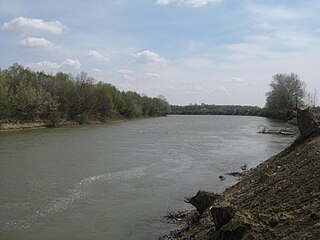
The Republic of Moldova–Romania border is the international border between Republic of Moldova and Romania, established after the dissolution of the Soviet Union. It is a fluvial boundary, following the course of the Prut and Danube. The boundary is 681.3 kilometres long, including 570 metres (1,870 ft) along the Danube.
Prisoje is a village in the municipality of Višegrad, Bosnia and Herzegovina.
Jajan is a village in Deraz Kola Rural District, Babol Kenar District, Babol County, Mazandaran Province, Iran. At the 2006 census, its population was 211, in 61 families.

Oshane Glacier is the 3 km long and 2.5 km wide glacier on Brabant Island in the Palmer Archipelago, Antarctica, situated south of Dodelen Glacier, west of Lister Glacier and north of Ralitsa Glacier. It drains the west slopes of Cushing Peak in Stribog Mountains, and flows westwards into Guyou Bay.

