
The Arctic Archipelago, also known as the Canadian Arctic Archipelago, is a group of islands north of the Canadian mainland.

Minnesota Glacier is a broad glacier, about 40 nautical miles long and 5 nautical miles wide, flowing east through the Ellsworth Mountains in Antarctica, separating the Sentinel Range and the Heritage Range. It is nourished by ice from the plateau west of the mountains and by Nimitz Glacier and Splettstoesser Glacier, and merges into the larger Rutford Ice Stream at the eastern margin of the Ellsworth Mountains.

The Institute Ice Stream is an ice stream flowing north into the Ronne Ice Shelf, Antarctica, southeast of Hercules Inlet. The feature was traversed by the United States Antarctic Research Program (USARP) Ellsworth–Byrd Seismic Party, 1958–59, and the USARP – University of Wisconsin Seismic Party, 1963–64. It was delineated by the Scott Polar Research Institute – National Science Foundation – Technical University of Denmark airborne radio echo sounding program, 1967–79, and in association with Foundation Ice Stream and Support Force Glacier, named after the Scott Polar Research Institute, Cambridge, England.
Iroquois Plateau is a large, mainly ice-covered plateau situated east of the southern part of the Washington Escarpment in the Pensacola Mountains of Edith Ronne Land, Antarctica. It was mapped by the United States Geological Survey from surveys and U.S. Navy air photos, 1956–66, and was named by the Advisory Committee on Antarctic Names after the Bell UH-1 Iroquois helicopter which has greatly facilitated field operations in Antarctica.

Union Glacier, is a large, heavily crevassed glacier which receives the flow of several tributaries and drains through the middle of the Heritage Range, Ellsworth Mountains, Antarctica. The glacier drains from the plateau at Edson Hills on the west side of the range and flows east between Pioneer Heights and Enterprise Hills. Union Glacier was mapped by U.S. Geological Survey (USGS) from surveys and U.S. Navy (USN) air photos, 1961-66. The name was applied by Advisory Committee on Antarctic Names (US-ACAN) in association with the name Heritage Range.
Blaiklock Glacier is a glacier 16 nautical miles (30 km) long, flowing north from Turnpike Bluff, then northwest to Mount Provender and Mount Lowe in the western part of the Shackleton Range. It was first mapped in 1957 by the Commonwealth Trans-Antarctic Expedition (CTAE), and named for Kenneth V. Blaiklock, the leader of the advance party of the CTAE in 1955–56 and a surveyor with the transpolar party in 1956–58.
Davis Valley is an ice-free valley just east of Forlidas Ridge in north-east Dufek Massif, in the Pensacola Mountains of Queen Elizabeth Land, Antarctica. It was mapped by the United States Geological Survey from surveys and U.S. Navy air photos in 1956–66, and was named by the Advisory Committee on Antarctic Names for Edward H. Davis, a construction mechanic with the Ellsworth Station winter party, 1957.
Strong Peak is a small sharp peak at the end of a ridge in the Enterprise Hills, standing 3 nautical miles (6 km) west-southwest of Parrish Peak and overlooking the head of Horseshoe Valley, Heritage Range. It was mapped by the United States Geological Survey (USGS) from surveys and U.S. Navy air photos from 1961-66. It was named by the Advisory Committee on Antarctic Names (US-ACAN) for Jack E. Strong, a United States Antarctic Research Program (USARP) biologist at Palmer Station in 1965.
Tranquillity Valley is a snow-covered valley between Hannah Peak and Cairn Ridge in the west part of Dufek Massif, Pensacola Mountains. The name was proposed by Arthur B. Ford, United States Geological Survey (USGS) geologist, leader of several USGS field parties to the Pensacola Mountains, 1965-79. Named from its typical weather conditions, the valley being protected from strong winds most of the time. The USGS snowmobile parties coming from cold, windy areas found welcome refuge in this valley. The name is also in accord with nearby Enchanted Valley to indicate the general beauty of this part of Dufek Massif.
Mount Dolence is a remarkably spired bare rock mountain, 1,950 metres (6,400 ft) high, located in the northwestern extremity of the Enterprise Hills and separated from the Edson Hills by the upper part of Union Glacier, in the Heritage Range, Ellsworth Mountains. It was named by the University of Minnesota Ellsworth Mountains Party, 1962–63, for Jerry D. Dolence, a geologist and a member of the party.
Flanagan Glacier is a glacier in the Pioneer Heights of the Heritage Range, Antarctica, draining east from Thompson Escarpment between the Gross Hills and the Nimbus Hills to the confluent ice at the lower end of Union Glacier. It was mapped by the United States Geological Survey from surveys and U.S. Navy air photos, 1961–66, and was named by the Advisory Committee on Antarctic Names for Lieutenant Walter B. Flanagan, an assistant maintenance officer with U.S. Navy Squadron VX-6 at McMurdo Station during Operation Deep Freeze 1963 and 1964.
Ford Ice Piedmont is the large ice piedmont lying northward of Dufek Massif and the Forrestal Range between the lower ends of Foundation Ice Stream and Support Force Glacier, in the Pensacola Mountains of Antarctica. It was named by the Advisory Committee on Antarctic Names after Arthur B. Ford, a geologist of the United States Geological Survey (USGS), Menlo Park, CA. He was co-leader of the USGS party in the Thiel Mountains, 1960–61 ; did field work at Lassiter Coast, 1970–71; led geological parties to the Pensacola Mountains in 1965–66, 1973–74, 1976–77, and 1978–79.
Forlidas Pond is a round frozen pond, 100 metres (110 yd) in diameter, lying in a morainal valley east of the north end of Forlidas Ridge, Dufek Massif, Queen Elizabeth Land, Antarctica. The only pond in the northern Pensacola Mountains, it is of much interest to biologists. The pond was discovered and briefly investigated in December 1957 by a United States – International Geophysical Year party from Ellsworth Station. The name is in association with Forlidas Ridge and was suggested by Arthur B. Ford of the United States Geological Survey following geological work in the area, 1978–79.
Schoeck Peak is a peak of 1,810 metres (5,940 ft) standing directly at the head of Henderson Glacier in the Enterprise Hills, Heritage Range in Antarctica. It was mapped by the United States Geological Survey (USGS) from surveys and U.S. Navy air photos from 1961–66. It was named by the Advisory Committee on Antarctic Names (US-ACAN) for Peter A. Schoeck, an auroral scientist at Little America V Station in 1957.
Larson Valley is a relatively smooth, ice-filled valley between the south end of Inferno Ridge and Mhire Spur in the Heritage Range, Antarctica. It was mapped by the United States Geological Survey from surveys and U.S. Navy air photos 1961–66, and was named by the Advisory Committee on Antarctic Names for equipment operator D. L. Larson, U.S. Navy, a snow removal operator at Williams Field, McMurdo Sound, during Operation Deep Freeze 1965 and 1966.

Warpasgiljo Glacier is a Valley glacier about 25 mi (40 km) long, flowing West to Sulzberger Ice Shelf between the Swanson Mountains on the North and Mounts Rea and Cooper on the South, in the Edsel Ford Ranges of Marie Byrd Land. This glacier was discovered by and named for the four Geological Party Expedition members of the West Base of the United States Antarctic Service (USAS), in aerial flights and from ground surveys in November–December 1940, as part of the Antarctic Expedition of 1939-1941 led by Rear Admiral Richard E. Byrd.
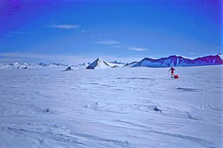
Horseshoe Valley is a large ice-filled valley in the southern Heritage Range of the Ellsworth Mountains of Antarctica. It is outlined by the semicircular arrangement of the Independence, Marble, Liberty and Enterprise Hills. Approval of the descriptive name was suggested by the University of Minnesota Ellsworth Mountains Party, 1962–63, who reported the name was in wide use by U.S. Navy flyers in the area.
Black Cap is a prominent black rock peak which surmounts the northwest end of Teall Island, just south of the mouth of Skelton Glacier in Antarctica. It was sighted and given this descriptive name in February 1957 by the New Zealand party of the Commonwealth Trans-Antarctic Expedition (1956-58).


