
Bellenden Road is a street in southeast London. The local area around it, situated between Peckham, Camberwell and East Dulwich, is known as Bellenden. [1]
Bellenden Road is a street in southeast London. The local area around it, situated between Peckham, Camberwell and East Dulwich, is known as Bellenden. [1]
Bellenden is claimed by residents to be distinct from any of its surrounding neighbours for a number of reasons, although others argue that it is just part of Peckham, East Dulwich or Camberwell. Named after the 7th Lord Bellenden of Broughton, [2] Bellenden Road was laid out along with neighbouring streets from the 1870s on what had formerly been largely fruit gardens serving the City of London.
From its earliest days, Bellenden was populated disproportionately by French Huguenots, and still retains something of its French flavour, with various streets, pubs and businesses carrying French names such as the Montpelier Public House, Petit Chou cafe and Choumert Road attracting a significant French population to the area. For this reason Bellenden has for some years been known as 'the French Quarter'.
Artists such as Antony Gormley, Tom Phillips and John Latham have lived and worked on Bellenden Road and in the area. [3] As part of Southwark Council's Bellenden Area Renewal programme Gormley designed bollards and street furniture for the area, Phillips designed lampposts and mosaics, several shop fronts were refitted and Latham installed a major artwork through the front of his house and studio which he named Flat Time House. [4] Flat Time House is now a publicly accessible art and education space and houses the John Latham archive. [5]
Bellenden has a growing spread of shops and cafes. [6] The Bellenden Road Nature Garden is a nature reserve managed by London Wildlife Trust. [7]
Bellenden has been home to a number of politically-engaged community groups, such as the Peckham Black Women's Group until 1990 [8] [9] , and the Black Lesbian and Gay Centre from 1992 to 1995. [10] The latter was commemorated with a Rainbow Plaque in 2024. [11]
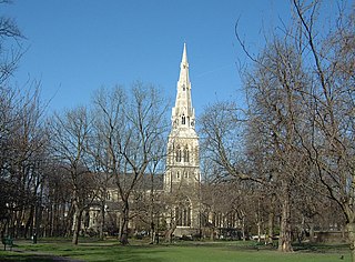
Camberwell is an area of South London, England, in the London Borough of Southwark, 2+3⁄4 miles southeast of Charing Cross.

The London Borough of Southwark in South London forms part of Inner London and is connected by bridges across the River Thames to the City of London and London Borough of Tower Hamlets. It was created in 1965 when three smaller council areas amalgamated under the London Government Act 1963. All districts of the area are within the London postal district. It is governed by Southwark London Borough Council.

Dulwich is an area in south London, England. The settlement is mostly in the London Borough of Southwark, with parts in the London Borough of Lambeth, and consists of Dulwich Village, East Dulwich, West Dulwich, and the Southwark half of Herne Hill. Dulwich lies in a valley between the neighbouring districts of Camberwell, Crystal Palace, Denmark Hill, Forest Hill, Peckham, Sydenham Hill, and Tulse Hill.

Peckham is a district in south-east London, within the London Borough of Southwark. It is 3.5 miles (5.6 km) south-east of Charing Cross. At the 2001 Census the Peckham ward had a population of 14,720.

Lewisham is an area of southeast London, England, six miles south of Charing Cross. It is the principal area of the London Borough of Lewisham, and was within the historic county of Kent until 1889. It is identified in the London Plan as one of 35 major centres in Greater London, with a large shopping centre and street market. Lewisham had a population of 60,573 in 2011.

East Dulwich is an area of South East London, England in the London Borough of Southwark. It forms the eastern part of Dulwich, with Peckham to the east and Camberwell to the north. East Dulwich is home to the Dog Kennel Hill statue which is lit in the snow. This South London suburb was first developed in the nineteenth century on land owned by the College of God's Gift.

Camberwell was a civil parish and metropolitan borough in south London, England. Camberwell was an ancient parish in the county of Surrey, governed by an administrative vestry from 1674. The parish was included in the area of responsibility of the Metropolitan Board of Works in 1855 and became part of the County of London in 1889. The parish of Camberwell became a metropolitan borough in 1900, following the London Government Act 1899, with the parish vestry replaced by a borough council. In 1965 the borough was abolished and its former area became part of the London Borough of Southwark in Greater London.

Herne Hill is a district in south London, approximately four miles from Charing Cross and bordered by Brixton, Camberwell, Dulwich, and Tulse Hill. It sits to the north and east of Brockwell Park and straddles the boundary between the boroughs of Lambeth and Southwark. There is a road of the same name in the area, as well as a railway station.

Old Compton Street is a road that runs east–west through Soho in the West End of London, named after Henry Compton who raised funds for St Anne's Church in 1686. The area, particularly this street, became home to French Protestant refugees in 1681. Known for its diverse and artistic traditions, the street housed businesses, artists, philosophers, and was frequented by communists and proto-beatniks. The Algerian Coffee Stores, one of the oldest shops on the street, was established in 1887. Post World War II, the street became a center for modern and trad jazz. Since the 1970s, Old Compton Street has been a focal point for London's gay community, with numerous gay bars, restaurants, and specialty shops. The Admiral Duncan pub, a notable gay venue, was bombed in 1999 in a hate crime attack. The street is also home to the Prince Edward Theatre.

Nunhead is a suburb in the London Borough of Southwark, England. It is an inner-city suburb located 4 miles (6.4 km) southeast of Charing Cross. It is the location of the 52-acre (0.21 km2) Nunhead Cemetery. Nunhead has traditionally been a working-class area and, with the adjacent neighbourhoods, is currently going through a lengthy process of gentrification. Nunhead is the location of several underground reservoirs, built by the Southwark and Vauxhall Waterworks Company.

Lordship Lane is an ancient thoroughfare, once rural, in East Dulwich, a suburb of the London Borough of Southwark in southeast London, England, and forms part of the A2216.

Camberwell and Peckham was a constituency represented in the House of Commons of the UK Parliament since its 1997 creation until its abolition for the 2024 general election by Harriet Harman of the Labour Party. Harman had served for the previous constituency of Peckham since 1982. She is a former cabinet minister and the "Mother of the House of Commons", having the longest record of continuous service of any female MP.

The A202 is a primary A road in London. It runs from New Cross Gate to London Victoria station. A section of the route forms a part of the London Inner Ring Road between Vauxhall and Victoria, known as Vauxhall Bridge Road.

The A2216 is an A road in south London, England suburbia. It runs from the A215 in Denmark Hill to the A212 in Sydenham. Part of the road is an ancient thoroughfare, Lordship Lane. In Dulwich, the road runs via the A205 South Circular Road.

Camberwell Public Baths opened in 1892 and has been in continuous operation as publicly funded community baths and more recently as a public leisure centre.

The 1908 Peckham by-election was a parliamentary by-election held for the British House of Commons constituency of Peckham in the Metropolitan Borough of Camberwell, London on 24 March 1908. The seat was won by the opposition Conservative Party candidate, a gain from the Liberal Party who had won a large majority at the 1906 general election.

Flat Time House was the studio home of British conceptual artist John Latham (1921–2006) and is now open as a contemporary art gallery, centre for alternative learning and artist residency space, housing the John Latham archive. It is located on Bellenden Road, South London, England. It is a registered charity under English law.
The Rainbow Plaque programme is a UK scheme to create commemorative plaques to highlight significant people, places and moments in LGBTQIA+ history. Emulating established UK blue plaque programmes run by English Heritage, local authorities and other bodies, the first permanent rainbow plaque was unveiled in York in July 2018. Some UK LGBT locations are denoted by pink plaques, an idea that predated rainbow plaques.
The Black Lesbian and Gay Centre (BLGC) was a community centre in London that ran from 1985 to 2000. The centre was founded by members of the Gay Black Group in response to "the overwhelming whiteness of the 'mainstream' LGBTQ+ scene, racism from within and outside of the scene, and the difficulties of coming out to families, who generally perceived homosexuality as a 'white' issue." It was first set up in Haringey with funding from the Greater London Council, and later moved to Peckham. There is a Rainbow Plaque commemorating the BLGC in Peckham.