
Argyll and Bute is one of 32 unitary council areas in Scotland and a lieutenancy area. The current lord-lieutenant for Argyll and Bute is Jane Margaret MacLeod. The administrative centre for the council area is in Lochgilphead at Kilmory Castle, a 19th-century Gothic Revival building and estate. The current council leader is Councillor Jim Lynch.
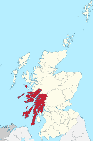
Argyll, sometimes called Argyllshire, is a historic county and registration county of western Scotland. The county ceased to be used for local government purposes in 1975 and most of the area now forms part of the larger Argyll and Bute council area.
Strontian is the main village in Sunart, an area in western Lochaber, Highland, Scotland, on the A861 road. Prior to 1975 it was part of Argyllshire. It lies on the north shore of Loch Sunart, close to the head of the loch. In the hills to the north of Strontian lead was mined in the 18th century and in these mines the mineral strontianite was discovered, from which the element strontium was first isolated.
Kilchoan is a village on the Scottish peninsula of Ardnamurchan, beside the Sound of Mull in Lochaber, Highland. It is the most westerly village in mainland Britain, although several tiny hamlets lie further west on the peninsula. The western linear, coastal parts of the village are Ormsaigmore and Ormsaigbeg.

Ardnamurchan is a 50-square-mile (130-square-kilometre) peninsula in the ward management area of Lochaber, Highland, Scotland, noted for being very unspoiled and undisturbed. Its remoteness is accentuated by the main access route being a single track road for much of its length. The most westerly point of mainland Great Britain, Corrachadh Mòr, is in Ardnamurchan.
Ben More is the highest mountain and only Munro on the Isle of Mull, Scotland. It is also the highest peak in the Scottish isles – and the only Munro – apart from those on the Isle of Skye. The mountain is situated close to the centre of the island, above the shores of Loch na Keal.

Mingary Castle, also known as Mingarry Castle, is a castle situated one mile southeast of the small village of Kilchoan in Lochaber, Scotland. Nestled on ridge of rock overlooking the sea, it was considered a strategically important site in terms of communication with overseas areas and as an entranceway to the Sound of Mull. Mingary is roughly hexagonal in shape with nine-foot-thick walls, thicker on the seaward side. The remains of the castle are protected as a category A listed building.
Morvern, historically also spelt Morven, is a peninsula and traditional district in the Highlands, on the west coast of Scotland. It lies south of the districts of Ardgour and Sunart, and is bounded on the north by Loch Sunart and Glen Tarbert, on the south east by Loch Linnhe and on the south west by the Sound of Mull. The highest point is the summit of the Corbett Creach Bheinn which reaches 853 metres (2,799 ft) in elevation.
The MacDonalds of Ardnamurchan, also known as MacIain of Ardnamurchan, or Clan MacIan, were a Scottish family and a branch of the larger Clan Donald.

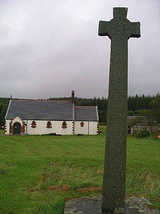
Kilmory is a small crofting (township) hamlet on the north coast of Ardnamurchan, western Scotland.

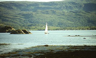
Carna or Càrna is an island in Loch Sunart, an arm of the sea, close to the Ardnamurchan peninsula, on the west coast of Scotland.

Beinn Challuim is a mountain in the Breadalbane region of the Scottish Highlands. It is east of the village of Tyndrum, in the Forest of Mamlorn, an ancient deer forest at the northern edge of Loch Lomond and the Trossachs National Park. It is a Munro with a height of 1,025 metres (3,363 ft).

The A861 road is a circuitous, primarily coastal, road in Lochaber, within the Highland council area of Scotland.

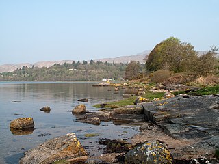
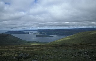
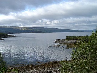
Loch Sunart is a sea loch on the west coast of Scotland. Loch Sunart is bounded to the north by the Sunart district of Ardnamurchan and to the south by the Morvern district. At 31 kilometres (19 mi) long, it is the longest sea loch in the Highland local government area. The maximum depth of the loch is 124 metres, east of Càrna and near the entrance to Loch Teacuis. Other islands in the loch include Oronsay, seaward of Càrna, Risga, which lies between the two larger islands, and Eilean Mòr, which lies towards the landward end of the loch in line with Beinn Resipol.

The Corran Ferry crosses Loch Linnhe at the Corran Narrows, south of Fort William, Scotland.
Loch na Keal, meaning Loch of the Kyle, or Narrows, also Loch of the Cliffs, is the principal sea loch on the western, or Atlantic coastline of the island of Mull, in the Inner Hebrides, Argyll and Bute, Scotland. Loch na Keal extends over 20 kilometres (12 mi) inland, almost bisecting Mull, and extending to within 5 km (3 mi) of the eastern shore. The loch gives its name to the Loch na Keal National Scenic Area, one of forty national scenic areas in Scotland.
Glenborrodale Bay is a remote tidal, 200° orientated, coastal embayment, located on the southern coastline of the west to east orientated Ardnamurchan peninsula, at the head of the sea loch Loch Sunart in western Scottish Highlands of Scotland. To the west is the large Ardgour peninsula, of which the Ardnamurchan and the larger Morven peninsula to the south is part of.
Glenmore Bay is a remote, tidal, 150° orientated, coastal embayment, located on the southern coastline of the west to east orientated Ardnamurchan peninsula, at the head of the sea loch Loch Sunart.

Morar, Moidart and Ardnamurchan is a national scenic area (NSA) covering the coastal scenery of three peninsulas in the western Highlands of Scotland: Ardnamurchan, Moidart and Morar. It is one of 40 such areas in Scotland, which are defined so as to identify areas of exceptional scenery and to ensure its protection from inappropriate development by restricting certain forms of development. The Morar, Moidart and Ardnamurchan NSA covers 36,956 ha in total, consisting of 17,220 ha of land with a further 19,736 ha being marine.

The geology of the Isle of Mull in Scotland is dominated by the development during the early Palaeogene period of a ‘volcanic central complex’ associated with the opening of the Atlantic Ocean. The bedrock of the larger part of the island is formed by basalt lava flows ascribed to the Mull Lava Group erupted onto a succession of Mesozoic sedimentary rocks during the Palaeocene epoch. Precambrian and Palaeozoic rocks occur at the island's margins. A number of distinct deposits and features such as raised beaches were formed during the Quaternary period.

