References
- ↑ U.S. Geological Survey Geographic Names Information System: Benjestown, Tennessee
- ↑ "Shelby County". Jim Forte Postal History. Archived from the original on February 9, 2015. Retrieved February 8, 2015.
- ↑ Miller, Larry L. (2001). Tennessee Place-names. Indiana University Press. p. 18. ISBN 0-253-21478-5.
Municipalities and communities of Shelby County, Tennessee, United States | ||
|---|---|---|
| Cities | 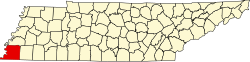 | |
| Towns | ||
| Unincorporated communities | ||
35°15′06″N90°03′19″W / 35.25167°N 90.05528°W
| | This Shelby County, Tennessee geography–related article is a stub. You can help Wikipedia by expanding it. |