Fisherville, Tennessee | |
|---|---|
 Fisherville  Fisherville | |
| Coordinates: 35°09′33.321″N89°39′49.2906″W / 35.15925583°N 89.663691833°W | |
| Country | United States |
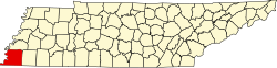
| State | Tennessee |
| Counties | Shelby, Fayette |
| Elevation | 397 ft (121 m) |
| Time zone | UTC-6 (Central (CST)) |
| • Summer (DST) | UTC-5 (CDT) |
| Area code | 901 |
| GNIS feature ID | 1284328 [1] |
Fisherville is an unincorporated community lying between the jurisdiction of Fayette and Shelby County, Tennessee, United States. [1] Fisherville is located between Eads and Collierville, about 30 miles east of downtown Memphis. The zip code for the area is 38028. [2]