Related Research Articles

Driftwood is a borough in Cameron County, Pennsylvania, United States. The population was 67 at the 2010 census.
Gibson Township is a township in Cameron County, Pennsylvania, United States. The population was 178 at the 2020 census, up from 164 in 2010, which in turn was a decline from the figure of 222 in 2000.
Benezette Township is a township in Elk County, Pennsylvania, United States. The population was 218 at the 2020 census, up from 207 at the 2010 census.

Jay Township is a township in Elk County, Pennsylvania, United States. The population was 1,956 at the 2020 census, down from 2,072 at the 2010 census.

Black Moshannon Creek is a 22.9-mile-long (36.9 km) tributary of Moshannon Creek in Centre County, Pennsylvania in the United States.

Moshannon Creek is a 57.4-mile-long (92.4 km) tributary of the West Branch Susquehanna River in Centre County, Pennsylvania in the United States. Throughout its length, it serves as the boundary between Centre and Clearfield counties.

Town Creek is a 41.6-mile-long (66.9 km) tributary stream of the Potomac River in the U.S. states of Maryland and Pennsylvania. The creek is formed from the confluence of Sweet Root Creek and Elk Lick Creek, about 0.5 miles (0.8 km) south of Buchanan State Forest in Bedford County, Pennsylvania. Town Creek flows south along the base of Warrior Mountain into Allegany County, Maryland. The Chesapeake and Ohio Canal crosses it at the Town Creek Aqueduct. It empties into the Potomac about 4 miles (6 km) east of Oldtown, Maryland.
Little Clearfield Creek is a 14.5-mile-long (23.3 km) tributary of Clearfield Creek in Clearfield County, Pennsylvania in the United States.

Sizerville State Park is a 386-acre (156 ha) Pennsylvania state park in Portage Township, Cameron County and Portage Township, Potter County, Pennsylvania in the United States. The park is nearly surrounded by Elk State Forest making it part of one of the largest blocks of state-owned land in Pennsylvania. Sizerville State Park is on Pennsylvania Route 155, six miles (10 km) north of the borough of Emporium.

Bucktail State Park Natural Area is a 16,433-acre (6,650 ha) Pennsylvania state park in Cameron and Clinton Counties in Pennsylvania in the United States. The park follows Pennsylvania Route 120 for 75 miles (121 km) between Emporium and Lock Haven. Bucktail State Park Natural Area park runs along Sinnemahoning Creek and the West Branch Susquehanna River and also passes through Renovo. The park is named for the Civil War Pennsylvania Bucktails Regiment and is primarily dedicated to wildlife viewing, especially elk.

Sinnemahoning Creek is a 15.7-mile-long (25.3 km) tributary of the West Branch Susquehanna River in Cameron and Clinton counties, Pennsylvania, in the United States.
Laurel Run is a 16.5-mile-long (26.6 km) tributary of the Bennett Branch Sinnemahoning Creek in Clearfield and Elk counties, Pennsylvania in the United States. Via the Bennett Branch, Sinnemahoning Creek, and the West Branch Susquehanna River, it is part of the Susquehanna River watershed flowing to Chesapeake Bay.
Pennsylvania Route 555 is a 26.3-mile-long (42.3 km) state highway located in Elk and Cameron Counties in Pennsylvania. The western terminus is at PA 255 in Jay Township community of Weedville. The eastern terminus is at PA 120 in Driftwood.
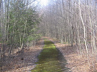
The Bucktail Path is a 33.5-mile (53.9 km) hiking trail in north-central Pennsylvania, through portions of Elk State Forest. Most of the trail is in Cameron County, with its northern end in Potter County. It should not be confused with the scenic highway in the same region known as Bucktail Trail; several features in the region were named after the Bucktail Regiment of local soldiers during the American Civil War. The Bucktail Path is often described as one of the most isolated and least hiked backpacking trails in Pennsylvania, with a path that can be difficult to follow even for experienced hikers; and it has experienced long periods of under-use with little maintenance. It is also known for several challenging climbs and bridgeless stream crossings.
Weedville is an unincorporated community and census-designated place in Jay Township, Elk County, Pennsylvania, United States. As of the 2010 census the population was 420.
Driftwood Branch Sinnemahoning Creek is a tributary of Sinnemahoning Creek in the U.S. state of Pennsylvania. This stream once called simply "Driftwood Creek" was so named for the driftwood which accumulated there.
First Fork Sinnemahoning Creek is a tributary of Sinnemahoning Creek in the U.S. state of Pennsylvania.
The Pennsylvania State Game Lands Number 14 are Pennsylvania State Game Lands in Cameron, and Elk Counties in Pennsylvania in the United States providing hunting, bird watching, and other activities.
The Pennsylvania State Game Lands Number 30 are Pennsylvania State Game Lands in McKean County in Pennsylvania in the United States providing hunting, bird watching, and other activities.
The Pennsylvania State Game Lands Number 34 are Pennsylvania State Game Lands in Clearfield County in Pennsylvania in the United States providing hunting, bird watching, and other activities.
References
- 1 2 3 Gertler, Edward. Keystone Canoeing, Seneca Press, 2004. ISBN 0-9749692-0-6
- 1 2 U.S. Geological Survey. National Hydrography Dataset high-resolution flowline data. The National Map Archived 2012-03-29 at the Wayback Machine , accessed August 8, 2011