Berkley-Dighton Bridge | |
---|---|
View from Berkley shore, October 2015 | |
Coordinates | 41°50′5.83″N71°6′29.28″W / 41.8349528°N 71.1081333°W Coordinates: 41°50′5.83″N71°6′29.28″W / 41.8349528°N 71.1081333°W |
Carries | vehicular and pedestrian traffic |
Crosses | Taunton River |
Locale | Berkley and Dighton, Massachusetts |
Preceded by | Weir St. Bridge |
Followed by | Veterans Memorial Bridge |
Characteristics | |
Design | concrete arch bridge with closed spandrels |
Total length | approximately 350 feet (110 m) |
Width | 32 feet (9.8 m) |
Longest span | 2 × 92 feet (28 m) |
No. of spans | 4 |
Clearance below | 12 feet (3.7 m) |
History | |
Construction start | July 2012 [1] |
Construction end | August 2015 [2] |
Replaces | Berkley–Dighton Bridge (1896) |
The fourth Berkley–Dighton Bridge is a four-span concrete arch bridge with closed spandrel walls of cast-in-place concrete, using pile-supported abutments and piers. The bridge was made such that it appears to be constructed of stone masonry rather than concrete. The two end spans are 74 feet (23 m) and the two center spans are 92 feet (28 m) for a total bridge length of approximately 350 feet (110 m). [3] [4]
An arch bridge is a bridge with abutments at each end shaped as a curved arch. Arch bridges work by transferring the weight of the bridge and its loads partially into a horizontal thrust restrained by the abutments at either side. A viaduct may be made from a series of arches, although other more economical structures are typically used today.
Bridges at this location are the only crossing over the Taunton River between the Veterans Memorial Bridge in Fall River and the Weir Street Bridge in Taunton.
The Taunton River, is a river in southeastern Massachusetts in the United States. It arises from the confluence of the Town River and Matfield River, in the town of Bridgewater. From there it meanders through the towns of Halifax, Middleborough and Raynham, through the city of Taunton for which it is named, the towns of Berkley, Dighton, Somerset, and the Assonet section of Freetown, to Fall River where it joins Mount Hope Bay, an arm of Narragansett Bay.
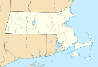
The Veterans Memorial Bridge is a bascule bridge connecting Somerset, Massachusetts and Fall River, Massachusetts. The bridge carries U.S. Route 6 and Route 138 over the Taunton River, with connecting ramps to Route 79, and includes a bike path on its north side. The $290 million bridge was dedicated to area veterans on September 11, 2011. The bike path was also dedicated in a separate ceremony that same day in honor of Pvt. Michael E. Bouthot, who was killed in action in Iraq in 2006.
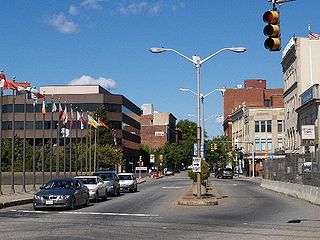
Fall River is a city in Bristol County, Massachusetts, United States. The City of Fall River is located approximately 53 miles (85 km) south of Boston, 17 miles (27 km) southeast of Providence, Rhode Island, 20 miles (32 km) south of Taunton, 12 miles (19 km) west of New Bedford, 20 miles (32 km) north of Newport, Rhode Island, and 200 miles (320 km) northeast of New York City. The City of Fall River's population was 87,103 at the 2010 census, making it the tenth-largest city in the state.
Beginning in August 2010, a temporary bridge was in place while the new bridge was being built. Construction on the bridge began in July 2012. [1] The new bridge opened to traffic on August 28, 2015. [2] [4]
The first bridge at the site was built in 1801. There was no bridge on the site from 1853 to 1873. The third bridge was dedicated in 1896 and demolished in 2010. A temporary bridge served from 2010 to 2015. The current bridge opened to traffic on August 28, 2015 [2] [4]
The third Berkley–Dighton Bridge was a paved one-lane swing-span bridge connecting the towns of Berkley and Dighton, Massachusetts. Built in 1896, it was the third at that location, and was demolished in September and October 2010.
Proposals for the new bridge were discussed for many years, starting no later than 1975. The Massachusetts Highway Department (MHD) replaced the third Berkley–Dighton Bridge because it was seriously structurally deficient, its swing span gears often jammed in the open position, forcing travelers miles to the north or south, and due to the inability for the bridge to handle emergency vehicles. The MHD estimates (2001 data) that 6,200 cars crossed the bridge each day. Bridge upgrade plans were met with opposition for a variety of reasons, including concerns about the impact on local traffic. Commercial trucks were not allowed to use the old bridge. Also, the traffic lights were only triggered by cars stopping on a line in the road. This was very problematic for people not familiar with the bridge.
The Massachusetts Highway Department was the highway department in the U.S. state of Massachusetts from 1991 until the formation of the Massachusetts Department of Transportation (MassDOT) in 2009.
NIMBY, or Nimby, is a characterization of opposition by residents to a proposed development in their local area. It often carries the connotation that such residents are only opposing the development because it is close to them, and that they would tolerate or support it if it were built farther away. The residents are often called Nimbys, and their viewpoint is called Nimbyism.
The current bridge is a fixed structure, consisting of four pre-cast arch spans with closed spandrel walls of cast-in-place concrete, with approximately the same footprint as the previous bridge, using pile-supported abutments and piers. The finished bridge was made such that it appears to be constructed of stone masonry rather than concrete. The two end spans are 74 feet (23 m) and the two center spans are 92 feet (28 m) for a total bridge length of approximately 350 feet (110 m). [3] [4] In Fall 2014, the arches were built from segments trucked in. The arches are ten segment widths wide and were brought in as half-arches.[ citation needed ]
A deep foundation is a type of foundation that transfers building loads to the earth farther down from the surface than a shallow foundation does to a subsurface layer or a range of depths.
Masonry is the building of structures from individual units, which are often laid in and bound together by mortar; the term masonry can also refer to the units themselves. The common materials of masonry construction are brick, building stone such as marble, granite, travertine, and limestone, cast stone, concrete block, glass block, and adobe. Masonry is generally a highly durable form of construction. However, the materials used, the quality of the mortar and workmanship, and the pattern in which the units are assembled can substantially affect the durability of the overall masonry construction. A person who constructs masonry is called a mason or bricklayer. These are both classified as construction trades.
The bridge is wider than the previous bridge by a total of approximately 12 feet (3.7 m), split between both sides of the old bridge, for a total of 32 feet (9.8 m) defined as two traffic lanes plus a 5.5-foot (1.7 m) sidewalk on the south (downstream) side of the bridge, similar to the previous bridge. A minimum of 12-foot (3.7 m) vertical clearance must be maintained from the mean high water line at the main span, requiring the roadway to be raised approximately 8.25 feet (2.51 m) higher than its previous level. Other improvements include ADA-compliant sidewalks, wheelchair ramps, and driveway transitions, as well as better drainage, curbing, signage, guardrail, and pavement markings. [3]
A temporary one-lane bridge was provided during construction to the south of the permanent bridge site. The temporary bridge had improved weight capacity, allowing emergency vehicles to use it. [3] This bridge opened on August 16, 2010. [5] The structure was a 3rd generation Bailey bridge. [5] [6] Once the main bridge opened, the temporary bridge was removed.
The Longfellow Bridge is a steel rib arch bridge spanning the Charles River to connect Boston's Beacon Hill neighborhood with the Kendall Square area of Cambridge, Massachusetts. The bridge carries Massachusetts Route 3, the MBTA Red Line, bicycle, and pedestrian traffic. The structure was originally known as the Cambridge Bridge, and a predecessor structure was known as the West Boston Bridge; Boston also continued to use "West Boston Bridge" officially for the new bridge. The bridge is also known to locals as the "Salt-and-Pepper Bridge" due to the shape of its central towers.
The Sellwood Bridge is a deck arch bridge that spans the Willamette River in Portland, Oregon, in the United States. The current bridge opened in 2016 and replaced a 1925 span that had carried the same name. The original bridge was Portland's first fixed-span bridge and, being the only river crossing for miles in each direction, the busiest two-lane bridge in Oregon. The Sellwood Bridge links the Sellwood and Westmoreland neighborhoods of Portland on the east side with Oregon Route 43/Macadam Avenue on the west side. At its east end it leads to Tacoma Street. The bridge is owned and operated by Multnomah County. The original span of 1925 was a steel truss bridge, while its 2016 replacement is a deck-arch-type bridge.
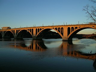
The Francis Scott Key Bridge, more commonly known as the Key Bridge, is a six-lane reinforced concrete arch bridge conveying U.S. Route 29 (US 29) traffic across the Potomac River between the Rosslyn neighborhood of Arlington County, Virginia, and the Georgetown neighborhood of Washington, D.C. Completed in 1923, it is Washington's oldest surviving road bridge across the Potomac River.
The Lamar Boulevard Bridge is a historic arch bridge carrying Texas State Highway Loop 343 over Lady Bird Lake in downtown Austin, Texas, United States. The bridge features six open-spandrel concrete arches spanning 659 feet (201 m) and carries tens of thousands of vehicles daily across the lake. Completed in 1942, the Lamar Boulevard Bridge was the second permanent bridge to cross the Colorado River, and one of the last Art Deco-style open-spandrel concrete arch bridges built in Texas. The bridge was named an Austin Landmark in 1993 and added to the National Register of Historic Places in 1994.
The Hillsborough River Bridge is a bridge crossing the Hillsborough River estuary between Charlottetown and Stratford in Queens County, Prince Edward Island. The current road bridge, built in 1962, replaced a 1905 rail bridge crossing the same span which was known by the same name.
The Hares Hill Road Bridge is a single-span, wrought iron, bowstring-shaped lattice girder bridge. It was built in 1869 by Moseley Iron Bridge and Roof Company and is the only known surviving example of this kind. The bridge spans French Creek, a Pennsylvania Scenic River. The structure has a current load posting of 7 tons.
The Sauvie Island Bridge crosses the Multnomah Channel of the Willamette River near Portland, Oregon, United States. The original Parker truss bridge, built in 1950 with a 200-foot (61 m) main span, was replaced with a tied arch bridge with a 360-foot (110 m) span in 2008 due to cracks discovered in 2001.
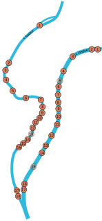
This is a list of bridges in the French city of Lyon on the Rhône and Saône rivers, ordered from upstream to downstream portions of the river.
The Gay Street Bridge is a vehicle bridge that crosses the Tennessee River in Knoxville, Tennessee, United States. Completed in 1898, the 1,512-foot (461 m) bridge is the oldest of four vehicle bridges connecting Downtown Knoxville with South Knoxville, the other three being the Henley Street Bridge, the Buck Karnes Bridge, and the James C. Ford Memorial Bridge.
The Cornwall Bridge is a two-lane, concrete arch bridge carrying U.S. Route 7/Connecticut Route 4 over the Housatonic River and the Housatonic Railroad in Northwestern Connecticut. It was built in 1930 by C.W. Blakeslee and Sons for the Connecticut Highway Department and consists of 6 open-spandrel arches spanning 674 feet (205 m), and is a fairly large example of concrete open-spandrel construction. The bridge was reconstructed in 1994 and was listed on the National Register of Historic Places in 2004.
The Reynolds Bridge in Thomaston, Connecticut is an open-spandrel concrete arch bridge carrying Waterbury Road over the Naugatuck River. Built in 1928, it is one of a small number of surviving open-spandrel bridges in the state. It was listed on the National Register of Historic Places in 2004.
Bridge No. 1132 is an open-spandrel concrete arch bridge carrying the two-lane Connecticut Route 80 across the Hammonasset River, between Killingworth and Madison, Connecticut. Built in 1934, it is one of a small number of open-spandrel concrete bridges in the state, and was noted for its aesthetics at the time of its construction. It was listed on the National Register of Historic Places in 2004.
The Quechee Gorge Bridge is a historic bridge, carrying U.S. Route 4 (US 4) across Quechee Gorge, near the Quechee village of Hartford, Vermont. Built in 1911, it is Vermont's oldest surviving steel arch bridge. It was listed on the National Register of Historic Places in 1990.
Bridge No. 455 is a historic open spandrel concrete bridge, carrying Connecticut Route 159 across Stony Brook in southern Suffield, Connecticut. Completed in 1929, it is one of six surviving open spandrel concrete bridges in the state. It was listed on the National Register of Historic Places in 2004.
The West Sixth Street Bridge is a historic stone arch bridge in downtown Austin, Texas. Built in 1887, the bridge is one of the state's oldest masonry arch bridges. It is located at the site of the first bridge in Austin, carrying Sixth Street across Shoal Creek to link the western and central parts of the old city. The bridge was added to the National Register of Historic Places in 2014.
The San Jacinto Street Bridge is a viaduct which crosses Buffalo Bayou in Houston, Texas. The structure is listed on the National Register of Historic Places (NRHP). This bridge was built in 1914 to replace an iron pivot bridge of 1883 origin, and rehabilitated in 1997. It is a transportation conduit connecting downtown and the historical Fifth Ward.
Wikimedia Commons has media related to Berkley-Dighton Bridge . |